
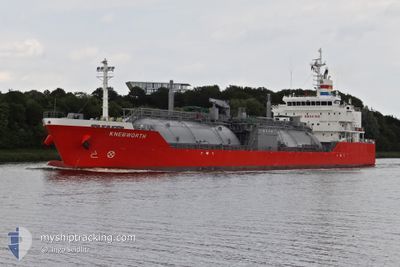
KNEBWORTH
Lpg Tanker
Current Trip
4MA NDR
| Time Travelled | 12 h, 59 mins |
|---|---|
| Remaining Time | --- |
| Distance Travelled | 161.60 nm |
| Remaining Distance | --- |
| AVG Speed | 12.6 Knots |
| MAX Speed | 14 Knots |
| AVG Wind | 5.8 knots |
| MAX Wind | 9.6 knots |
| MIN Temp | 20.2°C / 68.36°F |
| MAX Temp | 22.2°C / 71.96°F |
| Draught | 6.8 m |
| Position Received | 2 d ago |
Current Position
| Longitude | -3.56216° |
|---|---|
| Latitude | 35.75874° |
| Status | Under way using engine |
| Speed | 12.9 Knots |
| Course | 108.4° |
| Area | Alboran Sea |
| Station | T-AIS |
| Position Received | 2 d ago |
Info
Information
The current position of KNEBWORTH is in Alboran Sea with coordinates 35.75874° / -3.56216° as reported on 2024-06-10 20:33 by AIS to our vessel tracker app. The vessel's current speed is 12.9 Knots
The vessel KNEBWORTH (IMO: 9624809, MMSI: 566638000) is a Lpg Tanker that was built in 2012 ( 12 years old ). It's sailing under the flag of [SG] Singapore.
In this page you can find informations about the vessels current position, last detected port calls, and current voyage information. If the vessels is not in coverage by AIS you will find the latest position.
The current position of KNEBWORTH is detected by our AIS receivers and we are not responsible for the reliability of the data. The last position was recorded while the vessel was in Coverage by the Ais receivers of our vessel tracking app.
The current draught of KNEBWORTH as reported by AIS is 6.8 meters
Weather
| Temperature | 20.6°C / 69.08°F |
|---|---|
| Wind Speed | 9 knots |
| Direction | 72° ENE |
| Pressure | 1020.2 hPa |
| Humidity | 80.9 % |
| Cloud Coverage | --- |
Featured Company
Last Port Calls
| Port | Arrival | Departure | Time In Port |
|---|---|---|---|
| 2024-06-11 06:23 | 2024-06-12 18:19 | 1 d | |
| 2024-06-08 00:49 | 2024-06-10 04:11 | 2 d | |
| 2024-06-04 08:37 | 2024-06-06 06:26 | 1 d | |
| 2024-05-26 16:01 | 2024-05-28 19:13 | 2 d | |
| 2024-05-15 13:54 | 2024-05-18 06:08 | 2 d | |
| 2024-05-01 13:16 | 2024-05-02 16:18 | 1 d | |
| 2024-04-14 16:45 | 2024-04-15 06:32 | 13 h |
Most Visited Ports (Last year)
| Port | Arrivals | |
|---|---|---|
| 7 | ||
| 7 | ||
| 6 | ||
| 5 | ||
| 4 | ||
| 4 |
Last Trips
| Origin | Departure | Destination | Arrival | Distance | |
|---|---|---|---|---|---|
| 2024-06-10 06:11 | 2024-06-11 07:23 | 155.19 nm | |||
| 2024-06-06 07:26 | 2024-06-08 02:49 | 493.50 nm | |||
| 2024-05-28 20:13 | 2024-06-04 09:37 | 1489.22 nm | |||
| 2024-05-18 08:08 | 2024-05-26 17:01 | 497.09 nm | |||
| 2024-05-02 19:18 | 2024-05-15 15:54 | 3107.27 nm | |||
| 2024-04-15 07:32 | 2024-05-01 16:16 | 3140.33 nm | |||
| 2024-03-09 19:22 | 2024-04-14 17:45 | 3390.10 nm |
Events
| Time | Event | Details | Position / Dest | Info |
|---|---|---|---|---|
| 2024-06-12 18:23 | START Moving | 0.51 nm, South East of MELILLA |
35.28541 / -2.92019
4MA NDR
|
Speed: 3.1 kn Course: 23° |
| 2024-06-12 18:19 | PORT DEPARTURE |
|
35.28527 / -2.92027
4MA NDR
|
Speed: Course: -1° |
| 2024-06-11 06:23 | STOP Moving |
35.28333 / -2.91833
[MA] NADOR
|
Speed: Course: -1° |
|
| 2024-06-11 06:23 | PORT ARRIVAL |
|
35.28333 / -2.91833
[MA] NADOR
|
Speed: 3.1 kn Course: 220° |
| 2024-06-11 05:39 | START Moving | 1.77 nm, North East of NADOR |
35.28720 / -2.89070
4MA NDR
|
Speed: 5.1 kn Course: 315° |
| 2024-06-11 01:23 | STOP Moving | 1.88 nm, East of NADOR |
35.28060 / -2.88565
4MA NDR
|
Speed: 0.2 kn Course: 251° |
| 2024-06-10 20:47 | Status Changed | Default Under way using engine |
35.74500 / -3.50500
4MA NDR
|
Speed: 12.9 kn Course: 108.4° |
| 2024-06-10 20:33 | OUT of Coverage |
35.75874 / -3.56216
Alboran Sea
4MA NDR
|
Speed: 12.9 kn Course: 108.4° |
|
| 2024-06-10 20:24 | Change Sea Area | Spanish part of the Alboran Sea Moroccan part of the Alboran Sea |
35.76960 / -3.60417
Alboran Sea
4MA NDR
|
Speed: 12.9 kn Course: 107.2° |
| 2024-06-10 20:22 | Status Changed | Under way using engine Default |
35.77087 / -3.60925
4MA NDR
|
Speed: 12 kn Course: 105° |