
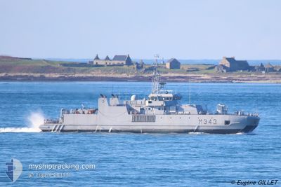
KNM HINNOEY
Military ops
Current Trip
MILITARY OPERATIONS
| Time Travelled | --- |
|---|---|
| Remaining Time | --- |
| Distance Travelled | 81.51 nm |
| Remaining Distance | --- |
| AVG Speed | 14.4 Knots |
| MAX Speed | 21.8 Knots |
| AVG Wind | 8 knots |
| MAX Wind | 17.2 knots |
| MIN Temp | -0.2°C / 31.64°F |
| MAX Temp | 15.5°C / 59.9°F |
| Draught | 3 m |
| Position Received | 3 m ago |
Current Position
| Longitude | 5.23653° |
|---|---|
| Latitude | 60.34021° |
| Status | Moored |
| Speed | |
| Course | 146° |
| Area | North Sea |
| Station | T-AIS |
| Position Received | 3 m ago |
Info
Information
The current position of KNM HINNOEY is in North Sea with coordinates 60.34021° / 5.23653° as reported on 2024-05-23 23:39 by AIS to our vessel tracker app. The vessel's current speed is 0 Knots
The vessel KNM HINNOEY (MMSI: 259019000) is a Military ops It's sailing under the flag of [NO] Norway.
In this page you can find informations about the vessels current position, last detected port calls, and current voyage information. If the vessels is not in coverage by AIS you will find the latest position.
The current position of KNM HINNOEY is detected by our AIS receivers and we are not responsible for the reliability of the data. The last position was recorded while the vessel was in Coverage by the Ais receivers of our vessel tracking app.
The current draught of KNM HINNOEY as reported by AIS is 3 meters
Weather
| Temperature | 12.5°C / 54.5°F |
|---|---|
| Wind Speed | 3 knots |
| Direction | 162° SSE |
| Pressure | 1014.9 hPa |
| Humidity | 85.7 % |
| Cloud Coverage | 22 % |
Featured Company
Last Port Calls
Last Trips
| Origin | Departure | Destination | Arrival | Distance |
|---|
Events
| Time | Event | Details | Position / Dest | Info |
|---|---|---|---|---|
| 2024-05-15 05:29 | Status Changed | Moored Under way using engine |
60.34021 / 5.23654
MILITARY OPERATIONS
|
Speed: Course: 146° |
| 2024-05-15 05:19 | STOP Moving | 2.86 nm, South East of KNARREVIK |
60.34184 / 5.23746
MILITARY OPERATIONS
|
Speed: Course: 345° |
| 2024-05-15 02:00 | START Moving | 10.91 nm, North of EIKEFET |
60.87322 / 5.44346
MILITARY OPERATIONS
|
Speed: 4.6 kn Course: 280° |
| 2024-05-15 01:45 | STOP Moving | 10.98 nm, North of EIKEFET |
60.87375 / 5.43878
MILITARY OPERATIONS
|
Speed: Course: 74° |
| 2024-05-14 23:52 | START Moving | 10.47 nm, East of SLOVAG |
60.87438 / 5.41653
MILITARY OPERATIONS
|
Speed: 3.2 kn Course: 68° |
| 2024-05-14 23:46 | STOP Moving | 10.3 nm, East of SLOVAG |
60.87328 / 5.41115
MILITARY OPERATIONS
|
Speed: Course: 90° |
| 2024-05-14 22:35 | START Moving | 9.49 nm, East of SLOVAG |
60.87158 / 5.38373
MILITARY OPERATIONS
|
Speed: 4.4 kn Course: 50° |
| 2024-05-14 21:01 | STOP Moving | 9.21 nm, East of SLOVAG |
60.86735 / 5.37519
MILITARY OPERATIONS
|
Speed: Course: 302° |
| 2024-05-14 16:41 | Status Changed | Under way using engine Moored |
60.33857 / 5.23864
MILITARY OPERATIONS
|
Speed: 3.2 kn Course: 131° |
| 2024-05-14 16:41 | START Moving | 3.01 nm, South East of KNARREVIK |
60.33857 / 5.23864
MILITARY OPERATIONS
|
Speed: 4 kn Course: 184° |