
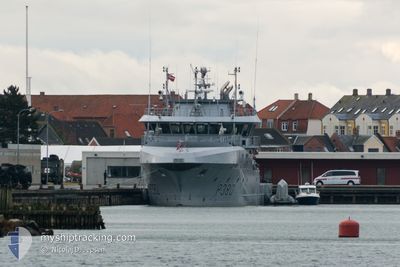
KNM OLAV TRYGGVASON
Patrol Vessel
Current Trip
MILITARY OPERATIONS
| Time Travelled | 1 day |
|---|---|
| Remaining Time | --- |
| Distance Travelled | 220.46 nm |
| Remaining Distance | --- |
| AVG Speed | 8.9 Knots |
| MAX Speed | 13.9 Knots |
| AVG Wind | 7.6 knots |
| MAX Wind | 18.8 knots |
| MIN Temp | 12.9°C / 55.22°F |
| MAX Temp | 23.2°C / 73.76°F |
| Draught | 4.2 m |
| Position Received | 1 m ago |
Current Position
| Longitude | 6.81825° |
|---|---|
| Latitude | 58.09122° |
| Status | Under way using engine |
| Speed | 0.8 Knots |
| Course | 220° |
| Area | North Sea |
| Station | T-AIS |
| Position Received | 1 m ago |
Info
Information
The current position of KNM OLAV TRYGGVASON is in North Sea with coordinates 58.09122° / 6.81825° as reported on 2024-05-27 07:33 by AIS to our vessel tracker app. The vessel's current speed is 0.8 Knots
The vessel KNM OLAV TRYGGVASON (IMO: 9517460, MMSI: 259366000) is a Patrol Vessel that was built in 2010 ( 14 years old ). It's sailing under the flag of [NO] Norway.
In this page you can find informations about the vessels current position, last detected port calls, and current voyage information. If the vessels is not in coverage by AIS you will find the latest position.
The current position of KNM OLAV TRYGGVASON is detected by our AIS receivers and we are not responsible for the reliability of the data. The last position was recorded while the vessel was in Coverage by the Ais receivers of our vessel tracking app.
The current draught of KNM OLAV TRYGGVASON as reported by AIS is 4.2 meters
Weather
| Temperature | 13°C / 55.4°F |
|---|---|
| Wind Speed | 16 knots |
| Direction | 109° ESE |
| Pressure | 1012.6 hPa |
| Humidity | 95.4 % |
| Cloud Coverage | 100 % |
Featured Company
Last Port Calls
| Port | Arrival | Departure | Time In Port |
|---|---|---|---|
| 2024-05-25 01:38 | 2024-05-25 09:44 | 8 h | |
| 2024-04-16 15:35 | 2024-04-17 06:09 | 14 h | |
| 2024-04-15 16:28 | 2024-04-16 06:58 | 14 h | |
| 2024-04-09 15:10 | 2024-04-09 15:44 | 33 m | |
| 2024-03-15 13:22 | 2024-03-18 12:18 | 2 d | |
| 2024-03-14 17:25 | 2024-03-15 09:41 | 16 h | |
| 2024-03-11 08:01 | 2024-03-11 11:50 | 3 h | |
| 2024-03-10 07:33 | 2024-03-10 12:27 | 4 h |
Last Trips
| Origin | Departure | Destination | Arrival | Distance | |
|---|---|---|---|---|---|
| 2024-04-17 08:09 | 2024-05-25 03:38 | 662.11 nm | |||
| 2024-04-16 08:58 | 2024-04-16 17:35 | 59.84 nm | |||
| 2024-04-09 17:44 | 2024-04-15 18:28 | 110.25 nm | |||
| 2024-03-18 13:18 | 2024-04-09 17:10 | 810.90 nm | |||
| 2024-03-15 10:41 | 2024-03-15 14:22 | 14.04 nm | |||
| 2024-03-11 12:50 | 2024-03-14 18:25 | 333.07 nm | |||
| 2024-03-10 13:27 | 2024-03-11 09:01 | 36.72 nm | |||
| 2024-02-21 17:15 | 2024-03-10 08:33 | 455.99 nm |
Events
| Time | Event | Details | Position / Dest | Info |
|---|---|---|---|---|
| 2024-05-27 07:28 | STOP Moving | 0.35 nm, South East of FARSUND |
58.09077 / 6.81841
MILITARY OPERATIONS
|
Speed: 0.3 kn Course: 253° |
| 2024-05-27 06:46 | START Moving | 2.91 nm, West of HAUSVIK |
58.05682 / 6.89471
MILITARY OPERATIONS
|
Speed: 4 kn Course: 260° |
| 2024-05-27 05:40 | Status Changed | Under way using engine At anchor |
58.05460 / 6.91211
MILITARY OPERATIONS
|
Speed: 1.7 kn Course: 149° |
| 2024-05-26 21:45 | Status Changed | At anchor Under way using engine |
58.05457 / 6.91033
MILITARY OPERATIONS
|
Speed: 0.1 kn Course: 120° |
| 2024-05-26 21:16 | STOP Moving | 2.48 nm, West of HAUSVIK |
58.05529 / 6.90782
MILITARY OPERATIONS
|
Speed: 0.1 kn Course: 132° |
| 2024-05-26 20:41 | Change Sea Area | Norwegian part of the North Sea Norwegian part of the Skaggerak |
57.97896 / 7.02055
North Sea
|
Speed: 13.9 kn Course: 281° |
| 2024-05-26 13:35 | START Moving | 0.25 nm, South East of ARENDAL |
58.45489 / 8.77588
MILITARY OPERATIONS
|
Speed: 4.8 kn Course: 157° |
| 2024-05-26 10:17 | STOP Moving | 0.12 nm, East of ARENDAL |
58.45790 / 8.77384
MILITARY OPERATIONS
|
Speed: 0.3 kn Course: 227° |
| 2024-05-26 06:51 | START Moving | 4.43 nm, South of RISOR |
58.65864 / 9.19875
MILITARY OPERATIONS
|
Speed: 5.7 kn Course: 193.9° |
| 2024-05-26 06:26 | STOP Moving | 4.31 nm, South of RISOR |
58.66042 / 9.20041
MILITARY OPERATIONS
|
Speed: 0.2 kn Course: 201° |