
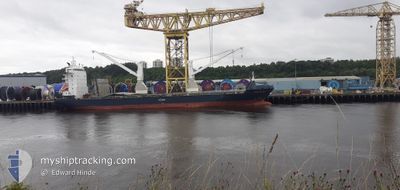
KOGA RANGER
General Cargo
Current Trip
| Trip Time | 4 days |
|---|---|
| Trip Distance | 969.29 nm |
| AVG Speed | 11.7 Knots |
| MAX Speed | 11.7 Knots |
| Draught | 6.4 m |
| AVG Wind | 5.5 knots |
| MAX Wind | 13.9 knots |
| MIN Temp | 19.2°C / 66.56°F |
| MAX Temp | 29.7°C / 85.46°F |
| Position Received | 15 h, 22 m ago |
Current Position
| Longitude | 28.65875° |
|---|---|
| Latitude | 44.10054° |
| Status | Moored |
| Speed | |
| Course | 3° |
| Area | Black Sea |
| Station | T-AIS |
| Position Received | 15 h, 22 m ago |
Info
Information
The current position of KOGA RANGER is in Black Sea with coordinates 44.10054° / 28.65875° as reported on 2024-06-05 20:02 by AIS to our vessel tracker app. The vessel's current speed is 0 Knots and is currently inside the port of CONSTANTA.
The vessel KOGA RANGER (IMO: 9277280, MMSI: 636092311) is a General Cargo that was built in 2005 ( 19 years old ). It's sailing under the flag of [LR] Liberia.
In this page you can find informations about the vessels current position, last detected port calls, and current voyage information. If the vessels is not in coverage by AIS you will find the latest position.
The current position of KOGA RANGER is detected by our AIS receivers and we are not responsible for the reliability of the data. The last position was recorded while the vessel was in Coverage by the Ais receivers of our vessel tracking app.
The current draught of KOGA RANGER as reported by AIS is 6.4 meters
Weather
| Temperature | 22.3°C / 72.14°F |
|---|---|
| Wind Speed | 9 knots |
| Direction | 228° SW |
| Pressure | 1013.3 hPa |
| Humidity | 73.6 % |
| Cloud Coverage | 100 % |
Featured Company
Most Visited Ports (Last year)
| Port | Arrivals | |
|---|---|---|
| 4 | ||
| 3 | ||
| 2 | ||
| 1 | ||
| 1 | ||
| 1 |
Last Trips
| Origin | Departure | Destination | Arrival | Distance | |
|---|---|---|---|---|---|
| 2024-05-31 23:02 | 2024-06-05 08:58 | 969.29 nm | |||
| 2024-05-17 18:50 | 2024-05-30 02:59 | 1555.43 nm | |||
| 2024-05-08 19:43 | 2024-05-13 18:12 | 1526.90 nm | |||
| 2024-04-09 01:15 | 2024-05-03 21:14 | 4623.74 nm | |||
| 2024-03-27 15:32 | 2024-04-02 14:51 | 2132.81 nm |
Events
| Time | Event | Details | Position / Dest | Info |
|---|---|---|---|---|
| 2024-06-05 20:02 | OUT of Coverage |
44.10054 / 28.65875
Black Sea
[RO] CONSTANTA
|
Speed: Course: 187.5° |
|
| 2024-06-05 20:02 | IN Coverage |
44.10054 / 28.65875
Black Sea
[RO] CONSTANTA
|
Speed: Course: 187.5° |
|
| 2024-06-05 05:58 | PORT ARRIVAL |
|
44.10056 / 28.65872
[RO] CONSTANTA
|
Speed: 44 kn Course: 24° |
| 2024-06-04 10:03 | START Moving | 4.32 nm, North East of CONSTANTA |
44.15170 / 28.76308
ROCND
|
Speed: 25.3 kn Course: 126° |
| 2024-06-04 01:46 | STOP Moving | 4.21 nm, North East of CONSTANTA |
44.15314 / 28.75933
ROCND
|
Speed: Course: 124° |
| 2024-06-04 01:32 | START Moving | 4.2 nm, North East of CONSTANTA |
44.15290 / 28.75941
ROCND
|
Speed: 9.6 kn Course: 310° |
| 2024-06-03 16:33 | STOP Moving | 4.33 nm, North East of CONSTANTA |
44.15362 / 28.76224
ROCND
|
Speed: Course: 186° |
| 2024-06-03 14:31 | Draught Changed | 6.4 6.3 |
44.15396 / 28.76145
ROCND
|
Speed: 4.6 kn Course: 166° |
| 2024-06-03 14:25 | OUT of Coverage |
44.15396 / 28.76145
Black Sea
|
Speed: 4.6 kn Course: 340.8° |
|
| 2024-06-03 14:07 | Status Changed | At anchor Default |
44.15370 / 28.76147
ROCND
|
Speed: 0.2 kn Course: 166° |