
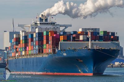
KOI
Container Ship
Current Trip
| Time Travelled | 3 days |
|---|---|
| Remaining Time | --- |
| Distance Travelled | 649.55 nm |
| Remaining Distance | --- |
| AVG Speed | 11.9 Knots |
| MAX Speed | 21.2 Knots |
| AVG Wind | 9.9 knots |
| MAX Wind | 18 knots |
| MIN Temp | 15.4°C / 59.72°F |
| MAX Temp | 19.5°C / 67.1°F |
| Draught | 12.3 m |
| Position Received | Now |
Current Position
| Longitude | 9.09876° |
|---|---|
| Latitude | 44.11658° |
| Status | Under way using engine |
| Speed | 0.3 Knots |
| Course | 133° |
| Area | Ligurian Sea |
| Station | T-AIS |
| Position Received | Now |
Info
Information
The current position of KOI is in Ligurian Sea with coordinates 44.11658° / 9.09876° as reported on 2024-05-18 08:55 by AIS to our vessel tracker app. The vessel's current speed is 0.3 Knots
The vessel KOI (IMO: 9461489, MMSI: 636018059) is a Container Ship that was built in 2011 ( 13 years old ). It's sailing under the flag of [LR] Liberia.
In this page you can find informations about the vessels current position, last detected port calls, and current voyage information. If the vessels is not in coverage by AIS you will find the latest position.
The current position of KOI is detected by our AIS receivers and we are not responsible for the reliability of the data. The last position was recorded while the vessel was in Coverage by the Ais receivers of our vessel tracking app.
The current draught of KOI as reported by AIS is 12.3 meters
Weather
| Temperature | 17.2°C / 62.96°F |
|---|---|
| Wind Speed | 7 knots |
| Direction | 66° ENE |
| Pressure | 1013.5 hPa |
| Humidity | 76.5 % |
| Cloud Coverage | 2 % |
Featured Company
Last Port Calls
| Port | Arrival | Departure | Time In Port |
|---|---|---|---|
| 2024-05-12 14:40 | 2024-05-14 22:08 | 2 d | |
| 2024-05-09 14:42 | 2024-05-10 23:11 | 1 d | |
| 2024-05-04 23:13 | 2024-05-06 05:19 | 1 d | |
| 2024-04-07 21:38 | 2024-04-08 19:09 | 21 h | |
| 2024-04-05 01:53 | 2024-04-06 05:05 | 1 d | |
| 2024-03-28 03:26 | 2024-03-30 12:50 | 2 d |
Most Visited Ports (Last year)
| Port | Arrivals | |
|---|---|---|
| 9 | ||
| 9 | ||
| 9 | ||
| 8 | ||
| 7 | ||
| 6 |
Last Trips
| Origin | Departure | Destination | Arrival | Distance | |
|---|---|---|---|---|---|
| 2024-05-11 02:11 | 2024-05-12 16:40 | 540.02 nm | |||
| 2024-05-06 07:19 | 2024-05-09 17:42 | 1278.17 nm | |||
| 2024-04-09 00:39 | 2024-05-05 01:13 | 10241.21 nm | |||
| 2024-04-06 10:35 | 2024-04-08 03:08 | 426.01 nm | |||
| 2024-03-30 16:50 | 2024-04-05 07:23 | 1348.78 nm | |||
| 2024-02-25 02:22 | 2024-03-28 07:26 | 11137.77 nm |
Events
| Time | Event | Details | Position / Dest | Info |
|---|---|---|---|---|
| 2024-05-18 01:51 | STOP Moving | 12.49 nm, South West of LAVAGNA |
44.13124 / 9.18185
ITGOA
|
Speed: 0.3 kn Course: 143° |
| 2024-05-18 00:19 | START Moving | 11.77 nm, South of RECCO |
44.16586 / 9.09795
ITGOA
|
Speed: 3.1 kn Course: 110° |
| 2024-05-17 23:44 | STOP Moving | 12.32 nm, South of RECCO |
44.15669 / 9.09590
ITGOA
|
Speed: 0.3 kn Course: 261° |
| 2024-05-17 17:18 | START Moving | 9.96 nm, South of RECCO |
44.19438 / 9.16466
ITGOA
|
Speed: 3.1 kn Course: 192° |
| 2024-05-17 09:08 | STOP Moving | 14.98 nm, South West of LAVAGNA |
44.10233 / 9.13856
ITGOA
|
Speed: 0.3 kn Course: 215° |
| 2024-05-16 22:17 | START Moving | 10.57 nm, South West of RIVA TRIGOSO |
44.14955 / 9.22610
ITGOA
|
Speed: 3.1 kn Course: 246° |
| 2024-05-16 14:40 | STOP Moving | 13.22 nm, South West of LAVAGNA |
44.12823 / 9.15824
ITGOA
|
Speed: 0.3 kn Course: 87° |
| 2024-05-16 08:58 | Change Sea Area | Italian part of the Ligurian Sea Italian part of the Tyrrhenian Sea |
43.29600 / 9.54063
Ligurian Sea
ITGOA
|
Speed: 12.7 kn Course: 340.7° |
| 2024-05-16 08:40 | Change Sea Area | Italian part of the Tyrrhenian Sea French part of the Tyrrhenian Sea |
43.23631 / 9.56735
Tyrrhenian Sea
ITGOA
|
Speed: 12.7 kn Course: 346.9° |
| 2024-05-16 07:40 | Change Sea Area | French part of the Tyrrhenian Sea Italian part of the Tyrrhenian Sea |
43.02908 / 9.64166
Tyrrhenian Sea
ITGOA
|
Speed: 12.8 kn Course: 341.4° |