
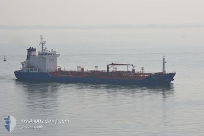
KONGO STAR
Oil/Chemical Tanker
Current Trip
| Time Travelled | 14 days |
|---|---|
| Remaining Time | --- |
| Distance Travelled | 3463.48 nm |
| Remaining Distance | 1601.03 nm |
| AVG Speed | 12.5 Knots |
| MAX Speed | 17.3 Knots |
| AVG Wind | 11.7 knots |
| MAX Wind | 38.3 knots |
| MIN Temp | 8.6°C / 47.48°F |
| MAX Temp | 34.3°C / 93.74°F |
| Draught | 6.5 m |
| Position Received | 10 d ago |
Current Position
| Longitude | -79.37709° |
|---|---|
| Latitude | 26.38017° |
| Status | Under way using engine |
| Speed | 13.6 Knots |
| Course | 359.2° |
| Area | North Atlantic Ocean |
| Station | T-AIS |
| Position Received | 10 d ago |
Info
Information
The current position of KONGO STAR is in North Atlantic Ocean with coordinates 26.38017° / -79.37709° as reported on 2024-06-11 01:56 by AIS to our vessel tracker app. The vessel's current speed is 13.6 Knots and is heading at the port of NEW YORK. The estimated time of arrival as calculated by vessel tracking app is 2024-06-15 15:00 LT
The vessel KONGO STAR (IMO: 9508823, MMSI: 248439000) is a Oil/Chemical Tanker that was built in 2010 ( 14 years old ). It's sailing under the flag of [MT] Malta.
In this page you can find informations about the vessels current position, last detected port calls, and current voyage information. If the vessels is not in coverage by AIS you will find the latest position.
The current position of KONGO STAR is detected by our AIS receivers and we are not responsible for the reliability of the data. The last position was recorded while the vessel was in Coverage by the Ais receivers of our vessel tracking app.
The current draught of KONGO STAR as reported by AIS is 6.5 meters
Weather
| Temperature | 18.1°C / 64.58°F |
|---|---|
| Wind Speed | 26 knots |
| Direction | 236° SW |
| Pressure | 1014.1 hPa |
| Humidity | 85.6 % |
| Cloud Coverage | 100 % |
Featured Company
Last Port Calls
| Port | Arrival | Departure | Time In Port |
|---|---|---|---|
| 2024-06-06 19:01 | 2024-06-07 02:27 | 7 h | |
| 2024-05-24 18:22 | 2024-05-24 20:16 | 1 h | |
| 2024-05-23 09:41 | 2024-05-23 10:16 | 34 m | |
| 2024-05-15 15:18 | 2024-05-17 12:46 | 1 d | |
| 2024-05-09 21:12 | 2024-05-15 11:01 | 5 d | |
| 2024-05-08 19:47 | 2024-05-08 20:21 | 34 m | |
| 2024-05-02 14:41 | 2024-05-02 20:45 | 6 h | |
| 2024-04-16 13:44 | 2024-04-19 02:44 | 2 d | |
| 2024-04-11 00:32 | 2024-04-11 23:19 | 22 h | |
| 2024-04-08 18:05 | 2024-04-10 01:09 | 1 d |
Last Trips
| Origin | Departure | Destination | Arrival | Distance | |
|---|---|---|---|---|---|
| 2024-05-24 16:16 | 2024-06-06 14:01 | 3292.66 nm | |||
| 2024-05-23 06:16 | 2024-05-24 14:22 | 297.05 nm | |||
| 2024-05-17 08:46 | 2024-05-23 05:41 | 384.92 nm | |||
| 2024-05-15 07:01 | 2024-05-15 11:18 | 42.12 nm | |||
| 2024-05-08 16:21 | 2024-05-09 17:12 | 232.10 nm | |||
| 2024-05-02 16:45 | 2024-05-08 15:47 | 340.11 nm | |||
| 2024-04-19 04:44 | 2024-05-02 10:41 | 3606.49 nm | |||
| 2024-04-12 00:19 | 2024-04-16 15:44 | 530.33 nm | |||
| 2024-04-10 02:09 | 2024-04-11 01:32 | 251.57 nm | |||
| 2024-03-27 19:35 | 2024-04-08 19:05 | 470.55 nm |
Events
| Time | Event | Details | Position / Dest | Info |
|---|---|---|---|---|
| 2024-06-18 18:15 | START Moving |
46.32738 / -54.96670
USNYC
|
Speed: 10.5 kn Course: 199° |
|
| 2024-06-17 23:42 | STOP Moving |
46.06500 / -55.15667
USNYC
|
Speed: Course: -1° |
|
| 2024-06-14 22:42 | START Moving |
37.04666 / -70.24667
USNYC
|
Speed: 6 kn Course: 54° |
|
| 2024-06-13 21:09 | STOP Moving |
36.82167 / -69.78833
USNYC
|
Speed: Course: -1° |