
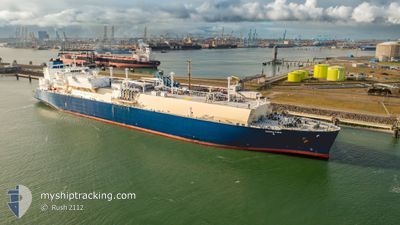
KOOL FIRN
Tanker D
Current Trip
FOR ORDERS
| Time Travelled | 20 days |
|---|---|
| Remaining Time | --- |
| Distance Travelled | 5140.03 nm |
| Remaining Distance | --- |
| AVG Speed | 14.3 Knots |
| MAX Speed | 21.3 Knots |
| AVG Wind | 12.1 knots |
| MAX Wind | 27.8 knots |
| MIN Temp | 16.1°C / 60.98°F |
| MAX Temp | 29.7°C / 85.46°F |
| Draught | 11.5 m |
| Position Received | 3 d ago |
Current Position
| Longitude | 121.75319° |
|---|---|
| Latitude | 34.38823° |
| Status | Under way using engine |
| Speed | 12.6 Knots |
| Course | 113.9° |
| Area | Yellow Sea |
| Station | T-AIS |
| Position Received | 3 d ago |
Info
Information
The current position of KOOL FIRN is in Yellow Sea with coordinates 34.38823° / 121.75319° as reported on 2024-06-02 15:19 by AIS to our vessel tracker app. The vessel's current speed is 12.6 Knots
The vessel KOOL FIRN (IMO: 9864746, MMSI: 636019878) is a Tanker D It's sailing under the flag of [LR] Liberia.
In this page you can find informations about the vessels current position, last detected port calls, and current voyage information. If the vessels is not in coverage by AIS you will find the latest position.
The current position of KOOL FIRN is detected by our AIS receivers and we are not responsible for the reliability of the data. The last position was recorded while the vessel was in Coverage by the Ais receivers of our vessel tracking app.
The current draught of KOOL FIRN as reported by AIS is 11.5 meters
Weather
| Temperature | 26.4°C / 79.52°F |
|---|---|
| Wind Speed | 12 knots |
| Direction | 75° ENE |
| Pressure | 1013.5 hPa |
| Humidity | 63.6 % |
| Cloud Coverage | 56 % |
Featured Company
Events
| Time | Event | Details | Position / Dest | Info |
|---|---|---|---|---|
| 2024-06-02 15:19 | Status Changed | Default Under way using engine |
34.38728 / 121.75578
FOR ORDERS
|
Speed: 12.6 kn Course: 113.9° |
| 2024-06-02 15:19 | Status Changed | Under way using engine Default |
34.38823 / 121.75319
FOR ORDERS
|
Speed: 12.6 kn Course: 114° |
| 2024-06-02 15:19 | OUT of Coverage |
34.38823 / 121.75319
Yellow Sea
|
Speed: 12.6 kn Course: 113.9° |
|
| 2024-06-02 15:19 | Change Sea Area | Chinese part of the Yellow Sea Australian part of the Coral Sea |
34.38823 / 121.75319
Yellow Sea
|
Speed: 12.6 kn Course: 113.9° |
| 2024-06-02 15:11 | IN Coverage |
34.38823 / 121.75319
Yellow Sea
|
Speed: 12.6 kn Course: 113.9° |
|
| 2024-06-02 09:10 | START Moving |
34.29288 / 120.28535
FOR ORDERS
|
Speed: 6 kn Course: 61° |
|
| 2024-06-01 08:34 | STOP Moving |
34.28917 / 120.28037
FOR ORDERS
|
Speed: Course: 68° |
|
| 2024-05-31 09:35 | START Moving |
33.34206 / 124.87904
FOR ORDERS
|
Speed: 4.5 kn Course: 239° |
|
| 2024-05-29 00:35 | STOP Moving |
33.22914 / 124.87157
FOR ORDERS
|
Speed: 0.3 kn Course: 256° |