
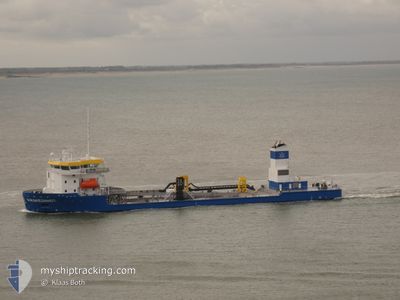
KRAKESANDT
Dredging or underwater ops
Current Trip
| Time Travelled | 26 days |
|---|---|
| Remaining Time | --- |
| Distance Travelled | 1461.65 nm |
| Remaining Distance | --- |
| AVG Speed | 9.4 Knots |
| MAX Speed | 14.6 Knots |
| AVG Wind | 13.5 knots |
| MAX Wind | 29 knots |
| MIN Temp | 9.7°C / 49.46°F |
| MAX Temp | 20.3°C / 68.54°F |
| Draught | 6.5 m |
| Position Received | 3 m ago |
Current Position
| Longitude | 3.59712° |
|---|---|
| Latitude | 51.38999° |
| Status | At anchor |
| Speed | |
| Course | 295° |
| Area | North Sea |
| Station | T-AIS |
| Position Received | 3 m ago |
Info
Information
The current position of KRAKESANDT is in North Sea with coordinates 51.38999° / 3.59712° as reported on 2024-06-19 19:35 by AIS to our vessel tracker app. The vessel's current speed is 0 Knots
The vessel KRAKESANDT (IMO: 9823807, MMSI: 244849000) is a Dredging or underwater ops It's sailing under the flag of [NL] Netherlands.
In this page you can find informations about the vessels current position, last detected port calls, and current voyage information. If the vessels is not in coverage by AIS you will find the latest position.
The current position of KRAKESANDT is detected by our AIS receivers and we are not responsible for the reliability of the data. The last position was recorded while the vessel was in Coverage by the Ais receivers of our vessel tracking app.
The current draught of KRAKESANDT as reported by AIS is 6.5 meters
Weather
| Temperature | 14.8°C / 58.64°F |
|---|---|
| Wind Speed | 16 knots |
| Direction | 26° NNE |
| Pressure | 1022 hPa |
| Humidity | 77.3 % |
| Cloud Coverage | 1 % |
Featured Company
Last Port Calls
| Port | Arrival | Departure | Time In Port |
|---|---|---|---|
| 2024-05-23 08:52 | 2024-05-24 04:34 | 19 h | |
| 2024-04-25 05:17 | 2024-04-25 09:29 | 4 h | |
| 2024-04-02 05:07 |
Most Visited Ports (Last year)
| Port | Arrivals | |
|---|---|---|
| 9 | ||
| 3 | ||
| 2 |
Last Trips
| Origin | Departure | Destination | Arrival | Distance | |
|---|---|---|---|---|---|
| 2024-04-25 11:29 | 2024-05-23 10:52 | 1676.60 nm | |||
| 2024-04-02 07:07 | 2024-04-25 07:17 | 1488.79 nm |
Events
| Time | Event | Details | Position / Dest | Info |
|---|---|---|---|---|
| 2024-06-19 10:53 | STOP Moving | 1.22 nm, South East of BRESKENS |
51.38997 / 3.59712
HOOFDPLAAT
|
Speed: 0.3 kn Course: 326° |
| 2024-06-19 08:29 | START Moving | 16.01 nm, North of ZEEBRUGGE |
51.60935 / 3.17604
HOOFDPLAAT
|
Speed: 3.3 kn Course: 85° |
| 2024-06-19 08:28 | Status Changed | At anchor Restricted manoeuverability |
51.60964 / 3.17486
HOOFDPLAAT
|
Speed: 1.9 kn Course: 55° |
| 2024-06-19 07:47 | STOP Moving | 15.23 nm, North of ZEEBRUGGE |
51.59554 / 3.16284
HOOFDPLAAT
|
Speed: 0.3 kn Course: 0° |
| 2024-06-19 06:50 | Draught Changed | 6.5 3.5 |
51.60174 / 3.16895
HOOFDPLAAT
|
Speed: 1.5 kn Course: 31° |
| 2024-06-19 06:44 | Destination Changed | HOOFDPLAAT STEENDIEP |
51.59949 / 3.16692
HOOFDPLAAT
|
Speed: 1.4 kn Course: 29° |
| 2024-06-19 06:44 | ETA Changed | 2024/06/19 13:00 2024/06/19 09:00 |
51.59949 / 3.16692
HOOFDPLAAT
|
Speed: 1.4 kn Course: 29° |
| 2024-06-19 06:33 | Status Changed | Restricted manoeuverability Under way using engine |
51.59613 / 3.16224
STEENDIEP
|
Speed: 2.1 kn Course: 41° |
| 2024-06-19 04:27 | START Moving | 1.16 nm, South East of BRESKENS |
51.38931 / 3.59474
STEENDIEP
|
Speed: 6.4 kn Course: 269.7° |
| 2024-06-19 04:25 | Status Changed | Under way using engine At anchor |
51.38985 / 3.59761
STEENDIEP
|
Speed: Course: 107° |