
KRIS
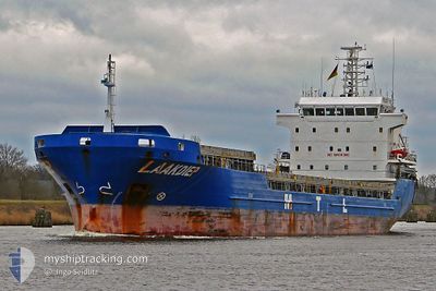
General Cargo
Current Trip
| Time Travelled | 2 days |
|---|---|
| Remaining Time | --- |
| Distance Travelled | 548.11 nm |
| Remaining Distance | --- |
| AVG Speed | 9.3 Knots |
| MAX Speed | 10.7 Knots |
| AVG Wind | 7.9 knots |
| MAX Wind | 16.7 knots |
| MIN Temp | 10.6°C / 51.08°F |
| MAX Temp | 23.8°C / 74.84°F |
| Draught | 7.3 m |
| Position Received | 1 m ago |
Current Position
| Longitude | 18.67834° |
|---|---|
| Latitude | 54.46119° |
| Status | At anchor |
| Speed | |
| Course | 113° |
| Area | Baltic Sea |
| Station | T-AIS |
| Position Received | 1 m ago |
Info
Information
The current position of KRIS is in Baltic Sea with coordinates 54.46119° / 18.67834° as reported on 2024-06-01 02:13 by AIS to our vessel tracker app. The vessel's current speed is 0 Knots
The vessel KRIS (IMO: 9408889, MMSI: 304502000) is a General Cargo that was built in 2007 ( 17 years old ). It's sailing under the flag of [AG] Antigua Barbuda.
In this page you can find informations about the vessels current position, last detected port calls, and current voyage information. If the vessels is not in coverage by AIS you will find the latest position.
The current position of KRIS is detected by our AIS receivers and we are not responsible for the reliability of the data. The last position was recorded while the vessel was in Coverage by the Ais receivers of our vessel tracking app.
The current draught of KRIS as reported by AIS is 7.3 meters
Weather
| Temperature | 13°C / 55.4°F |
|---|---|
| Wind Speed | 4 knots |
| Direction | 7° N |
| Pressure | 1010.5 hPa |
| Humidity | 95.4 % |
| Cloud Coverage | 5 % |
Featured Company
Last Port Calls
| Port | Arrival | Departure | Time In Port |
|---|---|---|---|
| 2024-05-27 21:20 | 2024-05-29 10:29 | 1 d | |
| 2024-05-20 04:18 | 2024-05-25 01:16 | 4 d | |
| 2024-05-14 12:26 | 2024-05-16 04:51 | 1 d | |
| 2024-05-12 06:48 | 2024-05-13 00:48 | 17 h | |
| 2024-05-10 05:59 | 2024-05-10 21:27 | 15 h | |
| 2024-05-05 19:28 | 2024-05-08 17:38 | 2 d | |
| 2024-05-01 20:53 | 2024-05-02 19:03 | 22 h | |
| 2024-04-29 12:22 | 2024-04-29 12:31 | 9 m | |
| 2024-04-28 04:20 | 2024-04-29 11:32 | 1 d | |
| 2024-04-15 21:40 | 2024-04-25 13:43 | 9 d |
Last Trips
| Origin | Departure | Destination | Arrival | Distance | |
|---|---|---|---|---|---|
| 2024-05-25 03:16 | 2024-05-28 00:20 | 569.22 nm | |||
| 2024-05-16 07:51 | 2024-05-20 06:18 | 551.04 nm | |||
| 2024-05-13 03:48 | 2024-05-14 15:26 | 338.23 nm | |||
| 2024-05-10 23:27 | 2024-05-12 09:48 | 322.58 nm | |||
| 2024-05-08 19:38 | 2024-05-10 07:59 | 242.04 nm | |||
| 2024-05-02 21:03 | 2024-05-05 21:28 | 257.75 nm | |||
| 2024-04-29 15:31 | 2024-05-01 22:53 | 544.69 nm | |||
| 2024-04-29 14:32 | 2024-04-29 15:22 | 6.56 nm | |||
| 2024-04-25 15:43 | 2024-04-28 07:20 | 736.56 nm | |||
| 2024-04-08 14:46 | 2024-04-15 23:40 | 1163.29 nm |
Events
| Time | Event | Details | Position / Dest | Info |
|---|---|---|---|---|
| 2024-06-01 00:01 | ETA Changed | 2025/05/31 18:00 2024/05/31 18:00 |
54.46109 / 18.67812
GDANSK
|
Speed: Course: 104° |
| 2024-05-31 19:37 | Status Changed | At anchor Under way using engine |
54.46136 / 18.67882
GDANSK
|
Speed: 0.4 kn Course: 165° |
| 2024-05-31 19:29 | STOP Moving | 4.86 nm, North of GDANSK |
54.46106 / 18.67967
GDANSK
|
Speed: 0.3 kn Course: 155° |
| 2024-05-31 15:57 | Detected in Sea | Polish part of the Baltic Sea |
54.93201 / 19.10770
Baltic Sea
GDANSK
|
Speed: 9.4 kn Course: 196.8° |
| 2024-05-31 15:57 | Status Changed | Under way using engine Default |
54.93201 / 19.10770
GDANSK
|
Speed: 9 kn Course: 196° |
| 2024-05-31 15:49 | IN Coverage |
54.93201 / 19.10770
Baltic Sea
GDANSK
|
Speed: 9.4 kn Course: 196.8° |
|
| 2024-05-31 14:01 | Status Changed | Default Under way using engine |
55.22666 / 19.27333
GDANSK
|
Speed: 9.7 kn Course: 198° |
| 2024-05-31 13:53 | Change Sea Area | Russian part of the Baltic Sea Estonian part of the Baltic Sea |
55.24813 / 19.28524
Baltic Sea
GDANSK
|
Speed: 9.7 kn Course: 198° |
| 2024-05-31 13:53 | Status Changed | Under way using engine Default |
55.24813 / 19.28524
GDANSK
|
Speed: 9.7 kn Course: 198° |
| 2024-05-31 13:53 | OUT of Coverage |
55.24813 / 19.28524
Baltic Sea
GDANSK
|
Speed: 9.7 kn Course: 198° |