
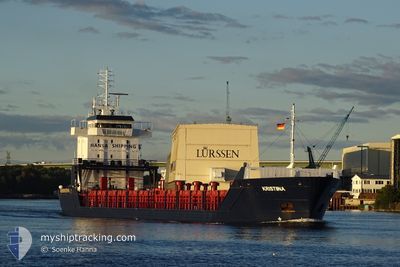
KRISTIINA
General Cargo
Current Trip
| Time Travelled | 1 day |
|---|---|
| Remaining Time | --- |
| Distance Travelled | 310.10 nm |
| Remaining Distance | --- |
| AVG Speed | 10.8 Knots |
| MAX Speed | 16.9 Knots |
| AVG Wind | 14.2 knots |
| MAX Wind | 24.9 knots |
| MIN Temp | 8°C / 46.4°F |
| MAX Temp | 14.4°C / 57.92°F |
| Draught | 4.6 m |
| Position Received | 8 m ago |
Current Position
| Longitude | -1.02607° |
|---|---|
| Latitude | 50.41681° |
| Status | Under way using engine |
| Speed | 12.9 Knots |
| Course | 260° |
| Area | English Channel |
| Station | T-AIS |
| Position Received | 8 m ago |
Info
Information
The current position of KRISTIINA is in English Channel with coordinates 50.41681° / -1.02607° as reported on 2024-05-29 04:30 by AIS to our vessel tracker app. The vessel's current speed is 12.9 Knots and is heading at the port of AUGHINISH. The estimated time of arrival as calculated by vessel tracking app is 2024-05-31 02:00 LT
The vessel KRISTIINA (IMO: 9187916, MMSI: 304188000) is a General Cargo that was built in 1999 ( 25 years old ). It's sailing under the flag of [AG] Antigua Barbuda.
In this page you can find informations about the vessels current position, last detected port calls, and current voyage information. If the vessels is not in coverage by AIS you will find the latest position.
The current position of KRISTIINA is detected by our AIS receivers and we are not responsible for the reliability of the data. The last position was recorded while the vessel was in Coverage by the Ais receivers of our vessel tracking app.
The current draught of KRISTIINA as reported by AIS is 4.6 meters
Weather
| Temperature | 13.6°C / 56.48°F |
|---|---|
| Wind Speed | 17 knots |
| Direction | 258° WSW |
| Pressure | 1010.3 hPa |
| Humidity | 90.2 % |
| Cloud Coverage | 83 % |
Featured Company
Last Port Calls
| Port | Arrival | Departure | Time In Port |
|---|---|---|---|
| 2024-05-24 19:02 | 2024-05-27 22:41 | 3 d | |
| 2024-05-15 20:02 | 2024-05-21 10:52 | 5 d | |
| 2024-05-13 12:13 | 2024-05-15 03:29 | 1 d | |
| 2024-05-04 14:16 | 2024-05-11 09:04 | 6 d | |
| 2024-04-26 03:34 | 2024-04-27 04:55 | 1 d | |
| 2024-04-17 07:07 | 2024-04-20 16:25 | 3 d | |
| 2024-04-13 11:51 | 2024-04-13 15:06 | 3 h | |
| 2024-04-07 04:45 | 2024-04-10 09:08 | 3 d | |
| 2024-04-03 03:58 | 2024-04-04 04:03 | 1 d | |
| 2024-03-30 17:09 | 2024-03-31 09:43 | 16 h |
Most Visited Ports (Last year)
| Port | Arrivals | |
|---|---|---|
| 23 | ||
| 17 | ||
| 8 | ||
| 6 | ||
| 2 | ||
| 1 |
Last Trips
| Origin | Departure | Destination | Arrival | Distance | |
|---|---|---|---|---|---|
| 2024-05-21 12:52 | 2024-05-24 20:02 | 893.40 nm | |||
| 2024-05-15 05:29 | 2024-05-15 22:02 | 13.08 nm | |||
| 2024-05-11 12:04 | 2024-05-13 14:13 | 583.18 nm | |||
| 2024-04-27 05:55 | 2024-05-04 17:16 | 1833.30 nm | |||
| 2024-04-20 18:25 | 2024-04-26 04:34 | 758.21 nm | |||
| 2024-04-13 17:06 | 2024-04-17 09:07 | 398.03 nm | |||
| 2024-04-10 12:08 | 2024-04-13 13:51 | 787.24 nm | |||
| 2024-04-04 07:03 | 2024-04-07 07:45 | 495.41 nm | |||
| 2024-03-31 11:43 | 2024-04-03 06:58 | 726.80 nm | |||
| 2024-03-29 05:17 | 2024-03-30 18:09 | 419.31 nm |
Events
| Time | Event | Details | Position / Dest | Info |
|---|---|---|---|---|
| 2024-05-29 04:36 | Status Changed | Default Under way using engine |
50.41367 / -1.05521
IE AUG
|
Speed: 12.9 kn Course: 260° |
| 2024-05-28 17:31 | Change Sea Area | United Kingdom part of the English Channel United Kingdom part of the North Sea |
51.07669 / 1.47229
English Channel
IE AUG
|
Speed: 8.2 kn Course: 229.6° |
| 2024-05-28 07:44 | ETA Changed | 2024/05/31 02:00 2024/05/31 01:00 |
52.76568 / 1.80611
IE AUG
|
Speed: 12 kn Course: 122.7° |
| 2024-05-28 03:33 | Status Changed | Under way using engine Default |
53.18824 / .81391
IE AUG
|
Speed: 8.9 kn Course: 131° |
| 2024-05-28 03:17 | Status Changed | Default Under way using engine |
53.21458 / .76570
IE AUG
|
Speed: 8.7 kn Course: 132.3° |
| 2024-05-28 03:10 | Status Changed | Under way using engine Default |
53.22746 / .74283
IE AUG
|
Speed: 8.9 kn Course: 134° |
| 2024-05-28 03:01 | IN Coverage |
53.22635 / .74483
North Sea
IE AUG
|
Speed: 8.7 kn Course: 132° |
|
| 2024-05-28 02:10 | Status Changed | Default Under way using engine |
53.34061 / .55954
IE AUG
|
Speed: 9.5 kn Course: 135.5° |
| 2024-05-28 02:04 | OUT of Coverage |
53.35211 / .54104
North Sea
IE AUG
|
Speed: 9.5 kn Course: 135.5° |
|
| 2024-05-27 22:44 | Status Changed | Under way using engine Moored |
53.73450 / -.27061
IE AUG
|
Speed: 7.9 kn Course: 128.2° |