
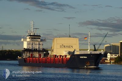
KRISTIINA
General Cargo
Current Trip
| Time Travelled | 5 days |
|---|---|
| Remaining Time | --- |
| Distance Travelled | 830.56 nm |
| Remaining Distance | --- |
| AVG Speed | 10.5 Knots |
| MAX Speed | 16.9 Knots |
| AVG Wind | 11.8 knots |
| MAX Wind | 24.9 knots |
| MIN Temp | 6.6°C / 43.88°F |
| MAX Temp | 15.2°C / 59.36°F |
| Draught | 4.2 m |
| Position Received | 2 d ago |
Current Position
| Longitude | -10.28309° |
|---|---|
| Latitude | 51.43234° |
| Status | Under way using engine |
| Speed | 8.7 Knots |
| Course | 305° |
| Area | North Atlantic Ocean |
| Station | T-AIS |
| Position Received | 2 d ago |
Info
Information
The current position of KRISTIINA is in North Atlantic Ocean with coordinates 51.43234° / -10.28309° as reported on 2024-05-30 18:31 by AIS to our vessel tracker app. The vessel's current speed is 8.7 Knots
The vessel KRISTIINA (IMO: 9187916, MMSI: 304188000) is a General Cargo that was built in 1999 ( 25 years old ). It's sailing under the flag of [AG] Antigua Barbuda.
In this page you can find informations about the vessels current position, last detected port calls, and current voyage information. If the vessels is not in coverage by AIS you will find the latest position.
The current position of KRISTIINA is detected by our AIS receivers and we are not responsible for the reliability of the data. The last position was recorded while the vessel was in Coverage by the Ais receivers of our vessel tracking app.
The current draught of KRISTIINA as reported by AIS is 4.2 meters
Weather
| Temperature | 15°C / 59°F |
|---|---|
| Wind Speed | 7 knots |
| Direction | 322° NW |
| Pressure | 1032.3 hPa |
| Humidity | 76.4 % |
| Cloud Coverage | 46 % |
Featured Company
Last Port Calls
| Port | Arrival | Departure | Time In Port |
|---|---|---|---|
| 2024-05-24 19:02 | 2024-05-27 22:41 | 3 d | |
| 2024-05-15 20:02 | 2024-05-21 10:52 | 5 d | |
| 2024-05-13 12:13 | 2024-05-15 03:29 | 1 d | |
| 2024-05-04 14:16 | 2024-05-11 09:04 | 6 d | |
| 2024-04-26 03:34 | 2024-04-27 04:55 | 1 d | |
| 2024-04-17 07:07 | 2024-04-20 16:25 | 3 d | |
| 2024-04-13 11:51 | 2024-04-13 15:06 | 3 h | |
| 2024-04-07 04:45 | 2024-04-10 09:08 | 3 d | |
| 2024-04-03 03:58 | 2024-04-04 04:03 | 1 d |
Most Visited Ports (Last year)
| Port | Arrivals | |
|---|---|---|
| 22 | ||
| 17 | ||
| 8 | ||
| 6 | ||
| 2 | ||
| 1 |
Last Trips
| Origin | Departure | Destination | Arrival | Distance | |
|---|---|---|---|---|---|
| 2024-05-21 12:52 | 2024-05-24 20:02 | 893.40 nm | |||
| 2024-05-15 05:29 | 2024-05-15 22:02 | 13.08 nm | |||
| 2024-05-11 12:04 | 2024-05-13 14:13 | 583.18 nm | |||
| 2024-04-27 05:55 | 2024-05-04 17:16 | 1833.30 nm | |||
| 2024-04-20 18:25 | 2024-04-26 04:34 | 758.21 nm | |||
| 2024-04-13 17:06 | 2024-04-17 09:07 | 398.03 nm | |||
| 2024-04-10 12:08 | 2024-04-13 13:51 | 787.24 nm | |||
| 2024-04-04 07:03 | 2024-04-07 07:45 | 495.41 nm | |||
| 2024-03-31 11:43 | 2024-04-03 06:58 | 726.80 nm |
Events
| Time | Event | Details | Position / Dest | Info |
|---|---|---|---|---|
| 2024-05-31 05:50 | STOP Moving | 1.61 nm, South East of CAPPA UPPER |
52.60605 / -9.47163
IE AUG
|
Speed: 0.3 kn Course: 106° |
| 2024-05-30 18:35 | Status Changed | Default Under way using engine |
51.43833 / -10.29500
IE AUG
|
Speed: 8.7 kn Course: 305° |
| 2024-05-30 18:31 | OUT of Coverage |
51.43234 / -10.28309
North Atlantic Ocean
IE AUG
|
Speed: 8.7 kn Course: 305° |
|
| 2024-05-30 17:54 | Draught Changed | 4.2 4.6 |
51.37192 / -10.16644
IE AUG
|
Speed: 8.8 kn Course: 311.1° |
| 2024-05-30 17:54 | ETA Changed | 2024/05/31 04:00 2024/05/31 02:00 |
51.37192 / -10.16644
IE AUG
|
Speed: 8.8 kn Course: 311.1° |
| 2024-05-30 17:47 | Change Sea Area | Irish part of the North Atlantic Ocean Irish part of the Celtic Sea |
51.36113 / -10.14526
North Atlantic Ocean
IE AUG
|
Speed: 9.5 kn Course: 310.4° |
| 2024-05-30 17:47 | Status Changed | Under way using engine Default |
51.36088 / -10.14478
IE AUG
|
Speed: 9 kn Course: 310° |
| 2024-05-30 17:42 | Status Changed | Default Under way using engine |
51.35166 / -10.12667
IE AUG
|
Speed: 9.2 kn Course: 310.3° |
| 2024-05-30 17:37 | Status Changed | Under way using engine Default |
51.34515 / -10.11468
IE AUG
|
Speed: 8 kn Course: 307° |
| 2024-05-30 16:54 | Status Changed | Default Under way using engine |
51.27334 / -9.97333
IE AUG
|
Speed: 9.4 kn Course: 309.3° |