
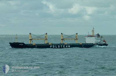
KURPIE
Bulk Carrier
Current Trip
| Time Travelled | 5 days |
|---|---|
| Remaining Time | --- |
| Distance Travelled | 1508.92 nm |
| Remaining Distance | --- |
| AVG Speed | 10.5 Knots |
| MAX Speed | 14.8 Knots |
| AVG Wind | 13.2 knots |
| MAX Wind | 31 knots |
| MIN Temp | 11.6°C / 52.88°F |
| MAX Temp | 18.3°C / 64.94°F |
| Draught | 8.7 m |
| Position Received | 12 m ago |
Current Position
| Longitude | -8.75552° |
|---|---|
| Latitude | 36.44553° |
| Status | Under way using engine |
| Speed | 11.1 Knots |
| Course | 106° |
| Area | North Atlantic Ocean |
| Station | T-AIS |
| Position Received | 12 m ago |
Info
Information
The current position of KURPIE is in North Atlantic Ocean with coordinates 36.44553° / -8.75552° as reported on 2024-06-20 10:26 by AIS to our vessel tracker app. The vessel's current speed is 11.1 Knots and is heading at the port of RAVENNA. The estimated time of arrival as calculated by vessel tracking app is 2024-06-27 06:00 LT
The vessel KURPIE (IMO: 9423786, MMSI: 311013900) is a Bulk Carrier that was built in 2009 ( 15 years old ). It's sailing under the flag of [BS] Bahamas.
In this page you can find informations about the vessels current position, last detected port calls, and current voyage information. If the vessels is not in coverage by AIS you will find the latest position.
The current position of KURPIE is detected by our AIS receivers and we are not responsible for the reliability of the data. The last position was recorded while the vessel was in Coverage by the Ais receivers of our vessel tracking app.
The current draught of KURPIE as reported by AIS is 8.7 meters
Weather
| Temperature | 18.3°C / 64.94°F |
|---|---|
| Wind Speed | 11 knots |
| Direction | 334° NNW |
| Pressure | 1021.2 hPa |
| Humidity | 74.1 % |
| Cloud Coverage | --- |
Featured Company
Last Port Calls
| Port | Arrival | Departure | Time In Port |
|---|---|---|---|
| 2024-06-07 02:10 | 2024-06-14 16:04 | 7 d | |
| 2024-05-27 08:41 | 2024-05-29 03:16 | 1 d | |
| 2024-05-19 07:04 | 2024-05-20 18:41 | 1 d | |
| 2024-05-02 08:58 | 2024-05-11 07:08 | 8 d |
Most Visited Ports (Last year)
| Port | Arrivals | |
|---|---|---|
| 4 | ||
| 3 | ||
| 2 | ||
| 2 | ||
| 1 | ||
| 1 |
Last Trips
| Origin | Departure | Destination | Arrival | Distance | |
|---|---|---|---|---|---|
| 2024-05-29 05:16 | 2024-06-07 04:10 | 484.32 nm | |||
| 2024-05-20 20:41 | 2024-05-27 10:41 | 1578.83 nm | |||
| 2024-05-11 08:08 | 2024-05-19 09:04 | 308.08 nm | |||
| 2024-03-28 23:19 | 2024-05-02 09:58 | 5220.88 nm |
Events
| Time | Event | Details | Position / Dest | Info |
|---|---|---|---|---|
| 2024-06-20 10:31 | Status Changed | Default Under way using engine |
36.44045 / -8.73533
IT RAN
|
Speed: 11.1 kn Course: 106° |
| 2024-06-20 10:26 | Status Changed | Under way using engine Default |
36.44553 / -8.75552
IT RAN
|
Speed: 11.1 kn Course: 107° |
| 2024-06-20 10:11 | Status Changed | Default Under way using engine |
36.45895 / -8.80818
IT RAN
|
Speed: 11.1 kn Course: 104° |
| 2024-06-20 10:03 | Status Changed | Under way using engine Default |
36.46663 / -8.84030
IT RAN
|
Speed: 11 kn Course: 104° |
| 2024-06-20 10:00 | Status Changed | Default Under way using engine |
36.46883 / -8.85130
IT RAN
|
Speed: 10.9 kn Course: 103° |
| 2024-06-20 09:24 | Status Changed | Under way using engine Default |
36.49500 / -8.98298
IT RAN
|
Speed: 11.4 kn Course: 104° |
| 2024-06-20 09:23 | Status Changed | Default Under way using engine |
36.49565 / -8.98615
IT RAN
|
Speed: 11.4 kn Course: 104° |
| 2024-06-20 09:16 | Status Changed | Under way using engine Default |
36.50117 / -9.01263
IT RAN
|
Speed: 11.3 kn Course: 101° |
| 2024-06-20 08:55 | Status Changed | Default Under way using engine |
36.51703 / -9.09350
IT RAN
|
Speed: 11.7 kn Course: 105° |
| 2024-06-20 08:40 | Status Changed | Under way using engine Default |
36.53092 / -9.15368
IT RAN
|
Speed: 11.7 kn Course: 106° |