
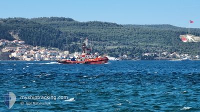
KURTARMA-3
Tug
Current Trip
| Trip Time | 3 h, 24 mins |
|---|---|
| Trip Distance | 12.80 nm |
| AVG Speed | 7.2 Knots |
| MAX Speed | 11.6 Knots |
| Draught | 0 m |
| AVG Wind | 9.6 knots |
| MAX Wind | 12 knots |
| MIN Temp | 12.7°C / 54.86°F |
| MAX Temp | 17°C / 62.6°F |
| Position Received | 1 d ago |
Current Position
| Longitude | 26.51260° |
|---|---|
| Latitude | 40.25137° |
| Status | Default |
| Speed | 9 Knots |
| Course | 49° |
| Area | Sea of Marmara |
| Station | T-AIS |
| Position Received | 1 d ago |
Info
Information
The current position of KURTARMA-3 is in Sea of Marmara with coordinates 40.25137° / 26.51260° as reported on 2024-05-13 11:02 by AIS to our vessel tracker app. The vessel's current speed is 9 Knots and is currently inside the port of GELIBOLU.
The vessel KURTARMA-3 (IMO: 9335939, MMSI: 271001021) is a Tug that was built in 2004 ( 20 years old ). It's sailing under the flag of [TR] Turkey.
In this page you can find informations about the vessels current position, last detected port calls, and current voyage information. If the vessels is not in coverage by AIS you will find the latest position.
The current position of KURTARMA-3 is detected by our AIS receivers and we are not responsible for the reliability of the data. The last position was recorded while the vessel was in Coverage by the Ais receivers of our vessel tracking app.
Weather
| Temperature | 13.2°C / 55.76°F |
|---|---|
| Wind Speed | 9 knots |
| Direction | 111° ESE |
| Pressure | 1017 hPa |
| Humidity | 64.9 % |
| Cloud Coverage | 79 % |
Featured Company
Last Port Calls
| Port | Arrival | Departure | Time In Port |
|---|---|---|---|
| 2024-05-14 09:47 | |||
| 2024-05-13 12:19 | 2024-05-14 06:23 | 18 h | |
| 2024-05-12 14:21 | 2024-05-13 03:43 | 13 h | |
| 2024-05-10 16:53 | 2024-05-12 10:25 | 1 d | |
| 2024-05-09 13:47 | 2024-05-10 04:50 | 15 h | |
| 2024-05-08 09:45 | 2024-05-09 05:40 | 19 h | |
| 2024-05-07 15:25 | 2024-05-08 03:36 | 12 h | |
| 2024-05-06 12:38 | 2024-05-07 05:45 | 17 h | |
| 2024-05-05 12:31 | 2024-05-06 06:54 | 18 h | |
| 2024-05-04 12:30 | 2024-05-05 04:08 | 15 h |
Last Trips
| Origin | Departure | Destination | Arrival | Distance | |
|---|---|---|---|---|---|
| 2024-05-14 09:23 | 2024-05-14 12:47 | 12.80 nm | |||
| 2024-05-13 06:43 | 2024-05-13 15:19 | 59.07 nm | |||
| 2024-05-12 13:25 | 2024-05-12 17:21 | 0.37 nm | |||
| 2024-05-10 07:50 | 2024-05-10 19:53 | 62.71 nm | |||
| 2024-05-09 08:40 | 2024-05-09 16:47 | 60.57 nm | |||
| 2024-05-08 06:36 | 2024-05-08 12:45 | 53.72 nm | |||
| 2024-05-07 08:45 | 2024-05-07 18:25 | 57.82 nm | |||
| 2024-05-06 09:54 | 2024-05-06 15:38 | 51.36 nm | |||
| 2024-05-05 07:08 | 2024-05-05 15:31 | 63.15 nm | |||
| 2024-05-04 06:26 | 2024-05-04 15:30 | 61.41 nm |
Events
| Time | Event | Details | Position / Dest | Info |
|---|---|---|---|---|
| 2024-05-14 09:47 | STOP Moving |
40.40477 / 26.66933
[TR] GELIBOLU
|
Speed: Course: 107° |
|
| 2024-05-14 09:47 | PORT ARRIVAL |
|
40.40477 / 26.66933
[TR] GELIBOLU
|
Speed: 4.2 kn Course: 284° |
| 2024-05-14 08:03 | START Moving | 4.88 nm, South West of LAPSEKI |
40.31421 / 26.59128
|
Speed: 7.6 kn Course: 104° |
| 2024-05-14 07:21 | STOP Moving | 5.39 nm, South West of LAPSEKI |
40.31757 / 26.57672
|
Speed: 0.2 kn Course: 278° |
| 2024-05-14 06:39 | START Moving | 2.1 nm, West of LAPSEKI |
40.35720 / 26.63938
|
Speed: 11.3 kn Course: 205° |
| 2024-05-14 06:23 | PORT DEPARTURE |
|
40.35720 / 26.63938
|
Speed: 0.2 kn Course: 107° |
| 2024-05-13 12:19 | PORT ARRIVAL |
|
40.40455 / 26.66936
[TR] GELIBOLU
|
Speed: 8 kn Course: 37° |
| 2024-05-13 11:02 | OUT of Coverage |
40.25137 / 26.51260
Sea of Marmara
|
Speed: 9 kn Course: 49° |
|
| 2024-05-13 09:07 | IN Coverage |
40.05332 / 26.32140
Sea of Marmara
|
Speed: 10 kn Course: 31° |
|
| 2024-05-13 07:27 | OUT of Coverage |
40.02852 / 26.29667
Sea of Marmara
|
Speed: 0.5 kn Course: 166° |