
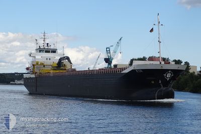
KYA
General Cargo
Current Trip
| Time Travelled | 5 days |
|---|---|
| Remaining Time | 10 h, 23 mins |
| Distance Travelled | 867.04 nm |
| Remaining Distance | 111.57 nm |
| AVG Speed | 10.4 Knots |
| MAX Speed | 11.9 Knots |
| AVG Wind | 6.4 knots |
| MAX Wind | 22.6 knots |
| MIN Temp | 5.3°C / 41.54°F |
| MAX Temp | 19.9°C / 67.82°F |
| Draught | 5.7 m |
| Position Received | 2 m ago |
Current Position
| Longitude | 4.82474° |
|---|---|
| Latitude | 62.06326° |
| Status | Under way using engine |
| Speed | 10.7 Knots |
| Course | 209.1° |
| Area | Norwegian Sea |
| Station | T-AIS |
| Position Received | 2 m ago |
Info
Information
The current position of KYA is in Norwegian Sea with coordinates 62.06326° / 4.82474° as reported on 2024-06-18 11:11 by AIS to our vessel tracker app. The vessel's current speed is 10.7 Knots and is heading at the port of KNARREVIK. The estimated time of arrival as calculated by vessel tracking app is 2024-06-18 21:36 LT
The vessel KYA (IMO: 9268837, MMSI: 257048880) is a General Cargo that was built in 2004 ( 20 years old ). It's sailing under the flag of [NO] Norway.
In this page you can find informations about the vessels current position, last detected port calls, and current voyage information. If the vessels is not in coverage by AIS you will find the latest position.
The current position of KYA is detected by our AIS receivers and we are not responsible for the reliability of the data. The last position was recorded while the vessel was in Coverage by the Ais receivers of our vessel tracking app.
The current draught of KYA as reported by AIS is 5.7 meters
Weather
| Temperature | 12.1°C / 53.78°F |
|---|---|
| Wind Speed | 7 knots |
| Direction | 252° WSW |
| Pressure | 1008.4 hPa |
| Humidity | 87.3 % |
| Cloud Coverage | 100 % |
Featured Company
Last Port Calls
| Port | Arrival | Departure | Time In Port |
|---|---|---|---|
| 2024-06-12 18:26 | 2024-06-13 07:39 | 13 h | |
| 2024-06-06 04:01 | 2024-06-06 17:27 | 13 h | |
| 2024-06-03 17:05 | 2024-06-04 23:27 | 1 d | |
| 2024-06-01 14:06 | 2024-06-02 16:32 | 1 d | |
| 2024-05-29 11:33 | 2024-05-30 02:22 | 14 h | |
| 2024-05-26 00:38 | 2024-05-27 05:29 | 1 d | |
| 2024-05-23 19:48 | 2024-05-25 22:07 | 2 d | |
| 2024-05-13 09:50 | 2024-05-14 19:13 | 1 d | |
| 2024-04-05 20:46 | 2024-05-13 06:59 | ||
| 2024-04-02 07:52 | 2024-04-03 16:21 | 1 d |
Most Visited Ports (Last year)
| Port | Arrivals | |
|---|---|---|
| 9 | ||
| 6 | ||
| 4 | ||
| 4 | ||
| 3 | ||
| 2 |
Last Trips
| Origin | Departure | Destination | Arrival | Distance | |
|---|---|---|---|---|---|
| 2024-06-06 19:27 | 2024-06-12 20:26 | 1309.02 nm | |||
| 2024-06-05 02:27 | 2024-06-06 06:01 | 284.41 nm | |||
| 2024-06-02 18:32 | 2024-06-03 20:05 | 265.82 nm | |||
| 2024-05-30 04:22 | 2024-06-01 16:06 | 617.05 nm | |||
| 2024-05-27 07:29 | 2024-05-29 13:33 | 531.14 nm | |||
| 2024-05-26 00:07 | 2024-05-26 02:38 | 0.29 nm | |||
| 2024-05-14 22:13 | 2024-05-23 21:48 | 1213.22 nm | |||
| 2024-05-13 09:59 | 2024-05-13 12:50 | 23.09 nm | |||
| 2024-04-03 18:21 | 2024-04-05 23:46 | 536.34 nm | |||
| 2024-03-30 10:35 | 2024-04-02 09:52 | 649.35 nm |
Events
| Time | Event | Details | Position / Dest | Info |
|---|---|---|---|---|
| 2024-06-16 13:15 | Status Changed | Under way using engine Moored |
67.39676 / 15.54914
NOKRV
|
Speed: 0.7 kn Course: 346° |
| 2024-06-16 13:15 | START Moving | 2.01 nm, North West of SALTEN |
67.39676 / 15.54914
NOKRV
|
Speed: 4 kn Course: 14° |
| 2024-06-15 16:27 | Draught Changed | 5.7 3.2 |
67.39539 / 15.54284
NOKRV
|
Speed: Course: 183° |
| 2024-06-15 16:21 | ETA Changed | 2024/06/18 23:00 2024/06/15 15:00 |
67.39539 / 15.54276
NOKRV
|
Speed: Course: 183° |
| 2024-06-15 16:20 | Destination Changed | NOKRV NOHFL |
67.39539 / 15.54276
NOKRV
|
Speed: Course: 183° |
| 2024-06-15 14:38 | Status Changed | Moored Under way using engine |
67.39538 / 15.54275
NOHFL
|
Speed: Course: 182° |
| 2024-06-15 14:33 | STOP Moving | 2.01 nm, North West of SALTEN |
67.39538 / 15.54290
NOHFL
|
Speed: 0.1 kn Course: 185° |
| 2024-06-15 06:10 | Status Changed | Under way using engine Default |
68.26948 / 15.72476
NOHFL
|
Speed: 11.6 kn Course: 226° |
| 2024-06-15 06:09 | Status Changed | Default Under way using engine |
68.27170 / 15.73101
NOHFL
|
Speed: 11.7 kn Course: 225.7° |
| 2024-06-15 03:15 | ETA Changed | 2024/06/15 15:00 2024/06/15 19:00 |
68.65542 / 16.62202
NOHFL
|
Speed: 11.4 kn Course: 214.2° |