
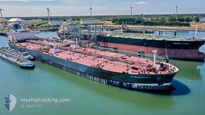
KYRAKATINGO
Tanker
Current Trip
| Time Travelled | 6 days |
|---|---|
| Remaining Time | --- |
| Distance Travelled | 1239.12 nm |
| Remaining Distance | --- |
| AVG Speed | 10.3 Knots |
| MAX Speed | 15.7 Knots |
| AVG Wind | 12.4 knots |
| MAX Wind | 22.8 knots |
| MIN Temp | 10.8°C / 51.44°F |
| MAX Temp | 28.1°C / 82.58°F |
| Draught | 8.6 m |
| Position Received | 5 d ago |
Current Position
| Longitude | -74.54663° |
|---|---|
| Latitude | 38.34273° |
| Status | Under way using engine |
| Speed | 12.1 Knots |
| Course | 127.1° |
| Area | North Atlantic Ocean |
| Station | T-AIS |
| Position Received | 5 d ago |
Info
Information
The current position of KYRAKATINGO is in North Atlantic Ocean with coordinates 38.34273° / -74.54663° as reported on 2024-05-12 04:00 by AIS to our vessel tracker app. The vessel's current speed is 12.1 Knots and is heading at the port of CORPUS CHRISTI. The estimated time of arrival as calculated by vessel tracking app is 2024-05-18 18:00 LT
The vessel KYRAKATINGO (IMO: 9779965, MMSI: 249997000) is a Tanker It's sailing under the flag of [MT] Malta.
In this page you can find informations about the vessels current position, last detected port calls, and current voyage information. If the vessels is not in coverage by AIS you will find the latest position.
The current position of KYRAKATINGO is detected by our AIS receivers and we are not responsible for the reliability of the data. The last position was recorded while the vessel was in Coverage by the Ais receivers of our vessel tracking app.
The current draught of KYRAKATINGO as reported by AIS is 8.6 meters
Weather
| Temperature | 28.1°C / 82.58°F |
|---|---|
| Wind Speed | 6 knots |
| Direction | 51° NE |
| Pressure | 1013.4 hPa |
| Humidity | 72.2 % |
| Cloud Coverage | 4 % |
Featured Company
Last Port Calls
| Port | Arrival | Departure | Time In Port |
|---|---|---|---|
| 2024-05-10 16:26 | 2024-05-11 19:10 | 1 d | |
| 2024-05-03 23:06 | 2024-05-05 01:34 | 1 d | |
| 2024-05-03 22:33 | 2024-05-03 22:43 | 9 m | |
| 2024-04-29 20:18 | 2024-05-01 20:39 | 2 d | |
| 2024-03-07 22:15 | 2024-03-09 10:03 | 1 d | |
| 2024-03-01 22:40 | 2024-03-03 04:32 | 1 d |
Last Trips
| Origin | Departure | Destination | Arrival | Distance | |
|---|---|---|---|---|---|
| 2024-05-04 21:34 | 2024-05-10 12:26 | 276.30 nm | |||
| 2024-05-03 18:43 | 2024-05-03 19:06 | 0.19 nm | |||
| 2024-05-01 16:39 | 2024-05-03 18:33 | 246.51 nm | |||
| 2024-03-09 10:03 | 2024-04-29 16:18 | 10050.92 nm | |||
| 2024-03-03 05:32 | 2024-03-07 22:15 | 767.19 nm | |||
| 2024-02-14 12:50 | 2024-03-01 23:40 | 1269.85 nm |
Events
| Time | Event | Details | Position / Dest | Info |
|---|---|---|---|---|
| 2024-05-14 04:53 | START Moving |
33.63126 / -71.62717
US CRP
|
Speed: 3.9 kn Course: 197° |
|
| 2024-05-13 17:51 | STOP Moving |
33.73667 / -71.45333
US CRP
|
Speed: Course: -1° |
|
| 2024-05-12 04:03 | Status Changed | Default Under way using engine |
38.33500 / -74.53500
US CRP
|
Speed: 12.1 kn Course: 127.1° |
| 2024-05-12 04:00 | OUT of Coverage |
38.34273 / -74.54663
North Atlantic Ocean
US CRP
|
Speed: 12.1 kn Course: 127.1° |
|
| 2024-05-12 03:56 | Status Changed | Under way using engine Default |
38.34995 / -74.55863
US CRP
|
Speed: 12 kn Course: 127° |
| 2024-05-12 03:54 | Status Changed | Default Under way using engine |
38.35333 / -74.56667
US CRP
|
Speed: 12 kn Course: 128.6° |
| 2024-05-11 23:06 | Draught Changed | 8.6 9.7 |
39.10213 / -75.20261
US CRP
|
Speed: 14.9 kn Course: 145° |
| 2024-05-11 23:06 | Destination Changed | US CRP USMAH |
39.10213 / -75.20261
US CRP
|
Speed: 14.9 kn Course: 145° |
| 2024-05-11 23:06 | ETA Changed | 2024/05/18 18:00 2024/05/09 08:00 |
39.10213 / -75.20261
US CRP
|
Speed: 14.9 kn Course: 145° |
| 2024-05-11 22:56 | Status Changed | Under way using engine Default |
39.13544 / -75.23236
USMAH |
Speed: 15 kn Course: 145° |