
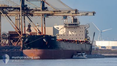
KYTHIRA I
Bulk Carrier
Current Trip
| Time Travelled | 3 h, 45 mins |
|---|---|
| Remaining Time | --- |
| Distance Travelled | 35.55 nm |
| Remaining Distance | --- |
| AVG Speed | 9.9 Knots |
| MAX Speed | 11.1 Knots |
| AVG Wind | 9 knots |
| MAX Wind | 10.4 knots |
| MIN Temp | 22.4°C / 72.32°F |
| MAX Temp | 23.2°C / 73.76°F |
| Draught | 14.7 m |
| Position Received | 2 m ago |
Current Position
| Longitude | -75.56506° |
|---|---|
| Latitude | 36.80363° |
| Status | Under way using engine |
| Speed | 11.4 Knots |
| Course | 92.1° |
| Area | North Atlantic Ocean |
| Station | T-AIS |
| Position Received | 2 m ago |
Info
Information
The current position of KYTHIRA I is in North Atlantic Ocean with coordinates 36.80363° / -75.56506° as reported on 2024-06-18 11:24 by AIS to our vessel tracker app. The vessel's current speed is 11.4 Knots and is heading at the port of PORT LOUIS. The estimated time of arrival as calculated by vessel tracking app is 2024-07-18 03:00 LT
The vessel KYTHIRA I (IMO: 9590046, MMSI: 636017090) is a Bulk Carrier that was built in 2011 ( 13 years old ). It's sailing under the flag of [LR] Liberia.
In this page you can find informations about the vessels current position, last detected port calls, and current voyage information. If the vessels is not in coverage by AIS you will find the latest position.
The current position of KYTHIRA I is detected by our AIS receivers and we are not responsible for the reliability of the data. The last position was recorded while the vessel was in Coverage by the Ais receivers of our vessel tracking app.
The current draught of KYTHIRA I as reported by AIS is 14.7 meters
Weather
| Temperature | 23.1°C / 73.58°F |
|---|---|
| Wind Speed | 8 knots |
| Direction | 161° SSE |
| Pressure | 1024.6 hPa |
| Humidity | 70.1 % |
| Cloud Coverage | 10 % |
Featured Company
Most Visited Ports (Last year)
| Port | Arrivals | |
|---|---|---|
| 2 | ||
| 2 | ||
| 2 | ||
| 2 | ||
| 1 | ||
| 1 |
Events
| Time | Event | Details | Position / Dest | Info |
|---|---|---|---|---|
| 2024-06-18 09:37 | Status Changed | Under way using engine Default |
36.89459 / -75.89546
PORT LOUIS
|
Speed: 10.1 kn Course: 136° |
| 2024-06-18 09:27 | Status Changed | Default Under way using engine |
36.91431 / -75.91911
PORT LOUIS
|
Speed: 10 kn Course: 112° |
| 2024-06-18 09:21 | Status Changed | Under way using engine Default |
36.92673 / -75.93478
PORT LOUIS
|
Speed: 10.2 kn Course: 110° |
| 2024-06-18 09:07 | Status Changed | Default Under way using engine |
36.94373 / -75.97757
PORT LOUIS
|
Speed: 10.7 kn Course: 79.9° |
| 2024-06-18 09:01 | Status Changed | Under way using engine Default |
36.94944 / -75.99670
PORT LOUIS
|
Speed: 10.4 kn Course: 80° |
| 2024-06-18 08:59 | Status Changed | Default Under way using engine |
36.94854 / -76.00318
PORT LOUIS
|
Speed: 10.4 kn Course: 80.3° |
| 2024-06-18 08:50 | Status Changed | Under way using engine Default |
36.95435 / -76.03819
PORT LOUIS
|
Speed: 10.6 kn Course: 108° |
| 2024-06-18 08:48 | Status Changed | Default Under way using engine |
36.95615 / -76.04514
PORT LOUIS
|
Speed: 10.5 kn Course: 110.2° |
| 2024-06-18 07:42 | PORT DEPARTURE |
|
37.00537 / -76.26693
PORT LOUIS
|
Speed: 10.5 kn Course: 76° |
| 2024-06-18 06:44 | START Moving |
36.95944 / -76.42498
[US] NORFOLK
|
Speed: 3.1 kn Course: 126° |