
L-317
Passenger
Current Trip
NAUVO-KORPPOO
| Time Travelled | --- |
|---|---|
| Remaining Time | --- |
| Distance Travelled | --- |
| Remaining Distance | --- |
| AVG Speed | --- |
| MAX Speed | --- |
| AVG Wind | --- |
| MAX Wind | --- |
| MIN Temp | --- |
| MAX Temp | --- |
| Draught | 2.4 m |
| Position Received | 2 h, 27 m ago |
Current Position
| Longitude | 21.32431° |
|---|---|
| Latitude | 60.54147° |
| Status | Under way using engine |
| Speed | 7.3 Knots |
| Course | 259° |
| Area | Gulf of Bothnia |
| Station | T-AIS |
| Position Received | 2 h, 27 m ago |
Info
Information
The current position of L-317 is in Gulf of Bothnia with coordinates 60.54147° / 21.32431° as reported on 2024-06-27 09:31 by AIS to our vessel tracker app. The vessel's current speed is 7.3 Knots
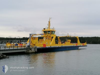
The vessel L-317 (MMSI: 230174460) is a Passenger It's sailing under the flag of [FI] Finland.
In this page you can find informations about the vessels current position, last detected port calls, and current voyage information. If the vessels is not in coverage by AIS you will find the latest position.
The current position of L-317 is detected by our AIS receivers and we are not responsible for the reliability of the data. The last position was recorded while the vessel was in Coverage by the Ais receivers of our vessel tracking app.
The current draught of L-317 as reported by AIS is 2.4 meters
Weather
| Temperature | 16.2°C / 61.16°F |
|---|---|
| Wind Speed | 8 knots |
| Direction | 189° S |
| Pressure | 1015.8 hPa |
| Humidity | 88.4 % |
| Cloud Coverage | --- |
Featured Company
Last Port Calls
Most Visited Ports (Last year)
| Port | Arrivals |
|---|
Last Trips
| Origin | Departure | Destination | Arrival | Distance |
|---|
Events
| Time | Event | Details | Position / Dest | Info |
|---|---|---|---|---|
| 2024-06-27 10:11 | STOP Moving | 3.33 nm, North East of VUOSNAINEN |
60.54249 / 21.33496
NAUVO-KORPPOO
|
Speed: Course: 258° |
| 2024-06-27 09:33 | Status Changed | Default Under way using engine |
60.54108 / 21.32051
NAUVO-KORPPOO
|
Speed: 7.3 kn Course: 259° |
| 2024-06-27 09:31 | Status Changed | Under way using engine Default |
60.54147 / 21.32431
NAUVO-KORPPOO
|
Speed: 7.3 kn Course: 257° |
| 2024-06-27 09:31 | IN Coverage |
60.54147 / 21.32431
Gulf of Bothnia
|
Speed: 7.3 kn Course: 259° |
|
| 2024-06-27 09:31 | OUT of Coverage |
60.54147 / 21.32431
Gulf of Bothnia
|
Speed: 7.3 kn Course: 259° |
|
| 2024-06-27 09:11 | START Moving | 3.05 nm, North East of VUOSNAINEN |
60.54144 / 21.32429
NAUVO-KORPPOO
|
Speed: 7.3 kn Course: 257° |
| 2024-06-27 08:54 | STOP Moving | 2.94 nm, North East of VUOSNAINEN |
60.54103 / 21.31994
NAUVO-KORPPOO
|
Speed: Course: 75° |
| 2024-06-27 08:39 | START Moving | 3.15 nm, North East of VUOSNAINEN |
60.54191 / 21.32802
NAUVO-KORPPOO
|
Speed: 7.2 kn Course: 83° |
| 2024-06-27 08:23 | Status Changed | Default Under way using engine |
60.54248 / 21.33496
NAUVO-KORPPOO
|
Speed: Course: 76° |
| 2024-06-27 08:10 | OUT of Coverage |
60.54102 / 21.31996
Gulf of Bothnia
|
Speed: Course: 256.4° |