
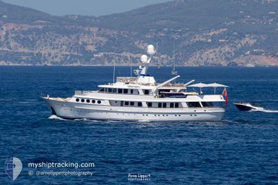
LADY GEORGINA
Yacht
Current Trip
| Trip Time | 2 days |
|---|---|
| Trip Distance | 37.90 nm |
| AVG Speed | 9.2 Knots |
| MAX Speed | 11.8 Knots |
| Draught | 2.9 m |
| AVG Wind | 5.9 knots |
| MAX Wind | 14.5 knots |
| MIN Temp | 15.6°C / 60.08°F |
| MAX Temp | 24.2°C / 75.56°F |
| Position Received | 4 m ago |
Current Position
| Longitude | 7.12409° |
|---|---|
| Latitude | 43.58737° |
| Status | Moored |
| Speed | |
| Course | 132° |
| Area | Mediterranean Sea - Western Basin |
| Station | T-AIS |
| Position Received | 4 m ago |
Info
Information
The current position of LADY GEORGINA is in Mediterranean Sea - Western Basin with coordinates 43.58737° / 7.12409° as reported on 2024-06-25 05:55 by AIS to our vessel tracker app. The vessel's current speed is 0 Knots and is currently inside the port of ANTIBES.
The vessel LADY GEORGINA (IMO: 1002275, MMSI: 232205000) is a Yacht that was built in 1982 ( 42 years old ). It's sailing under the flag of [GB] United Kingdom.
In this page you can find informations about the vessels current position, last detected port calls, and current voyage information. If the vessels is not in coverage by AIS you will find the latest position.
The current position of LADY GEORGINA is detected by our AIS receivers and we are not responsible for the reliability of the data. The last position was recorded while the vessel was in Coverage by the Ais receivers of our vessel tracking app.
The current draught of LADY GEORGINA as reported by AIS is 2.9 meters
Weather
| Temperature | 19.7°C / 67.46°F |
|---|---|
| Wind Speed | 3 knots |
| Direction | 286° WNW |
| Pressure | 1011.3 hPa |
| Humidity | 68 % |
| Cloud Coverage | 97 % |
Featured Company
Last Port Calls
| Port | Arrival | Departure | Time In Port |
|---|---|---|---|
| 2024-06-24 15:14 | |||
| 2024-06-17 15:37 | 2024-06-21 15:31 | 3 d | |
| 2024-06-11 10:18 | 2024-06-16 09:38 | 4 d | |
| 2024-04-11 13:43 | 2024-06-11 08:40 | ||
| 2024-04-09 20:16 | 2024-04-09 23:54 | 3 h |
Most Visited Ports (Last year)
| Port | Arrivals | |
|---|---|---|
| 6 | ||
| 4 | ||
| 4 | ||
| 2 | ||
| 2 | ||
| 1 |
Last Trips
| Origin | Departure | Destination | Arrival | Distance | |
|---|---|---|---|---|---|
| 2024-06-21 17:31 | 2024-06-24 17:14 | 37.90 nm | |||
| 2024-06-16 11:38 | 2024-06-17 17:37 | 356.60 nm | |||
| 2024-06-11 10:40 | 2024-06-11 12:18 | 13.93 nm | |||
| 2024-04-10 01:54 | 2024-04-11 15:43 | 460.48 nm | |||
| 2024-03-29 11:43 | 2024-04-09 22:16 | 3204.19 nm |
Events
| Time | Event | Details | Position / Dest | Info |
|---|---|---|---|---|
| 2024-06-24 18:17 | Status Changed | Moored Under way using engine |
43.58733 / 7.12408
[FR] ANTIBES
|
Speed: Course: 133° |
| 2024-06-24 15:24 | STOP Moving |
43.58714 / 7.12858
[FR] ANTIBES
|
Speed: 0.3 kn Course: 137° |
|
| 2024-06-24 15:14 | PORT ARRIVAL |
|
43.59072 / 7.13123
[FR] ANTIBES
|
Speed: 3.8 kn Course: 184° |
| 2024-06-24 14:15 | START Moving | 0.76 nm, West of SAINTJEAN CAP FERRAT |
43.69354 / 7.31818
ANTIBES
|
Speed: 6.6 kn Course: 213.9° |
| 2024-06-24 14:09 | Destination Changed | ANTIBES VILLE FRANCHE |
43.69566 / 7.32008
ANTIBES
|
Speed: 0.2 kn Course: 186° |
| 2024-06-24 14:09 | ETA Changed | 2024/06/24 17:30 2024/06/24 12:30 |
43.69566 / 7.32008
ANTIBES
|
Speed: 0.2 kn Course: 186° |
| 2024-06-24 14:09 | Status Changed | Under way using engine At anchor |
43.69567 / 7.32007
VILLE FRANCHE
|
Speed: Course: 186° |
| 2024-06-24 08:54 | Status Changed | At anchor Under way using engine |
43.69525 / 7.31942
VILLE FRANCHE
|
Speed: 0.1 kn Course: 105° |
| 2024-06-24 08:42 | STOP Moving | 0.71 nm, West of SAINTJEAN CAP FERRAT |
43.69508 / 7.31983
VILLE FRANCHE
|
Speed: 0.3 kn Course: 45° |
| 2024-06-24 08:14 | START Moving | 0.42 nm, East of SAINTJEAN CAP FERRAT |
43.69352 / 7.34407
VILLE FRANCHE
|
Speed: 7 kn Course: 125.7° |