
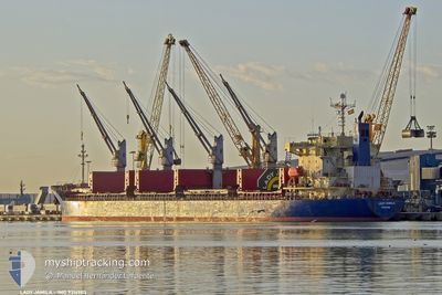
LADY JAMILA
Bulk Carrier
Current Trip
| Time Travelled | 31 days |
|---|---|
| Remaining Time | --- |
| Distance Travelled | 2680.14 nm |
| Remaining Distance | --- |
| AVG Speed | 10.2 Knots |
| MAX Speed | 10.2 Knots |
| AVG Wind | 6.5 knots |
| MAX Wind | 20.9 knots |
| MIN Temp | 8.4°C / 47.12°F |
| MAX Temp | 30.6°C / 87.08°F |
| Draught | 6.1 m |
| Position Received | 1 d ago |
Current Position
| Longitude | 29.94318° |
|---|---|
| Latitude | 44.97396° |
| Status | At anchor |
| Speed | |
| Course | 221° |
| Area | Black Sea |
| Station | T-AIS |
| Position Received | 1 d ago |
Info
Information
The current position of LADY JAMILA is in Black Sea with coordinates 44.97396° / 29.94318° as reported on 2024-06-11 22:04 by AIS to our vessel tracker app. The vessel's current speed is 0 Knots and is heading at the port of GALATI.
The vessel LADY JAMILA (IMO: 9316983, MMSI: 352002374) is a Bulk Carrier that was built in 2007 ( 17 years old ). It's sailing under the flag of [PA] Panama.
In this page you can find informations about the vessels current position, last detected port calls, and current voyage information. If the vessels is not in coverage by AIS you will find the latest position.
The current position of LADY JAMILA is detected by our AIS receivers and we are not responsible for the reliability of the data. The last position was recorded while the vessel was in Coverage by the Ais receivers of our vessel tracking app.
The current draught of LADY JAMILA as reported by AIS is 6.1 meters
Weather
| Temperature | 21.3°C / 70.34°F |
|---|---|
| Wind Speed | 9 knots |
| Direction | 94° E |
| Pressure | 1014.8 hPa |
| Humidity | 81.8 % |
| Cloud Coverage | 56 % |
Featured Company
Last Port Calls
| Port | Arrival | Departure | Time In Port |
|---|---|---|---|
| 2024-05-12 08:29 | 2024-05-12 09:45 | 1 h | |
| 2024-05-07 04:36 | 2024-05-10 09:40 | 3 d | |
| 2024-05-02 11:00 | 2024-05-07 04:18 | 4 d | |
| 2024-05-01 18:50 | 2024-05-02 10:59 | 16 h | |
| 2024-04-03 13:46 | 2024-04-03 17:06 | 3 h | |
| 2024-04-02 14:53 |
Last Trips
| Origin | Departure | Destination | Arrival | Distance | |
|---|---|---|---|---|---|
| 2024-05-10 12:40 | 2024-05-12 11:29 | 358.34 nm | |||
| 2024-05-07 07:18 | 2024-05-07 07:36 | 1.55 nm | |||
| 2024-05-02 13:59 | 2024-05-02 14:00 | 0.46 nm | |||
| 2024-04-03 20:06 | 2024-05-01 21:50 | 1408.63 nm |
Events
| Time | Event | Details | Position / Dest | Info |
|---|---|---|---|---|
| 2024-06-11 22:06 | Status Changed | Default At anchor |
44.97396 / 29.94316
RO GAL
|
Speed: Course: 221° |
| 2024-06-11 22:04 | OUT of Coverage |
44.97396 / 29.94318
Black Sea
|
Speed: Course: 124.1° |
|
| 2024-06-11 21:44 | Status Changed | At anchor Default |
44.97404 / 29.94267
RO GAL
|
Speed: 0.9 kn Course: 218° |
| 2024-06-11 21:20 | Status Changed | Default At anchor |
44.97415 / 29.94242
RO GAL
|
Speed: 0.2 kn Course: 208° |
| 2024-06-11 21:03 | Status Changed | At anchor Under way using engine |
44.97421 / 29.94233
RO GAL
|
Speed: 0.3 kn Course: 209° |
| 2024-06-11 20:56 | Status Changed | Under way using engine Default |
44.97416 / 29.94221
RO GAL
|
Speed: 0.4 kn Course: 209° |
| 2024-06-11 20:53 | Status Changed | Default Under way using engine |
44.97407 / 29.94217
RO GAL
|
Speed: 0.1 kn Course: 219° |
| 2024-06-11 20:28 | STOP Moving | 15.82 nm, East of SFANTU GHEORGHE |
44.97380 / 29.94363
RO GAL
|
Speed: 0.3 kn Course: 240° |
| 2024-06-11 20:26 | Status Changed | Under way using engine Default |
44.97373 / 29.94331
RO GAL
|
Speed: 0.7 kn Course: 203° |
| 2024-06-11 20:21 | Status Changed | Default Under way using engine |
44.97349 / 29.94220
RO GAL
|
Speed: 0.7 kn Course: 115° |