
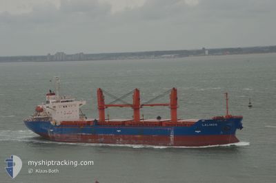
LADY LAGUNA
Cargo
Current Trip
| Time Travelled | 4 days |
|---|---|
| Remaining Time | --- |
| Distance Travelled | 910.03 nm |
| Remaining Distance | --- |
| AVG Speed | 10.9 Knots |
| MAX Speed | 10.9 Knots |
| AVG Wind | 4.6 knots |
| MAX Wind | 18.8 knots |
| MIN Temp | 13.2°C / 55.76°F |
| MAX Temp | 27.6°C / 81.68°F |
| Draught | 8.2 m |
| Position Received | 21 h, 11 m ago |
Current Position
| Longitude | 33.97387° |
|---|---|
| Latitude | 45.04227° |
| Status | Under way using engine |
| Speed | 54.9 Knots |
| Course | 185.1° |
| Area | Black Sea |
| Station | T-AIS |
| Position Received | 21 h, 11 m ago |
Info
Information
The current position of LADY LAGUNA is in Black Sea with coordinates 45.04227° / 33.97387° as reported on 2024-05-31 20:23 by AIS to our vessel tracker app. The vessel's current speed is 54.9 Knots
The vessel LADY LAGUNA (IMO: 93540400, MMSI: 314570000) is a Cargo It's sailing under the flag of [BB] Barbados.
In this page you can find informations about the vessels current position, last detected port calls, and current voyage information. If the vessels is not in coverage by AIS you will find the latest position.
The current position of LADY LAGUNA is detected by our AIS receivers and we are not responsible for the reliability of the data. The last position was recorded while the vessel was in Coverage by the Ais receivers of our vessel tracking app.
The current draught of LADY LAGUNA as reported by AIS is 8.2 meters
Weather
| Temperature | 20°C / 68°F |
|---|---|
| Wind Speed | 17 knots |
| Direction | 177° S |
| Pressure | 1015.8 hPa |
| Humidity | 78.7 % |
| Cloud Coverage | 8 % |
Featured Company
Last Port Calls
| Port | Arrival | Departure | Time In Port |
|---|---|---|---|
| 2024-05-28 16:02 | |||
| 2024-05-12 04:34 | 2024-05-16 07:24 | 4 d | |
| 2024-04-26 21:19 | 2024-04-27 16:00 | 18 h | |
| 2024-04-12 21:32 |
Most Visited Ports (Last year)
| Port | Arrivals | |
|---|---|---|
| 2 | ||
| 2 | ||
| 1 | ||
| 1 | ||
| 1 | ||
| 1 |
Last Trips
| Origin | Departure | Destination | Arrival | Distance | |
|---|---|---|---|---|---|
| 2024-04-13 01:32 | 2024-05-12 07:34 | 3311.59 nm | |||
| 2024-04-13 01:32 | 2024-04-26 23:19 | 2937.60 nm |
Events
| Time | Event | Details | Position / Dest | Info |
|---|---|---|---|---|
| 2024-05-31 20:23 | OUT of Coverage |
45.04227 / 33.97387
Black Sea
|
Speed: 54.9 kn Course: 185.1° |
|
| 2024-05-31 20:08 | IN Coverage |
45.03705 / 33.97264
Black Sea
|
Speed: 65 kn Course: 9.4° |
|
| 2024-05-31 19:08 | IN Coverage |
45.05208 / 33.94495
Black Sea
|
Speed: 96 kn Course: 340° |
|
| 2024-05-31 19:08 | OUT of Coverage |
45.05208 / 33.94495
Black Sea
|
Speed: 96 kn Course: 340° |
|
| 2024-05-31 10:26 | STOP Moving | 10.07 nm, East of SULINA |
45.18536 / 29.88187
SULINA
|
Speed: Course: 181° |
| 2024-05-30 15:02 | Status Changed | Default Under way using engine |
41.51230 / 29.24970
SULINA
|
Speed: 12.1 kn Course: 8° |
| 2024-05-30 14:57 | OUT of Coverage |
41.49673 / 29.24653
Black Sea
SULINA
|
Speed: 12.1 kn Course: 8° |
|
| 2024-05-30 13:31 | Change Sea Area | Turkish part of the Black Sea Turkish part of the Sea of Marmara |
41.23112 / 29.14097
Black Sea
SULINA
|
Speed: 11 kn Course: 38° |
| 2024-05-30 09:27 | START Moving | 13.61 nm, South of YESILKOY |
40.73303 / 28.88595
SULINA
|
Speed: 3.1 kn Course: 17° |
| 2024-05-30 03:15 | STOP Moving | 12.76 nm, South of YESILKOY |
40.75485 / 28.91953
SULINA
|
Speed: 0.3 kn Course: 21° |