
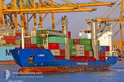
LAGOA
General Cargo
Current Trip
CVMIN
| Time Travelled | 3 days |
|---|---|
| Remaining Time | --- |
| Distance Travelled | 1041.97 nm |
| Remaining Distance | --- |
| AVG Speed | 13.6 Knots |
| MAX Speed | 15.3 Knots |
| AVG Wind | 15.9 knots |
| MAX Wind | 29 knots |
| MIN Temp | 16.7°C / 62.06°F |
| MAX Temp | 21.4°C / 70.52°F |
| Draught | 6.3 m |
| Position Received | 8 h, 39 m ago |
Current Position
| Longitude | -16.97793° |
|---|---|
| Latitude | 27.22852° |
| Status | Under way using engine |
| Speed | 14.7 Knots |
| Course | 214.3° |
| Area | North Atlantic Ocean |
| Station | T-AIS |
| Position Received | 8 h, 39 m ago |
Info
Information
The current position of LAGOA is in North Atlantic Ocean with coordinates 27.22852° / -16.97793° as reported on 2024-06-20 10:25 by AIS to our vessel tracker app. The vessel's current speed is 14.7 Knots
The vessel LAGOA (IMO: 9150470, MMSI: 617105000) is a General Cargo that was built in 1997 ( 27 years old ). It's sailing under the flag of [CV] Cape Verde.
In this page you can find informations about the vessels current position, last detected port calls, and current voyage information. If the vessels is not in coverage by AIS you will find the latest position.
The current position of LAGOA is detected by our AIS receivers and we are not responsible for the reliability of the data. The last position was recorded while the vessel was in Coverage by the Ais receivers of our vessel tracking app.
The current draught of LAGOA as reported by AIS is 6.3 meters
Weather
| Temperature | 21.4°C / 70.52°F |
|---|---|
| Wind Speed | 15 knots |
| Direction | 46° NE |
| Pressure | 1019.8 hPa |
| Humidity | 75.3 % |
| Cloud Coverage | --- |
Featured Company
Last Port Calls
| Port | Arrival | Departure | Time In Port |
|---|---|---|---|
| 2024-06-16 16:17 | 2024-06-17 13:43 | 21 h | |
| 2024-06-11 19:07 | 2024-06-15 23:42 | 4 d | |
| 2024-05-27 05:18 | 2024-05-27 18:27 | 13 h | |
| 2024-05-26 00:08 | 2024-05-26 15:31 | 15 h | |
| 2024-05-25 05:39 | 2024-05-25 16:34 | 10 h | |
| 2024-05-06 15:42 | 2024-05-07 13:20 | 21 h | |
| 2024-05-05 06:28 | 2024-05-05 21:55 | 15 h | |
| 2024-04-18 07:53 | 2024-04-18 17:24 | 9 h | |
| 2024-04-15 07:10 | 2024-04-17 16:11 | 2 d |
Last Trips
| Origin | Departure | Destination | Arrival | Distance | |
|---|---|---|---|---|---|
| 2024-06-16 00:42 | 2024-06-16 17:17 | 194.59 nm | |||
| 2024-05-27 19:27 | 2024-06-11 20:07 | 3634.07 nm | |||
| 2024-05-26 16:31 | 2024-05-27 06:18 | 191.74 nm | |||
| 2024-05-25 17:34 | 2024-05-26 01:08 | 39.84 nm | |||
| 2024-05-07 14:20 | 2024-05-25 06:39 | 4032.21 nm | |||
| 2024-05-05 22:55 | 2024-05-06 16:42 | 202.76 nm | |||
| 2024-04-18 18:24 | 2024-05-05 07:28 | 3822.72 nm | |||
| 2024-04-17 17:11 | 2024-04-18 08:53 | 190.42 nm | |||
| 2024-03-30 00:09 | 2024-04-15 08:10 | 3632.06 nm |
Events
| Time | Event | Details | Position / Dest | Info |
|---|---|---|---|---|
| 2024-06-20 10:31 | Status Changed | Default Under way using engine |
27.20977 / -16.99325
CVMIN
|
Speed: 14.7 kn Course: 214.3° |
| 2024-06-20 10:25 | OUT of Coverage |
27.22852 / -16.97793
North Atlantic Ocean
CVMIN
|
Speed: 14.7 kn Course: 214.3° |
|
| 2024-06-20 10:25 | Status Changed | Under way using engine Default |
27.23085 / -16.97607
CVMIN
|
Speed: 14.8 kn Course: 216° |
| 2024-06-20 10:19 | Status Changed | Default Under way using engine |
27.25094 / -16.95970
CVMIN
|
Speed: 14.7 kn Course: 215.4° |
| 2024-06-20 00:59 | Draught Changed | 6.3 5.4 |
29.09848 / -15.53519
CVMIN
|
Speed: 14.3 kn Course: 203.7° |
| 2024-06-20 00:59 | ETA Changed | 2024/06/22 20:00 2024/06/23 16:00 |
29.09848 / -15.53519
CVMIN
|
Speed: 14.3 kn Course: 203.7° |
| 2024-06-20 00:36 | Status Changed | Under way using engine Default |
29.18073 / -15.49385
CVMIN
|
Speed: 14.2 kn Course: 203° |
| 2024-06-20 00:35 | Status Changed | Default Under way using engine |
29.18473 / -15.49186
CVMIN
|
Speed: 14.3 kn Course: 201.8° |
| 2024-06-20 00:30 | Status Changed | Under way using engine Default |
29.20354 / -15.48249
CVMIN
|
Speed: 14.2 kn Course: 204° |
| 2024-06-20 00:27 | Status Changed | Default Under way using engine |
29.21412 / -15.47725
CVMIN
|
Speed: 14.2 kn Course: 204° |