
LAN HUA HAI
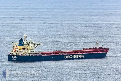
Bulk Carrier
Current Trip
| Time Travelled | 17 days |
|---|---|
| Remaining Time | --- |
| Distance Travelled | 3445.04 nm |
| Remaining Distance | --- |
| AVG Speed | 12.7 Knots |
| MAX Speed | 16.4 Knots |
| AVG Wind | 10.2 knots |
| MAX Wind | 24.3 knots |
| MIN Temp | 17°C / 62.6°F |
| MAX Temp | 30.7°C / 87.26°F |
| Draught | 7.7 m |
| Position Received | 6 h, 1 m ago |
Current Position
| Longitude | 114.84604° |
|---|---|
| Latitude | -21.40654° |
| Status | At anchor |
| Speed | 0.1 Knots |
| Course | 64° |
| Area | Indian Ocean |
| Station | T-AIS |
| Position Received | 6 h, 1 m ago |
Info
Information
The current position of LAN HUA HAI is in Indian Ocean with coordinates -21.40654° / 114.84604° as reported on 2024-05-22 18:00 by AIS to our vessel tracker app. The vessel's current speed is 0.1 Knots
The vessel LAN HUA HAI (IMO: 9620542, MMSI: 414145000) is a Bulk Carrier that was built in 2013 ( 11 years old ). It's sailing under the flag of [CN] China.
In this page you can find informations about the vessels current position, last detected port calls, and current voyage information. If the vessels is not in coverage by AIS you will find the latest position.
The current position of LAN HUA HAI is detected by our AIS receivers and we are not responsible for the reliability of the data. The last position was recorded while the vessel was in Coverage by the Ais receivers of our vessel tracking app.
The current draught of LAN HUA HAI as reported by AIS is 7.7 meters
Weather
| Temperature | 23.7°C / 74.66°F |
|---|---|
| Wind Speed | 8 knots |
| Direction | 89° E |
| Pressure | 1014.4 hPa |
| Humidity | 50.7 % |
| Cloud Coverage | --- |
Featured Company
Last Port Calls
| Port | Arrival | Departure | Time In Port |
|---|---|---|---|
| 2024-05-03 07:08 | 2024-05-05 00:40 | 1 d | |
| 2024-04-30 07:24 | 2024-05-01 01:21 | 17 h | |
| 2024-04-11 10:03 | 2024-04-13 00:14 | 1 d | |
| 2024-03-18 11:27 | 2024-03-20 00:48 | 1 d |
Last Trips
| Origin | Departure | Destination | Arrival | Distance | |
|---|---|---|---|---|---|
| 2024-05-01 09:21 | 2024-05-03 15:08 | 328.59 nm | |||
| 2024-04-13 08:14 | 2024-04-30 15:24 | 3209.80 nm | |||
| 2024-03-20 08:48 | 2024-04-11 18:03 | 3873.16 nm | |||
| 2024-02-28 18:33 | 2024-03-18 19:27 | 3903.52 nm |
Events
| Time | Event | Details | Position / Dest | Info |
|---|---|---|---|---|
| 2024-05-22 18:09 | Status Changed | Default At anchor |
-21.40621 / 114.84589
ASHBURTON AU
|
Speed: 0.1 kn Course: 64° |
| 2024-05-22 18:00 | Status Changed | At anchor Default |
-21.40654 / 114.84604
ASHBURTON AU
|
Speed: 0.1 kn Course: 60° |
| 2024-05-22 18:00 | OUT of Coverage |
-21.40654 / 114.84604
Indian Ocean
|
Speed: 0.1 kn Course: 339.2° |
|
| 2024-05-22 17:54 | Status Changed | Default At anchor |
-21.40667 / 114.84610
ASHBURTON AU
|
Speed: Course: 59° |
| 2024-05-22 17:51 | Status Changed | At anchor Default |
-21.40669 / 114.84613
ASHBURTON AU
|
Speed: Course: 58° |
| 2024-05-22 17:45 | Status Changed | Default At anchor |
-21.40670 / 114.84613
ASHBURTON AU
|
Speed: Course: 58° |
| 2024-05-22 17:36 | Status Changed | At anchor Default |
-21.40669 / 114.84609
ASHBURTON AU
|
Speed: Course: 58° |
| 2024-05-22 17:18 | IN Coverage |
-21.40669 / 114.84609
Indian Ocean
|
Speed: Course: 343.6° |
|
| 2024-05-22 15:06 | Status Changed | Default At anchor |
-21.40733 / 114.84647
ASHBURTON AU
|
Speed: Course: 34° |
| 2024-05-22 15:00 | OUT of Coverage |
-21.40740 / 114.84656
Indian Ocean
|
Speed: Course: 312° |