
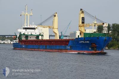
LAPISLAND
General Cargo
Current Trip
| Time Travelled | 14 mins |
|---|---|
| Remaining Time | 1 day |
| Distance Travelled | 2.00 nm |
| Remaining Distance | 402.52 nm |
| AVG Speed | 9.7 Knots |
| MAX Speed | 9.7 Knots |
| AVG Wind | 14.8 knots |
| MAX Wind | 16.9 knots |
| MIN Temp | 13.6°C / 56.48°F |
| MAX Temp | 14.3°C / 57.74°F |
| Draught | 4 m |
| Position Received | Now |
Current Position
| Longitude | 10.20186° |
|---|---|
| Latitude | 54.39551° |
| Status | Under way using engine |
| Speed | 9.9 Knots |
| Course | 12.4° |
| Area | North Sea |
| Station | T-AIS |
| Position Received | Now |
Info
Information
The current position of LAPISLAND is in North Sea with coordinates 54.39551° / 10.20186° as reported on 2024-06-06 11:05 by AIS to our vessel tracker app. The vessel's current speed is 9.9 Knots and is heading at the port of LIEPAJA. The estimated time of arrival as calculated by vessel tracking app is 2024-06-08 05:13 LT
The vessel LAPISLAND (IMO: 9519054, MMSI: 255806471) is a General Cargo that was built in 2013 ( 11 years old ). It's sailing under the flag of [PT] Portugal.
In this page you can find informations about the vessels current position, last detected port calls, and current voyage information. If the vessels is not in coverage by AIS you will find the latest position.
The current position of LAPISLAND is detected by our AIS receivers and we are not responsible for the reliability of the data. The last position was recorded while the vessel was in Coverage by the Ais receivers of our vessel tracking app.
The current draught of LAPISLAND as reported by AIS is 4 meters
Weather
| Temperature | 13.7°C / 56.66°F |
|---|---|
| Wind Speed | 17 knots |
| Direction | 243° WSW |
| Pressure | 1015.8 hPa |
| Humidity | 66.5 % |
| Cloud Coverage | 97 % |
Featured Company
Last Port Calls
| Port | Arrival | Departure | Time In Port |
|---|---|---|---|
| 2024-06-06 10:48 | 2024-06-06 10:52 | 4 m | |
| 2024-06-04 22:16 | 2024-06-04 22:26 | 10 m | |
| 2024-06-03 08:48 | |||
| 2024-06-01 19:47 | 2024-06-01 22:07 | 2 h | |
| 2024-05-27 06:33 | 2024-05-29 12:18 | 2 d | |
| 2024-05-26 06:03 | 2024-05-27 06:09 | 1 d | |
| 2024-05-20 18:53 | 2024-05-22 01:53 | 1 d | |
| 2024-05-17 18:48 | 2024-05-19 06:32 | 1 d | |
| 2024-05-16 01:39 | 2024-05-16 20:09 | 18 h | |
| 2024-05-13 08:14 | 2024-05-14 08:13 | 23 h |
Most Visited Ports (Last year)
| Port | Arrivals | |
|---|---|---|
| 8 | ||
| 7 | ||
| 6 | ||
| 5 | ||
| 3 | ||
| 3 |
Last Trips
| Origin | Departure | Destination | Arrival | Distance | |
|---|---|---|---|---|---|
| 2024-06-05 00:26 | 2024-06-06 12:48 | 330.39 nm | |||
| 2024-06-02 00:07 | 2024-06-05 00:16 | 291.61 nm | |||
| 2024-06-02 00:07 | 2024-06-03 10:48 | 291.31 nm | |||
| 2024-05-29 14:18 | 2024-06-01 21:47 | 745.13 nm | |||
| 2024-05-27 08:09 | 2024-05-27 08:33 | 3.21 nm | |||
| 2024-05-22 03:53 | 2024-05-26 08:03 | 800.68 nm | |||
| 2024-05-19 09:32 | 2024-05-20 20:53 | 348.67 nm | |||
| 2024-05-16 22:09 | 2024-05-17 21:48 | 221.35 nm | |||
| 2024-05-14 10:13 | 2024-05-16 03:39 | 372.19 nm | |||
| 2024-05-10 19:24 | 2024-05-13 10:14 | 416.88 nm |
Events
| Time | Event | Details | Position / Dest | Info |
|---|---|---|---|---|
| 2024-06-06 10:52 | PORT DEPARTURE |
|
54.36414 / 10.17317
LVLPX
|
Speed: 9.3 kn Course: 42° |
| 2024-06-06 10:48 | PORT ARRIVAL |
|
54.36370 / 10.15500
[DE] KIEL
|
Speed: 8.9 kn Course: 111.8° |
| 2024-06-06 10:45 | START Moving | 1.32 nm, South West of STICKENHΟRN SPORT |
54.36581 / 10.14442
LVLPX
|
Speed: 4.8 kn Course: 105° |
| 2024-06-06 09:51 | STOP Moving | 1.37 nm, South West of STICKENHΟRN SPORT |
54.36639 / 10.14112
LVLPX
|
Speed: 0.2 kn Course: 102° |
| 2024-06-06 08:32 | START Moving | 6.97 nm, West of KIEL |
54.34168 / 9.96184
LVLPX
|
Speed: 3.4 kn Course: 80° |
| 2024-06-06 07:59 | STOP Moving | 7.17 nm, West of KIEL |
54.34152 / 9.95602
LVLPX
|
Speed: 0.2 kn Course: 69° |
| 2024-06-06 01:02 | START Moving | 0.69 nm, South West of BRUNSBUETTEL |
53.89334 / 9.14964
LVLPX
|
Speed: 3.3 kn Course: 38° |
| 2024-06-06 00:42 | STOP Moving | 0.81 nm, South West of BRUNSBUETTEL |
53.89173 / 9.14733
LVLPX
|
Speed: 0.2 kn Course: 39° |
| 2024-06-05 22:21 | IN Coverage |
53.96557 / 8.55395
North Sea
LVLPX
|
Speed: 12.2 kn Course: 98.2° |
|
| 2024-06-05 21:12 | OUT of Coverage |
53.98817 / 8.16340
North Sea
LVLPX
|
Speed: 10.2 kn Course: 81.3° |