
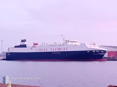
LAUDACE
Vehicles Carrier
Current Trip
| Time Travelled | 1 day |
|---|---|
| Remaining Time | 1 day |
| Distance Travelled | 706.13 nm |
| Remaining Distance | 528.17 nm |
| AVG Speed | 18.6 Knots |
| MAX Speed | 19.7 Knots |
| AVG Wind | 14.7 knots |
| MAX Wind | 27 knots |
| MIN Temp | 18.9°C / 66.02°F |
| MAX Temp | 26.1°C / 78.98°F |
| Draught | 5.8 m |
| Position Received | 1 m ago |
Current Position
| Longitude | -8.12580° |
|---|---|
| Latitude | 34.18330° |
| Status | Under way using engine |
| Speed | 19.2 Knots |
| Course | 226.7° |
| Area | North Atlantic Ocean |
| Station | T-AIS |
| Position Received | 1 m ago |
Info
Information
The current position of LAUDACE is in North Atlantic Ocean with coordinates 34.18330° / -8.12580° as reported on 2024-06-16 02:36 by AIS to our vessel tracker app. The vessel's current speed is 19.2 Knots and is heading at the port of LAS PALMAS. The estimated time of arrival as calculated by vessel tracking app is 2024-06-17 05:56 LT
The vessel LAUDACE (IMO: 9187318, MMSI: 224876000) is a Vehicles Carrier that was built in 1999 ( 25 years old ). It's sailing under the flag of [ES] Spain.
In this page you can find informations about the vessels current position, last detected port calls, and current voyage information. If the vessels is not in coverage by AIS you will find the latest position.
The current position of LAUDACE is detected by our AIS receivers and we are not responsible for the reliability of the data. The last position was recorded while the vessel was in Coverage by the Ais receivers of our vessel tracking app.
The current draught of LAUDACE as reported by AIS is 5.8 meters
Weather
| Temperature | 18.9°C / 66.02°F |
|---|---|
| Wind Speed | 13 knots |
| Direction | 353° N |
| Pressure | 1016.4 hPa |
| Humidity | 74.4 % |
| Cloud Coverage | --- |
Featured Company
Last Port Calls
| Port | Arrival | Departure | Time In Port |
|---|---|---|---|
| 2024-06-14 03:13 | 2024-06-14 12:51 | 9 h | |
| 2024-06-10 17:15 | 2024-06-10 22:57 | 5 h | |
| 2024-06-10 06:50 | 2024-06-10 14:13 | 7 h | |
| 2024-06-07 03:08 | 2024-06-07 12:59 | 9 h | |
| 2024-06-03 17:02 | 2024-06-03 22:56 | 5 h | |
| 2024-06-03 05:47 | 2024-06-03 14:01 | 8 h | |
| 2024-05-31 03:08 | 2024-05-31 13:16 | 10 h | |
| 2024-05-27 17:12 | 2024-05-27 22:57 | 5 h | |
| 2024-05-27 06:27 | 2024-05-27 14:08 | 7 h | |
| 2024-05-24 03:19 | 2024-05-24 13:10 | 9 h |
Most Visited Ports (Last year)
| Port | Arrivals | |
|---|---|---|
| 18 | ||
| 16 | ||
| 16 | ||
| 15 | ||
| 15 | ||
| 12 |
Last Trips
| Origin | Departure | Destination | Arrival | Distance | |
|---|---|---|---|---|---|
| 2024-06-10 23:57 | 2024-06-14 05:13 | 1244.93 nm | |||
| 2024-06-10 15:13 | 2024-06-10 18:15 | 54.39 nm | |||
| 2024-06-07 14:59 | 2024-06-10 07:50 | 1237.37 nm | |||
| 2024-06-03 23:56 | 2024-06-07 05:08 | 1247.53 nm | |||
| 2024-06-03 15:01 | 2024-06-03 18:02 | 54.88 nm | |||
| 2024-05-31 15:16 | 2024-06-03 06:47 | 1230.77 nm | |||
| 2024-05-27 23:57 | 2024-05-31 05:08 | 1243.52 nm | |||
| 2024-05-27 15:08 | 2024-05-27 18:12 | 54.41 nm | |||
| 2024-05-24 15:10 | 2024-05-27 07:27 | 1239.22 nm | |||
| 2024-05-21 00:15 | 2024-05-24 05:19 | 1243.36 nm |
Events
| Time | Event | Details | Position / Dest | Info |
|---|---|---|---|---|
| 2024-06-16 02:33 | Status Changed | Under way using engine Default |
34.19238 / -8.11425
ESLPA
|
Speed: 19.3 kn Course: 226° |
| 2024-06-16 02:22 | Status Changed | Default Under way using engine |
34.23508 / -8.06027
ESLPA
|
Speed: 19.3 kn Course: 226.2° |
| 2024-06-16 01:37 | Status Changed | Under way using engine Default |
34.40056 / -7.84976
ESLPA
|
Speed: 18.9 kn Course: 225° |
| 2024-06-16 01:34 | Status Changed | Default Under way using engine |
34.41280 / -7.83446
ESLPA
|
Speed: 18.9 kn Course: 224.7° |
| 2024-06-15 23:21 | Status Changed | Under way using engine Default |
34.90327 / -7.22440
ESLPA
|
Speed: 18.9 kn Course: 225° |
| 2024-06-15 23:19 | Status Changed | Default Under way using engine |
34.90911 / -7.21697
ESLPA
|
Speed: 19.1 kn Course: 226.2° |
| 2024-06-15 23:04 | Status Changed | Under way using engine Default |
34.96576 / -7.14614
ESLPA
|
Speed: 19 kn Course: 226° |
| 2024-06-15 22:47 | IN Coverage |
34.96315 / -7.14939
North Atlantic Ocean
ESLPA
|
Speed: 18.8 kn Course: 225.6° |
|
| 2024-06-15 19:59 | Status Changed | Default Under way using engine |
35.64872 / -6.28591
ESLPA
|
Speed: 19.5 kn Course: 227.9° |
| 2024-06-15 19:53 | OUT of Coverage |
35.67093 / -6.25575
North Atlantic Ocean
ESLPA
|
Speed: 19.5 kn Course: 227.9° |