
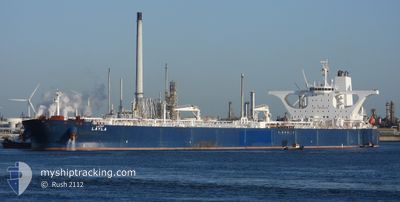
LAYLA
Crude Oil Tanker
Current Trip
| Time Travelled | 17 h, 20 mins |
|---|---|
| Remaining Time | --- |
| Distance Travelled | 109.42 nm |
| Remaining Distance | --- |
| AVG Speed | 9.5 Knots |
| MAX Speed | 12.5 Knots |
| AVG Wind | 18.2 knots |
| MAX Wind | 22.8 knots |
| MIN Temp | 27.4°C / 81.32°F |
| MAX Temp | 29.6°C / 85.28°F |
| Draught | 0 m |
| Position Received | 13 d ago |
Current Position
| Longitude | 38.63305° |
|---|---|
| Latitude | 22.48572° |
| Status | Under way using engine |
| Speed | 11.5 Knots |
| Course | 27° |
| Area | Red Sea |
| Station | T-AIS |
| Position Received | 13 d ago |
Info
Information
The current position of LAYLA is in Red Sea with coordinates 22.48572° / 38.63305° as reported on 2024-05-19 00:29 by AIS to our vessel tracker app. The vessel's current speed is 11.5 Knots
The vessel LAYLA (IMO: 9336098, MMSI: 403507001) is a Crude Oil Tanker that was built in 2007 ( 17 years old ). It's sailing under the flag of [SA] Saudi Arabia.
In this page you can find informations about the vessels current position, last detected port calls, and current voyage information. If the vessels is not in coverage by AIS you will find the latest position.
The current position of LAYLA is detected by our AIS receivers and we are not responsible for the reliability of the data. The last position was recorded while the vessel was in Coverage by the Ais receivers of our vessel tracking app.
Weather
| Temperature | 28.3°C / 82.94°F |
|---|---|
| Wind Speed | 12 knots |
| Direction | 313° NW |
| Pressure | 1005 hPa |
| Humidity | 73.5 % |
| Cloud Coverage | --- |
Featured Company
Last Port Calls
| Port | Arrival | Departure | Time In Port |
|---|---|---|---|
| 2024-05-29 09:48 | 2024-06-01 04:35 | 2 d | |
| 2024-05-08 10:11 | 2024-05-09 23:37 | 1 d | |
| 2024-04-20 16:27 |
Most Visited Ports (Last year)
| Port | Arrivals | |
|---|---|---|
| 4 | ||
| 2 | ||
| 1 | ||
| 1 |
Last Trips
| Origin | Departure | Destination | Arrival | Distance | |
|---|---|---|---|---|---|
| 2024-05-10 02:37 | 2024-05-29 12:48 | 2812.57 nm | |||
| 2024-04-20 19:27 | 2024-05-08 13:11 | 3783.03 nm |
Events
| Time | Event | Details | Position / Dest | Info |
|---|---|---|---|---|
| 2024-06-01 04:35 | PORT DEPARTURE |
|
22.73240 / 38.96143
SARAB
|
Speed: 7.5 kn Course: 249° |
| 2024-06-01 04:10 | START Moving |
22.74185 / 39.00011
[SA] RABIGH
|
Speed: 3.7 kn Course: 275° |
|
| 2024-05-29 10:32 | STOP Moving |
22.74015 / 39.00285
[SA] RABIGH
|
Speed: 0.1 kn Course: 325° |
|
| 2024-05-29 09:48 | PORT ARRIVAL |
|
22.73358 / 38.98220
[SA] RABIGH
|
Speed: 5.4 kn Course: 81° |
| 2024-05-29 05:13 | START Moving | 19.16 nm, West of RABIGH |
22.65975 / 38.66027
SARAB
|
Speed: 4.8 kn Course: 97° |
| 2024-05-28 07:57 | STOP Moving | 16.05 nm, West of RABIGH |
22.64075 / 38.72585
SARAB
|
Speed: 0.3 kn Course: 191° |
| 2024-05-28 06:23 | START Moving | 15.82 nm, South West of RABIGH |
22.62935 / 38.73553
SARAB
|
Speed: 4.1 kn Course: 71° |
| 2024-05-26 06:51 | STOP Moving | 18.57 nm, West of RABIGH |
22.63497 / 38.67967
SARAB
|
Speed: 0.3 kn Course: 252° |
| 2024-05-26 04:48 | START Moving | 20.5 nm, South West of RABIGH |
22.54971 / 38.68722
SARAB
|
Speed: 3.8 kn Course: 19° |