
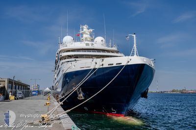
LE BELLOT
Passenger
Current Trip
| Trip Time | 12 h, 33 mins |
|---|---|
| Trip Distance | 150.62 nm |
| AVG Speed | 12.5 Knots |
| MAX Speed | 16.5 Knots |
| Draught | 4.7 m |
| AVG Wind | 15 knots |
| MAX Wind | 19 knots |
| MIN Temp | 9.2°C / 48.56°F |
| MAX Temp | 11.1°C / 51.98°F |
| Position Received | 13 h, 49 m ago |
Current Position
| Longitude | -4.33427° |
|---|---|
| Latitude | 58.70345° |
| Status | Under way using engine |
| Speed | 13.2 Knots |
| Course | 265.1° |
| Area | North Atlantic Ocean |
| Station | T-AIS |
| Position Received | 13 h, 49 m ago |
Info
Information
The current position of LE BELLOT is in North Atlantic Ocean with coordinates 58.70345° / -4.33427° as reported on 2024-05-13 23:50 by AIS to our vessel tracker app. The vessel's current speed is 13.2 Knots and is currently inside the port of STORNOWAY.
The vessel LE BELLOT (IMO: 9852418, MMSI: 578001500) is a Passenger It's sailing under the flag of [WF] Wallis Futuna Is.
In this page you can find informations about the vessels current position, last detected port calls, and current voyage information. If the vessels is not in coverage by AIS you will find the latest position.
The current position of LE BELLOT is detected by our AIS receivers and we are not responsible for the reliability of the data. The last position was recorded while the vessel was in Coverage by the Ais receivers of our vessel tracking app.
The current draught of LE BELLOT as reported by AIS is 4.7 meters
Weather
| Temperature | 11.7°C / 53.06°F |
|---|---|
| Wind Speed | 7 knots |
| Direction | 17° NNE |
| Pressure | 1002.9 hPa |
| Humidity | 94.4 % |
| Cloud Coverage | 100 % |
Featured Company
Last Port Calls
| Port | Arrival | Departure | Time In Port |
|---|---|---|---|
| 2024-05-14 06:30 | |||
| 2024-05-13 05:35 | 2024-05-13 17:57 | 12 h | |
| 2024-05-10 06:26 | 2024-05-10 20:01 | 13 h | |
| 2024-05-08 10:06 | 2024-05-08 17:44 | 7 h | |
| 2024-05-07 05:41 | 2024-05-07 11:06 | 5 h | |
| 2024-05-06 05:21 | 2024-05-06 12:03 | 6 h | |
| 2024-05-05 05:44 | 2024-05-05 17:22 | 11 h | |
| 2024-05-04 04:31 | 2024-05-04 15:45 | 11 h | |
| 2024-05-03 05:09 | 2024-05-03 17:29 | 12 h | |
| 2024-05-02 06:20 | 2024-05-02 16:06 | 9 h |
Most Visited Ports (Last year)
| Port | Arrivals | |
|---|---|---|
| 12 | ||
| 10 | ||
| 9 | ||
| 9 | ||
| 8 | ||
| 8 |
Last Trips
| Origin | Departure | Destination | Arrival | Distance | |
|---|---|---|---|---|---|
| 2024-05-13 18:57 | 2024-05-14 07:30 | 150.62 nm | |||
| 2024-05-10 21:01 | 2024-05-13 06:35 | 384.75 nm | |||
| 2024-05-08 18:44 | 2024-05-10 07:26 | 227.30 nm | |||
| 2024-05-07 13:06 | 2024-05-08 11:06 | 290.15 nm | |||
| 2024-05-06 14:03 | 2024-05-07 07:41 | 128.94 nm | |||
| 2024-05-05 19:22 | 2024-05-06 07:21 | 130.22 nm | |||
| 2024-05-04 17:45 | 2024-05-05 07:44 | 153.23 nm | |||
| 2024-05-03 19:29 | 2024-05-04 06:31 | 130.10 nm | |||
| 2024-05-02 18:06 | 2024-05-03 07:09 | 98.42 nm | |||
| 2024-04-30 18:04 | 2024-05-02 08:20 | 239.20 nm |
Events
| Time | Event | Details | Position / Dest | Info |
|---|---|---|---|---|
| 2024-05-14 06:51 | STOP Moving |
58.20651 / -6.39130
[GB] STORNOWAY
|
Speed: 0.1 kn Course: 330° |
|
| 2024-05-14 06:30 | PORT ARRIVAL |
|
58.19223 / -6.36254
[GB] STORNOWAY
|
Speed: 9.6 kn Course: 324° |
| 2024-05-13 23:57 | Status Changed | Default Under way using engine |
58.70500 / -4.38167
GB STO
|
Speed: 13.2 kn Course: 265.1° |
| 2024-05-13 23:50 | OUT of Coverage |
58.70345 / -4.33427
North Atlantic Ocean
GB STO
|
Speed: 13.2 kn Course: 265.1° |
|
| 2024-05-13 21:22 | Change Sea Area | United Kingdom part of the North Atlantic Ocean United Kingdom part of the North Sea |
58.71767 / -3.41223
North Atlantic Ocean
GB STO
|
Speed: 11.7 kn Course: 269.4° |
| 2024-05-13 19:32 | Status Changed | Under way using engine Default |
58.84919 / -2.68605
GB STO
|
Speed: 13.6 kn Course: 222° |
| 2024-05-13 19:27 | Status Changed | Default Under way using engine |
58.86597 / -2.65668
GB STO
|
Speed: 13.6 kn Course: 206.7° |
| 2024-05-13 19:20 | Status Changed | Under way using engine Default |
58.88487 / -2.62669
GB STO
|
Speed: 13 kn Course: 197° |
| 2024-05-13 18:55 | Status Changed | Default Under way using engine |
58.96670 / -2.66615
GB STO
|
Speed: 11.3 kn Course: 150.2° |
| 2024-05-13 17:58 | START Moving | 0.73 nm, North West of KIRKWALL |
59.00225 / -2.97036
GB STO
|
Speed: 3.9 kn Course: 30° |