
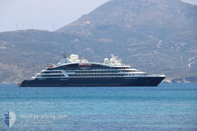
LE BOUGAINVILLE
Passenger
Current Trip
IT GIA
| Time Travelled | 17 h, 45 mins |
|---|---|
| Remaining Time | --- |
| Distance Travelled | 146.18 nm |
| Remaining Distance | --- |
| AVG Speed | 10.3 Knots |
| MAX Speed | 12 Knots |
| AVG Wind | 3.6 knots |
| MAX Wind | 8 knots |
| MIN Temp | 16.4°C / 61.52°F |
| MAX Temp | 26.5°C / 79.7°F |
| Draught | 4.7 m |
| Position Received | 3 h, 54 m ago |
Current Position
| Longitude | 15.35027° |
|---|---|
| Latitude | 37.86827° |
| Status | Under way using engine |
| Speed | 9.3 Knots |
| Course | 225.5° |
| Area | Ionian Sea |
| Station | T-AIS |
| Position Received | 3 h, 54 m ago |
Info
Information
The current position of LE BOUGAINVILLE is in Ionian Sea with coordinates 37.86827° / 15.35027° as reported on 2024-06-01 04:30 by AIS to our vessel tracker app. The vessel's current speed is 9.3 Knots
The vessel LE BOUGAINVILLE (IMO: 9814040, MMSI: 578001300) is a Passenger It's sailing under the flag of [WF] Wallis Futuna Is.
In this page you can find informations about the vessels current position, last detected port calls, and current voyage information. If the vessels is not in coverage by AIS you will find the latest position.
The current position of LE BOUGAINVILLE is detected by our AIS receivers and we are not responsible for the reliability of the data. The last position was recorded while the vessel was in Coverage by the Ais receivers of our vessel tracking app.
The current draught of LE BOUGAINVILLE as reported by AIS is 4.7 meters
Weather
| Temperature | 23.1°C / 73.58°F |
|---|---|
| Wind Speed | 6 knots |
| Direction | 106° ESE |
| Pressure | 1016.2 hPa |
| Humidity | 59.2 % |
| Cloud Coverage | 2 % |
Featured Company
Last Port Calls
| Port | Arrival | Departure | Time In Port |
|---|---|---|---|
| 2024-05-31 05:58 | 2024-05-31 14:40 | 8 h | |
| 2024-05-30 05:57 | 2024-05-30 12:52 | 6 h | |
| 2024-05-29 05:22 | 2024-05-29 14:23 | 9 h | |
| 2024-05-28 04:57 | 2024-05-28 15:30 | 10 h | |
| 2024-05-27 10:51 | 2024-05-27 16:43 | 5 h | |
| 2024-05-22 16:53 | 2024-05-27 09:53 | 4 d | |
| 2024-05-22 04:24 | 2024-05-22 15:29 | 11 h | |
| 2024-05-21 05:16 | 2024-05-21 14:12 | 8 h | |
| 2024-05-20 09:56 | 2024-05-20 16:36 | 6 h | |
| 2024-05-19 09:37 | 2024-05-19 16:22 | 6 h |
Last Trips
| Origin | Departure | Destination | Arrival | Distance | |
|---|---|---|---|---|---|
| 2024-05-30 14:52 | 2024-05-31 07:58 | 218.81 nm | |||
| 2024-05-29 16:23 | 2024-05-30 07:57 | 196.93 nm | |||
| 2024-05-28 17:30 | 2024-05-29 07:22 | 123.26 nm | |||
| 2024-05-27 18:43 | 2024-05-28 06:57 | 148.41 nm | |||
| 2024-05-27 11:53 | 2024-05-27 12:51 | 10.10 nm | |||
| 2024-05-22 17:29 | 2024-05-22 18:53 | 12.91 nm | |||
| 2024-05-21 16:12 | 2024-05-22 06:24 | 154.32 nm | |||
| 2024-05-20 18:36 | 2024-05-21 07:16 | 124.28 nm | |||
| 2024-05-19 18:22 | 2024-05-20 11:56 | 195.62 nm | |||
| 2024-05-18 16:02 | 2024-05-19 11:37 | 219.84 nm |
Events
| Time | Event | Details | Position / Dest | Info |
|---|---|---|---|---|
| 2024-06-01 05:13 | STOP Moving | 21.51 nm, South West of TREMESTIERI |
37.83091 / 15.28023
IT GIA
|
Speed: 0.2 kn Course: 261° |
| 2024-06-01 04:33 | Status Changed | Default Under way using engine |
37.86163 / 15.34143
IT GIA
|
Speed: 9.3 kn Course: 225.5° |
| 2024-06-01 04:30 | Status Changed | Under way using engine Default |
37.86827 / 15.35027
IT GIA
|
Speed: 9.3 kn Course: 226° |
| 2024-06-01 04:30 | OUT of Coverage |
37.86827 / 15.35027
Ionian Sea
IT GIA
|
Speed: 9.3 kn Course: 225.5° |
|
| 2024-06-01 04:00 | Status Changed | Default Under way using engine |
37.92717 / 15.41516
IT GIA
|
Speed: 10.4 kn Course: 229.2° |
| 2024-06-01 01:43 | Change Sea Area | Italian part of the Ionian Sea Italian part of the Tyrrhenian Sea |
38.25603 / 15.64643
Ionian Sea
IT GIA
|
Speed: 12.4 kn Course: 246.1° |
| 2024-05-31 20:08 | Status Changed | Under way using engine Default |
38.25743 / 14.56143
IT GIA
|
Speed: 10 kn Course: 83° |
| 2024-05-31 19:52 | IN Coverage |
38.25795 / 14.56684
Tyrrhenian Sea
IT GIA
|
Speed: 10.3 kn Course: 83.2° |
|
| 2024-05-31 18:04 | Status Changed | Default Under way using engine |
38.21167 / 14.11500
IT GIA
|
Speed: 10.3 kn Course: 82.2° |
| 2024-05-31 17:52 | OUT of Coverage |
38.20763 / 14.07282
Tyrrhenian Sea
IT GIA
|
Speed: 10.3 kn Course: 82.2° |