
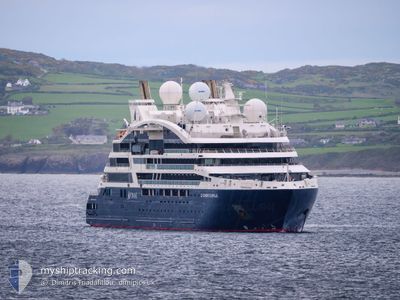
LE DUMONT D'URVILLE
Passenger
Current Trip
| Time Travelled | 8 h, 10 mins |
|---|---|
| Remaining Time | 1 day |
| Distance Travelled | 109.13 nm |
| Remaining Distance | 383.46 nm |
| AVG Speed | 13.5 Knots |
| MAX Speed | 14.2 Knots |
| AVG Wind | 5.1 knots |
| MAX Wind | 8.1 knots |
| MIN Temp | 18.4°C / 65.12°F |
| MAX Temp | 19.8°C / 67.64°F |
| Draught | 4.6 m |
| Position Received | 3 m ago |
Current Position
| Longitude | -15.01675° |
|---|---|
| Latitude | 33.48933° |
| Status | Under way using engine |
| Speed | 13.7 Knots |
| Course | 59.5° |
| Area | North Atlantic Ocean |
| Station | T-AIS |
| Position Received | 3 m ago |
Info
Information
The current position of LE DUMONT D'URVILLE is in North Atlantic Ocean with coordinates 33.48933° / -15.01675° as reported on 2024-05-09 02:13 by AIS to our vessel tracker app. The vessel's current speed is 13.7 Knots and is heading at the port of LAGOS. The estimated time of arrival as calculated by vessel tracking app is 2024-05-10 06:20 LT
The vessel LE DUMONT D'URVILLE (IMO: 9814052, MMSI: 578001200) is a Passenger It's sailing under the flag of [WF] Wallis Futuna Is.
In this page you can find informations about the vessels current position, last detected port calls, and current voyage information. If the vessels is not in coverage by AIS you will find the latest position.
The current position of LE DUMONT D'URVILLE is detected by our AIS receivers and we are not responsible for the reliability of the data. The last position was recorded while the vessel was in Coverage by the Ais receivers of our vessel tracking app.
The current draught of LE DUMONT D'URVILLE as reported by AIS is 4.6 meters
Weather
| Temperature | 18.9°C / 66.02°F |
|---|---|
| Wind Speed | 8 knots |
| Direction | 350° N |
| Pressure | 1015.8 hPa |
| Humidity | 74 % |
| Cloud Coverage | 100 % |
Featured Company
Last Port Calls
| Port | Arrival | Departure | Time In Port |
|---|---|---|---|
| 2024-05-07 10:37 | 2024-05-08 18:06 | 1 d | |
| 2024-05-05 21:24 | 2024-05-06 15:15 | 17 h | |
| 2024-05-05 06:10 | 2024-05-05 16:23 | 10 h | |
| 2024-05-04 06:02 | 2024-05-04 21:47 | 15 h | |
| 2024-05-03 05:24 | 2024-05-03 20:33 | 15 h | |
| 2024-05-01 21:08 | 2024-05-02 16:26 | 19 h | |
| 2024-05-01 04:35 | 2024-05-01 17:14 | 12 h | |
| 2024-04-29 21:57 | 2024-04-30 20:33 | 22 h | |
| 2024-04-29 06:17 | 2024-04-29 16:06 | 9 h | |
| 2024-04-28 07:06 | 2024-04-28 15:59 | 8 h |
Most Visited Ports (Last year)
| Port | Arrivals | |
|---|---|---|
| 8 | ||
| 7 | ||
| 6 | ||
| 5 | ||
| 5 | ||
| 5 |
Last Trips
| Origin | Departure | Destination | Arrival | Distance | |
|---|---|---|---|---|---|
| 2024-05-06 16:15 | 2024-05-07 11:37 | 243.12 nm | |||
| 2024-05-05 17:23 | 2024-05-05 22:24 | 59.41 nm | |||
| 2024-05-04 22:47 | 2024-05-05 07:10 | 78.79 nm | |||
| 2024-05-03 21:33 | 2024-05-04 07:02 | 54.67 nm | |||
| 2024-05-02 17:26 | 2024-05-03 06:24 | 167.54 nm | |||
| 2024-05-01 18:14 | 2024-05-01 22:08 | 47.76 nm | |||
| 2024-04-30 21:33 | 2024-05-01 05:35 | 63.04 nm | |||
| 2024-04-29 17:06 | 2024-04-29 22:57 | 69.29 nm | |||
| 2024-04-28 16:59 | 2024-04-29 07:17 | 182.70 nm | |||
| 2024-04-28 05:06 | 2024-04-28 08:06 | 34.15 nm |
Events
| Time | Event | Details | Position / Dest | Info |
|---|---|---|---|---|
| 2024-05-09 02:10 | Status Changed | Under way using engine Default |
33.48381 / -15.02821
LAGOS
|
Speed: 14 kn Course: 60° |
| 2024-05-09 02:05 | IN Coverage |
33.48629 / -15.02307
North Atlantic Ocean
LAGOS
|
Speed: 13.7 kn Course: 61.2° |
|
| 2024-05-09 01:02 | Status Changed | Default Under way using engine |
33.35529 / -15.29341
LAGOS
|
Speed: 13.6 kn Course: 59.9° |
| 2024-05-09 00:56 | Status Changed | Under way using engine Default |
33.34284 / -15.31907
LAGOS
|
Speed: 13.9 kn Course: 61° |
| 2024-05-09 00:56 | OUT of Coverage |
33.34284 / -15.31907
North Atlantic Ocean
LAGOS
|
Speed: 13.6 kn Course: 59.9° |
|
| 2024-05-09 00:55 | Status Changed | Default Under way using engine |
33.34030 / -15.32429
LAGOS
|
Speed: 13.5 kn Course: 60.7° |
| 2024-05-09 00:34 | Status Changed | Under way using engine Default |
33.30154 / -15.40432
LAGOS
|
Speed: 13.4 kn Course: 59° |
| 2024-05-08 23:50 | Status Changed | Default Under way using engine |
33.22025 / -15.57176
LAGOS
|
Speed: 13.2 kn Course: 61.1° |
| 2024-05-08 22:47 | Draught Changed | 4.6 4.7 |
33.10418 / -15.81567
LAGOS
|
Speed: 13.7 kn Course: 61.5° |
| 2024-05-08 22:47 | Destination Changed | LAGOS FUNCHAL |
33.10418 / -15.81567
LAGOS
|
Speed: 13.7 kn Course: 61.5° |