
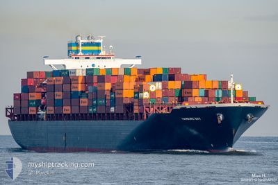
LE HAVRE EXPRESS
Container Ship
Current Trip
| Time Travelled | 16 h, 43 mins |
|---|---|
| Remaining Time | 1 day |
| Distance Travelled | 263.56 nm |
| Remaining Distance | 532.94 nm |
| AVG Speed | 16.5 Knots |
| MAX Speed | 18 Knots |
| AVG Wind | 9 knots |
| MAX Wind | 13.6 knots |
| MIN Temp | 24.6°C / 76.28°F |
| MAX Temp | 28.2°C / 82.76°F |
| Draught | 11 m |
| Position Received | 1 m ago |
Current Position
| Longitude | 28.41661° |
|---|---|
| Latitude | 34.98101° |
| Status | Under way using engine |
| Speed | 17.7 Knots |
| Course | 319° |
| Area | Mediterranean Sea - Eastern Basin |
| Station | T-AIS |
| Position Received | 1 m ago |
Info
Information
The current position of LE HAVRE EXPRESS is in Mediterranean Sea - Eastern Basin with coordinates 34.98101° / 28.41661° as reported on 2024-06-07 03:19 by AIS to our vessel tracker app. The vessel's current speed is 17.7 Knots and is heading at the port of ISTANBUL. The estimated time of arrival as calculated by vessel tracking app is 2024-06-08 09:10 LT
The vessel LE HAVRE EXPRESS (IMO: 9332872, MMSI: 636093082) is a Container Ship that was built in 2009 ( 15 years old ). It's sailing under the flag of [LR] Liberia.
In this page you can find informations about the vessels current position, last detected port calls, and current voyage information. If the vessels is not in coverage by AIS you will find the latest position.
The current position of LE HAVRE EXPRESS is detected by our AIS receivers and we are not responsible for the reliability of the data. The last position was recorded while the vessel was in Coverage by the Ais receivers of our vessel tracking app.
The current draught of LE HAVRE EXPRESS as reported by AIS is 11 meters
Weather
| Temperature | 25.1°C / 77.18°F |
|---|---|
| Wind Speed | 7 knots |
| Direction | 284° WNW |
| Pressure | 1008.8 hPa |
| Humidity | 74.7 % |
| Cloud Coverage | 36 % |
Featured Company
Last Port Calls
| Port | Arrival | Departure | Time In Port |
|---|---|---|---|
| 2024-06-04 21:36 | 2024-06-06 10:38 | 1 d | |
| 2024-06-04 18:10 | 2024-06-04 21:31 | 3 h | |
| 2024-05-25 05:59 | 2024-05-26 04:43 | 22 h | |
| 2024-05-22 18:12 | 2024-05-23 19:59 | 1 d | |
| 2024-05-18 22:02 | 2024-05-19 10:17 | 12 h | |
| 2024-05-01 19:09 | 2024-05-04 00:52 | 2 d | |
| 2024-04-28 16:23 | 2024-04-29 13:42 | 21 h | |
| 2024-04-12 14:43 | 2024-04-13 10:44 | 20 h | |
| 2024-04-11 00:58 | 2024-04-12 05:35 | 1 d | |
| 2024-04-08 01:49 | 2024-04-09 10:16 | 1 d |
Last Trips
| Origin | Departure | Destination | Arrival | Distance | |
|---|---|---|---|---|---|
| 2024-06-04 23:31 | 2024-06-04 23:36 | 3.22 nm | |||
| 2024-05-26 06:43 | 2024-06-04 20:10 | 3615.68 nm | |||
| 2024-05-23 21:59 | 2024-05-25 07:59 | 375.28 nm | |||
| 2024-05-19 11:17 | 2024-05-22 20:12 | 171.54 nm | |||
| 2024-05-03 19:52 | 2024-05-18 23:02 | 5184.15 nm | |||
| 2024-04-29 08:42 | 2024-05-01 14:09 | 519.40 nm | |||
| 2024-04-13 12:44 | 2024-04-28 11:23 | 5759.75 nm | |||
| 2024-04-12 07:35 | 2024-04-12 16:43 | 112.83 nm | |||
| 2024-04-09 12:16 | 2024-04-11 02:58 | 399.14 nm | |||
| 2024-04-07 01:38 | 2024-04-08 03:49 | 196.98 nm |
Events
| Time | Event | Details | Position / Dest | Info |
|---|---|---|---|---|
| 2024-06-06 23:53 | ETA Changed | 2024/06/08 14:00 2024/06/08 15:00 |
34.20419 / 29.21401
EGDAM>TRIST
|
Speed: 17.6 kn Course: 319° |
| 2024-06-06 22:31 | Detected in Sea | Greek part of the Mediterranean Sea - Eastern Basin |
33.90879 / 29.52289
Mediterranean Sea - Eastern Basin
EGDAM>TRIST
|
Speed: 16.7 kn Course: 320° |
| 2024-06-06 22:31 | IN Coverage |
33.90879 / 29.52289
Mediterranean Sea - Eastern Basin
EGDAM>TRIST
|
Speed: 16.7 kn Course: 320° |
|
| 2024-06-06 18:43 | OUT of Coverage |
33.11157 / 30.32411
Mediterranean Sea - Eastern Basin
EGDAM>TRIST
|
Speed: 15.8 kn Course: 321° |
|
| 2024-06-06 17:54 | IN Coverage |
32.94893 / 30.48923
Mediterranean Sea - Eastern Basin
EGDAM>TRIST
|
Speed: 16.3 kn Course: 318° |
|
| 2024-06-06 16:17 | OUT of Coverage |
32.62275 / 30.85177
Mediterranean Sea - Eastern Basin
EGDAM>TRIST
|
Speed: 15.9 kn Course: 318° |
|
| 2024-06-06 16:15 | IN Coverage |
32.62175 / 30.85284
Mediterranean Sea - Eastern Basin
EGDAM>TRIST
|
Speed: 15.9 kn Course: 318° |
|
| 2024-06-06 14:33 | OUT of Coverage |
32.26508 / 31.20005
Mediterranean Sea - Eastern Basin
EGDAM>TRIST
|
Speed: 15.4 kn Course: 321° |
|
| 2024-06-06 13:35 | IN Coverage |
32.09081 / 31.38351
Mediterranean Sea - Eastern Basin
EGDAM>TRIST
|
Speed: 14.6 kn Course: 319° |
|
| 2024-06-06 11:30 | OUT of Coverage |
31.68813 / 31.76519
Mediterranean Sea - Eastern Basin
EGDAM>TRIST
|
Speed: 15.1 kn Course: 322° |