
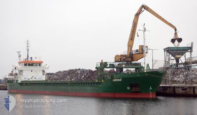
LECKO
General Cargo
Current Trip
| Time Travelled | 3 days |
|---|---|
| Remaining Time | --- |
| Distance Travelled | 465.37 nm |
| Remaining Distance | --- |
| AVG Speed | 7.8 Knots |
| MAX Speed | 12.1 Knots |
| AVG Wind | 8.7 knots |
| MAX Wind | 30.8 knots |
| MIN Temp | 1.5°C / 34.7°F |
| MAX Temp | 13.1°C / 55.58°F |
| Draught | 5.4 m |
| Position Received | 1 d ago |
Current Position
| Longitude | 7.84183° |
|---|---|
| Latitude | 53.92442° |
| Status | Under way using engine |
| Speed | 8.5 Knots |
| Course | 96.6° |
| Area | North Sea |
| Station | T-AIS |
| Position Received | 1 d ago |
Info
Information
The current position of LECKO is in North Sea with coordinates 53.92442° / 7.84183° as reported on 2024-04-29 06:50 by AIS to our vessel tracker app. The vessel's current speed is 8.5 Knots
The vessel LECKO (IMO: 9263576, MMSI: 244063000) is a General Cargo that was built in 2003 ( 21 years old ). It's sailing under the flag of [NL] Netherlands.
In this page you can find informations about the vessels current position, last detected port calls, and current voyage information. If the vessels is not in coverage by AIS you will find the latest position.
The current position of LECKO is detected by our AIS receivers and we are not responsible for the reliability of the data. The last position was recorded while the vessel was in Coverage by the Ais receivers of our vessel tracking app.
The current draught of LECKO as reported by AIS is 5.4 meters
Weather
| Temperature | 11.3°C / 52.34°F |
|---|---|
| Wind Speed | 11 knots |
| Direction | 132° SE |
| Pressure | 1019 hPa |
| Humidity | 91.1 % |
| Cloud Coverage | 100 % |
Featured Company
Last Port Calls
| Port | Arrival | Departure | Time In Port |
|---|---|---|---|
| 2024-04-25 16:56 | 2024-04-26 14:08 | 21 h | |
| 2024-04-25 02:40 | 2024-04-25 13:08 | 10 h | |
| 2024-04-18 19:47 | 2024-04-19 19:46 | 23 h | |
| 2024-04-16 05:24 | 2024-04-18 09:59 | 2 d | |
| 2024-04-08 01:29 | 2024-04-09 15:49 | 1 d | |
| 2024-04-07 04:21 | 2024-04-07 21:44 | 17 h | |
| 2024-04-03 09:45 | 2024-04-04 01:53 | 16 h | |
| 2024-03-28 20:42 | 2024-03-29 11:45 | 15 h | |
| 2024-03-25 11:29 | 2024-03-26 21:07 | 1 d | |
| 2024-03-23 01:44 | 2024-03-23 14:40 | 12 h |
Most Visited Ports (Last year)
| Port | Arrivals | |
|---|---|---|
| 8 | ||
| 6 | ||
| 5 | ||
| 4 | ||
| 4 | ||
| 4 |
Last Trips
| Origin | Departure | Destination | Arrival | Distance | |
|---|---|---|---|---|---|
| 2024-04-25 15:08 | 2024-04-25 18:56 | 44.56 nm | |||
| 2024-04-19 21:46 | 2024-04-25 04:40 | 1307.17 nm | |||
| 2024-04-18 11:59 | 2024-04-18 21:47 | 104.76 nm | |||
| 2024-04-09 17:49 | 2024-04-16 07:24 | 1391.33 nm | |||
| 2024-04-07 23:44 | 2024-04-08 03:29 | 42.04 nm | |||
| 2024-04-04 04:53 | 2024-04-07 06:21 | 642.64 nm | |||
| 2024-03-29 13:45 | 2024-04-03 12:45 | 614.61 nm | |||
| 2024-03-26 22:07 | 2024-03-28 22:42 | 482.91 nm | |||
| 2024-03-23 15:40 | 2024-03-25 12:29 | 411.92 nm | |||
| 2024-03-22 22:53 | 2024-03-23 02:44 | 42.10 nm |
Events
| Time | Event | Details | Position / Dest | Info |
|---|---|---|---|---|
| 2024-04-29 07:08 | STOP Moving | 8.18 nm, North of WANGEROOGE |
53.91000 / 7.87167
DE NHA
|
Speed: Course: -1° |
| 2024-04-29 06:55 | Status Changed | Default Under way using engine |
53.92175 / 7.85764
DE NHA
|
Speed: 8.5 kn Course: 96.6° |
| 2024-04-29 06:50 | OUT of Coverage |
53.92442 / 7.84183
North Sea
DE NHA
|
Speed: 8.5 kn Course: 96.6° |
|
| 2024-04-29 06:44 | Status Changed | Under way using engine Default |
53.92617 / 7.81780
DE NHA
|
Speed: 8 kn Course: 97° |
| 2024-04-29 06:31 | Status Changed | Default Under way using engine |
53.92996 / 7.76691
DE NHA
|
Speed: 8.5 kn Course: 96.6° |
| 2024-04-29 06:25 | Status Changed | Under way using engine Default |
53.93176 / 7.74182
DE NHA
|
Speed: 8 kn Course: 96° |
| 2024-04-29 06:23 | IN Coverage |
53.93176 / 7.74182
North Sea
DE NHA
|
Speed: 8.5 kn Course: 96.6° |
|
| 2024-04-28 19:14 | Status Changed | Default Under way using engine |
55.11666 / 7.34667
DE NHA
|
Speed: 6.4 kn Course: 174.9° |
| 2024-04-28 19:01 | Status Changed | Under way using engine Default |
55.14170 / 7.34508
DE NHA
|
Speed: 6 kn Course: 173° |
| 2024-04-28 19:01 | OUT of Coverage |
55.14170 / 7.34508
North Sea
DE NHA
|
Speed: 6.4 kn Course: 174.9° |