
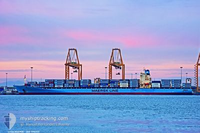
LEDA MAERSK
Container Ship
Current Trip
USNYC>PAMIT
| Time Travelled | 3 h, 17 mins |
|---|---|
| Remaining Time | --- |
| Distance Travelled | 14.22 nm |
| Remaining Distance | --- |
| AVG Speed | 8.7 Knots |
| MAX Speed | 12.7 Knots |
| AVG Wind | 6.9 knots |
| MAX Wind | 10 knots |
| MIN Temp | 25.3°C / 77.54°F |
| MAX Temp | 28.9°C / 84.02°F |
| Draught | 12.9 m |
| Position Received | 1 d ago |
Current Position
| Longitude | -79.88432° |
|---|---|
| Latitude | 9.36689° |
| Status | Moored |
| Speed | |
| Course | 246° |
| Area | North Atlantic Ocean |
| Station | T-AIS |
| Position Received | 1 d ago |
Info
Information
The current position of LEDA MAERSK is in North Atlantic Ocean with coordinates 9.36689° / -79.88432° as reported on 2024-05-17 13:22 by AIS to our vessel tracker app. The vessel's current speed is 0 Knots
The vessel LEDA MAERSK (IMO: 9190755, MMSI: 477648800) is a Container Ship that was built in 2001 ( 23 years old ). It's sailing under the flag of [HK] Hong Kong.
In this page you can find informations about the vessels current position, last detected port calls, and current voyage information. If the vessels is not in coverage by AIS you will find the latest position.
The current position of LEDA MAERSK is detected by our AIS receivers and we are not responsible for the reliability of the data. The last position was recorded while the vessel was in Coverage by the Ais receivers of our vessel tracking app.
The current draught of LEDA MAERSK as reported by AIS is 12.9 meters
Weather
| Temperature | 27.4°C / 81.32°F |
|---|---|
| Wind Speed | 2 knots |
| Direction | 59° ENE |
| Pressure | 1011.6 hPa |
| Humidity | 88 % |
| Cloud Coverage | 94 % |
Featured Company
Last Port Calls
| Port | Arrival | Departure | Time In Port |
|---|---|---|---|
| 2024-05-17 03:54 | 2024-05-18 10:38 | 1 d | |
| 2024-05-10 19:16 | 2024-05-11 22:34 | 1 d | |
| 2024-05-02 11:22 | 2024-05-03 02:27 | 15 h | |
| 2024-04-25 15:59 | 2024-04-26 17:24 | 1 d | |
| 2024-04-23 16:40 | 2024-04-25 09:30 | 1 d | |
| 2024-04-22 04:26 | 2024-04-22 16:32 | 12 h | |
| 2024-04-16 11:08 | 2024-04-18 05:24 | 1 d | |
| 2024-04-12 08:08 | 2024-04-13 03:36 | 19 h | |
| 2024-04-11 03:39 | 2024-04-11 21:56 | 18 h | |
| 2024-03-28 23:46 | 2024-03-30 08:11 | 1 d |
Most Visited Ports (Last year)
| Port | Arrivals | |
|---|---|---|
| 10 | ||
| 9 | ||
| 8 | ||
| 7 | ||
| 5 | ||
| 5 |
Last Trips
| Origin | Departure | Destination | Arrival | Distance | |
|---|---|---|---|---|---|
| 2024-05-11 18:34 | 2024-05-16 22:54 | 1977.56 nm | |||
| 2024-05-03 04:27 | 2024-05-10 15:16 | 3424.86 nm | |||
| 2024-04-26 20:24 | 2024-05-02 13:22 | 1940.92 nm | |||
| 2024-04-25 12:30 | 2024-04-25 18:59 | 64.49 nm | |||
| 2024-04-22 19:32 | 2024-04-23 19:40 | 333.62 nm | |||
| 2024-04-18 08:24 | 2024-04-22 07:26 | 286.52 nm | |||
| 2024-04-13 05:36 | 2024-04-16 14:08 | 1525.87 nm | |||
| 2024-04-11 21:56 | 2024-04-12 10:08 | 63.19 nm | |||
| 2024-03-30 03:11 | 2024-04-11 03:39 | 4552.68 nm | |||
| 2024-03-28 02:45 | 2024-03-28 18:46 | 60.80 nm |
Events
| Time | Event | Details | Position / Dest | Info |
|---|---|---|---|---|
| 2024-05-18 12:58 | STOP Moving | 4.21 nm, South of CRISTOBAL |
9.27593 / -79.91308
USNYC>PAMIT
|
Speed: Course: 171° |
| 2024-05-18 10:38 | START Moving | 0.25 nm, South West of COLON |
9.36937 / -79.89342
USNYC>PAMIT
|
Speed: 6 kn Course: 314° |
| 2024-05-18 10:38 | PORT DEPARTURE |
|
9.36937 / -79.89342
USNYC>PAMIT
|
Speed: Course: 246° |
| 2024-05-17 13:25 | Status Changed | Default Moored |
9.36689 / -79.88432
[PA] MANZANILLO
|
Speed: Course: 246° |
| 2024-05-17 13:22 | Status Changed | Moored Default |
9.36689 / -79.88432
[PA] MANZANILLO
|
Speed: Course: 246° |
| 2024-05-17 13:22 | OUT of Coverage |
9.36689 / -79.88432
North Atlantic Ocean
[PA] MANZANILLO
|
Speed: Course: 88° |
|
| 2024-05-17 13:05 | IN Coverage |
9.36689 / -79.88432
North Atlantic Ocean
[PA] MANZANILLO
|
Speed: Course: 88° |
|
| 2024-05-17 03:55 | STOP Moving |
9.36690 / -79.88432
[PA] MANZANILLO
|
Speed: Course: 246° |
|
| 2024-05-17 03:54 | PORT ARRIVAL |
|
9.36690 / -79.88432
[PA] MANZANILLO
|
Speed: 1.1 kn Course: 255° |
| 2024-05-17 02:11 | START Moving | 6.24 nm, North of COLON |
9.47559 / -79.90237
USNYC>PAMIT
|
Speed: 3.6 kn Course: 185° |