
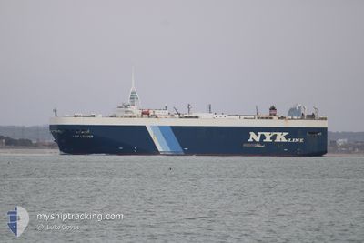
LEO LEADER
Vehicles Carrier
Current Trip
| Time Travelled | 10 days |
|---|---|
| Remaining Time | 1 day |
| Distance Travelled | 3459.51 nm |
| Remaining Distance | 337.15 nm |
| AVG Speed | 14.3 Knots |
| MAX Speed | 19.5 Knots |
| AVG Wind | 10.2 knots |
| MAX Wind | 19 knots |
| MIN Temp | 16.1°C / 60.98°F |
| MAX Temp | 30.7°C / 87.26°F |
| Draught | 8.1 m |
| Position Received | 14 h, 53 m ago |
Current Position
| Longitude | -115.38121° |
|---|---|
| Latitude | 27.07363° |
| Status | Under way using engine |
| Speed | 12.3 Knots |
| Course | 319.7° |
| Area | North Pacific Ocean |
| Station | T-AIS |
| Position Received | 14 h, 53 m ago |
Info
Information
The current position of LEO LEADER is in North Pacific Ocean with coordinates 27.07363° / -115.38121° as reported on 2024-06-03 01:10 by AIS to our vessel tracker app. The vessel's current speed is 12.3 Knots and is heading at the port of HUENEME. The estimated time of arrival as calculated by vessel tracking app is 2024-06-04 19:40 LT
The vessel LEO LEADER (IMO: 9181558, MMSI: 357682000) is a Vehicles Carrier that was built in 1999 ( 25 years old ). It's sailing under the flag of [PA] Panama.
In this page you can find informations about the vessels current position, last detected port calls, and current voyage information. If the vessels is not in coverage by AIS you will find the latest position.
The current position of LEO LEADER is detected by our AIS receivers and we are not responsible for the reliability of the data. The last position was recorded while the vessel was in Coverage by the Ais receivers of our vessel tracking app.
The current draught of LEO LEADER as reported by AIS is 8.1 meters
Weather
| Temperature | 16.6°C / 61.88°F |
|---|---|
| Wind Speed | 13 knots |
| Direction | 308° NW |
| Pressure | 1014.1 hPa |
| Humidity | 87.2 % |
| Cloud Coverage | 100 % |
Featured Company
Last Port Calls
| Port | Arrival | Departure | Time In Port |
|---|---|---|---|
| 2024-05-23 22:17 | 2024-05-24 09:25 | 11 h | |
| 2024-05-21 01:11 | 2024-05-21 09:29 | 8 h | |
| 2024-05-17 23:57 | 2024-05-18 17:47 | 17 h | |
| 2024-04-22 12:33 | 2024-04-23 16:38 | 1 d | |
| 2024-04-19 05:52 | 2024-04-21 19:12 | 2 d | |
| 2024-04-16 22:53 | 2024-04-18 03:47 | 1 d | |
| 2024-04-12 03:29 | 2024-04-12 16:20 | 12 h |
Most Visited Ports (Last year)
| Port | Arrivals | |
|---|---|---|
| 3 | ||
| 3 | ||
| 3 | ||
| 3 | ||
| 3 | ||
| 3 |
Last Trips
| Origin | Departure | Destination | Arrival | Distance | |
|---|---|---|---|---|---|
| 2024-05-21 05:29 | 2024-05-23 17:17 | 737.58 nm | |||
| 2024-05-18 13:47 | 2024-05-20 21:11 | 821.85 nm | |||
| 2024-04-23 17:38 | 2024-05-17 19:57 | 8785.02 nm | |||
| 2024-04-21 21:12 | 2024-04-22 13:33 | 206.53 nm | |||
| 2024-04-18 05:47 | 2024-04-19 07:52 | 331.43 nm | |||
| 2024-04-12 18:20 | 2024-04-17 00:53 | 1210.70 nm | |||
| 2024-03-28 09:23 | 2024-04-12 05:29 | 5793.45 nm |
Events
| Time | Event | Details | Position / Dest | Info |
|---|---|---|---|---|
| 2024-06-03 01:15 | Status Changed | Default Under way using engine |
27.08667 / -115.39333
USNTD
|
Speed: 12.3 kn Course: 319.7° |
| 2024-06-03 01:10 | Status Changed | Under way using engine Default |
27.07363 / -115.38121
USNTD
|
Speed: 12 kn Course: 320° |
| 2024-06-03 01:10 | OUT of Coverage |
27.07363 / -115.38121
North Pacific Ocean
USNTD
|
Speed: 12.3 kn Course: 319.7° |
|
| 2024-06-03 01:03 | Status Changed | Default Under way using engine |
27.05500 / -115.36334
USNTD
|
Speed: 11.6 kn Course: 323.5° |
| 2024-06-03 01:00 | Status Changed | Under way using engine Default |
27.04952 / -115.35884
USNTD
|
Speed: 12 kn Course: 322° |
| 2024-06-03 01:00 | IN Coverage |
27.04952 / -115.35884
North Pacific Ocean
USNTD
|
Speed: 11.6 kn Course: 323.5° |
|
| 2024-06-01 17:23 | Status Changed | Default Under way using engine |
22.11636 / -110.21946
USNTD
|
Speed: 13.6 kn Course: 303.5° |
| 2024-06-01 17:16 | Status Changed | Under way using engine Default |
22.10097 / -110.19568
USNTD
|
Speed: 13.2 kn Course: 306° |
| 2024-06-01 17:16 | OUT of Coverage |
22.10097 / -110.19568
North Pacific Ocean
USNTD
|
Speed: 13.6 kn Course: 303.5° |
|
| 2024-06-01 17:00 | IN Coverage |
22.10097 / -110.19568
North Pacific Ocean
USNTD
|
Speed: 13.6 kn Course: 303.5° |