
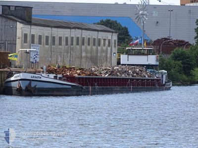
LESATH
Other Type
Current Trip
| Time Travelled | 6 days |
|---|---|
| Remaining Time | --- |
| Distance Travelled | 207.56 nm |
| Remaining Distance | --- |
| AVG Speed | 5.4 Knots |
| MAX Speed | 6.7 Knots |
| AVG Wind | 6.6 knots |
| MAX Wind | 12 knots |
| MIN Temp | 12.3°C / 54.14°F |
| MAX Temp | 21.9°C / 71.42°F |
| Draught | 2.1 m |
| Position Received | 2 d ago |
Current Position
| Longitude | 11.69988° |
|---|---|
| Latitude | 52.23080° |
| Status | Under way using engine |
| Speed | 5.2 Knots |
| Course | 81.7° |
| Area | North Sea |
| Station | T-AIS |
| Position Received | 2 d ago |
Info
Information
The current position of LESATH is in North Sea with coordinates 52.23080° / 11.69988° as reported on 2024-06-24 10:16 by AIS to our vessel tracker app. The vessel's current speed is 5.2 Knots and is heading at the port of LINGEN.
The vessel LESATH (MMSI: 211228330) is a Other Type It's sailing under the flag of [DE] Germany.
In this page you can find informations about the vessels current position, last detected port calls, and current voyage information. If the vessels is not in coverage by AIS you will find the latest position.
The current position of LESATH is detected by our AIS receivers and we are not responsible for the reliability of the data. The last position was recorded while the vessel was in Coverage by the Ais receivers of our vessel tracking app.
The current draught of LESATH as reported by AIS is 2.1 meters
Weather
| Temperature | 21.8°C / 71.24°F |
|---|---|
| Wind Speed | 5 knots |
| Direction | 349° N |
| Pressure | 1020.5 hPa |
| Humidity | 56 % |
| Cloud Coverage | 4 % |
Featured Company
Last Port Calls
| Port | Arrival | Departure | Time In Port |
|---|---|---|---|
| 2024-06-19 08:30 | 2024-06-20 08:31 | 1 d | |
| 2024-06-17 08:16 | 2024-06-19 07:11 | 1 d | |
| 2024-06-15 14:10 | 2024-06-15 15:36 | 1 h | |
| 2024-06-13 17:58 | 2024-06-14 03:50 | 9 h | |
| 2024-06-06 06:00 | 2024-06-07 17:54 | 1 d | |
| 2024-06-05 15:16 | 2024-06-06 04:08 | 12 h | |
| 2024-05-30 14:08 | 2024-06-04 06:16 | 4 d | |
| 2024-05-22 11:19 | |||
| 2024-05-18 08:53 | 2024-05-18 09:54 | 1 h | |
| 2024-05-17 19:32 | 2024-05-18 07:24 | 11 h |
Most Visited Ports (Last year)
| Port | Arrivals | |
|---|---|---|
| 17 | ||
| 15 | ||
| 11 | ||
| 7 | ||
| 6 | ||
| 4 |
Last Trips
| Origin | Departure | Destination | Arrival | Distance | |
|---|---|---|---|---|---|
| 2024-06-19 09:11 | 2024-06-19 10:30 | 8.56 nm | |||
| 2024-06-15 17:36 | 2024-06-17 10:16 | 34.54 nm | |||
| 2024-06-14 05:50 | 2024-06-15 16:10 | 101.89 nm | |||
| 2024-06-07 19:54 | 2024-06-13 19:58 | 117.94 nm | |||
| 2024-06-06 06:08 | 2024-06-06 08:00 | 16.06 nm | |||
| 2024-06-04 08:16 | 2024-06-05 17:16 | 102.92 nm | |||
| 2024-05-22 13:19 | 2024-05-30 16:08 | 196.71 nm | |||
| 2024-05-18 09:24 | 2024-05-18 10:53 | 11.91 nm | |||
| 2024-05-17 05:38 | 2024-05-17 21:32 | 60.15 nm | |||
| 2024-05-14 06:06 | 2024-05-14 11:50 | 51.57 nm |
Events
| Time | Event | Details | Position / Dest | Info |
|---|---|---|---|---|
| 2024-06-24 10:16 | OUT of Coverage |
52.23080 / 11.69988
North Sea
|
Speed: 5.2 kn Course: 81.7° |
|
| 2024-06-24 10:06 | IN Coverage |
52.22893 / 11.67779
North Sea
|
Speed: 5.4 kn Course: 84.1° |
|
| 2024-06-23 04:16 | OUT of Coverage |
52.40686 / 9.74221
North Sea
|
Speed: 6.3 kn Course: 118.4° |
|
| 2024-06-23 04:00 | IN Coverage |
52.41816 / 9.70963
North Sea
|
Speed: 4.3 kn Course: 120.2° |
|
| 2024-06-22 17:52 | OUT of Coverage |
52.40757 / 9.59085
North Sea
|
Speed: 5.9 kn Course: 53.3° |
|
| 2024-06-22 16:01 | IN Coverage |
52.38742 / 9.31328
North Sea
|
Speed: 5.1 kn Course: 85.4° |
|
| 2024-06-22 13:53 | OUT of Coverage |
52.31012 / 9.05108
North Sea
|
Speed: 5.3 kn Course: 53.2° |
|
| 2024-06-22 12:43 | IN Coverage |
52.30162 / 8.89492
North Sea
|
Speed: 5.5 kn Course: 83° |
|
| 2024-06-22 07:32 | OUT of Coverage |
52.38106 / 8.21196
North Sea
|
Speed: 5 kn Course: 128.3° |
|
| 2024-06-22 04:58 | IN Coverage |
52.37678 / 7.87470
North Sea
|
Speed: 5.1 kn Course: 67° |