
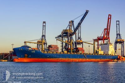
LETO
Container Ship
Current Trip
| Trip Time | 1 day |
|---|---|
| Trip Distance | 164.03 nm |
| AVG Speed | 14.1 Knots |
| MAX Speed | 18.5 Knots |
| Draught | 12 m |
| AVG Wind | 6.7 knots |
| MAX Wind | 11 knots |
| MIN Temp | 26.6°C / 79.88°F |
| MAX Temp | 28.4°C / 83.12°F |
| Position Received | 12 d ago |
Current Position
| Longitude | -13.56515° |
|---|---|
| Latitude | 28.08750° |
| Status | Under way using engine |
| Speed | 18.2 Knots |
| Course | 214.8° |
| Area | North Atlantic Ocean |
| Station | T-AIS |
| Position Received | 12 d ago |
Info
Information
The current position of LETO is in North Atlantic Ocean with coordinates 28.08750° / -13.56515° as reported on 2024-05-22 06:08 by AIS to our vessel tracker app. The vessel's current speed is 18.2 Knots and is currently inside the port of MALABO.
The vessel LETO (IMO: 9311880, MMSI: 636091088) is a Container Ship that was built in 2006 ( 18 years old ). It's sailing under the flag of [LR] Liberia.
In this page you can find informations about the vessels current position, last detected port calls, and current voyage information. If the vessels is not in coverage by AIS you will find the latest position.
The current position of LETO is detected by our AIS receivers and we are not responsible for the reliability of the data. The last position was recorded while the vessel was in Coverage by the Ais receivers of our vessel tracking app.
The current draught of LETO as reported by AIS is 12 meters
Weather
| Temperature | 24.6°C / 76.28°F |
|---|---|
| Wind Speed | 2 knots |
| Direction | 223° SW |
| Pressure | 1013.3 hPa |
| Humidity | 87.8 % |
| Cloud Coverage | 100 % |
Featured Company
Last Port Calls
| Port | Arrival | Departure | Time In Port |
|---|---|---|---|
| 2024-06-03 12:43 | |||
| 2024-05-31 16:37 | 2024-06-01 13:28 | 20 h | |
| 2024-05-29 03:14 | 2024-05-30 01:22 | 22 h | |
| 2024-05-25 14:04 | 2024-05-26 11:56 | 21 h | |
| 2024-05-19 21:04 | 2024-05-20 17:23 | 20 h | |
| 2024-05-17 01:49 | 2024-05-18 02:53 | 1 d | |
| 2024-05-13 13:54 | 2024-05-14 17:51 | 1 d | |
| 2024-04-30 07:36 | 2024-05-03 09:25 | 3 d | |
| 2024-04-28 06:28 | 2024-04-29 18:42 | 1 d | |
| 2024-04-25 19:16 | 2024-04-26 15:20 | 20 h |
Last Trips
| Origin | Departure | Destination | Arrival | Distance | |
|---|---|---|---|---|---|
| 2024-06-01 14:28 | 2024-06-03 13:43 | 164.03 nm | |||
| 2024-05-30 01:22 | 2024-05-31 17:37 | 675.25 nm | |||
| 2024-05-26 11:56 | 2024-05-29 03:14 | 1097.14 nm | |||
| 2024-05-20 19:23 | 2024-05-25 14:04 | 2024.31 nm | |||
| 2024-05-18 03:53 | 2024-05-19 23:04 | 142.53 nm | |||
| 2024-05-14 19:51 | 2024-05-17 02:49 | 442.32 nm | |||
| 2024-05-03 10:25 | 2024-05-13 15:54 | 3931.17 nm | |||
| 2024-04-29 19:42 | 2024-04-30 08:36 | 146.52 nm | |||
| 2024-04-26 16:20 | 2024-04-28 07:28 | 640.84 nm | |||
| 2024-04-23 00:00 | 2024-04-25 20:16 | 310.53 nm |
Events
| Time | Event | Details | Position / Dest | Info |
|---|---|---|---|---|
| 2024-06-03 12:51 | STOP Moving |
3.76186 / 8.77877
[GQ] MALABO
|
Speed: 0.2 kn Course: 154° |
|
| 2024-06-03 12:43 | PORT ARRIVAL |
|
3.76407 / 8.77760
[GQ] MALABO
|
Speed: 3 kn Course: 157° |
| 2024-06-03 12:31 | START Moving | 0.62 nm, North of MALABO |
3.77424 / 8.77516
SLFNA
|
Speed: 3.1 kn Course: 180° |
| 2024-06-03 12:19 | STOP Moving | 0.71 nm, North of MALABO |
3.77602 / 8.77827
SLFNA
|
Speed: 0.3 kn Course: 234° |
| 2024-06-03 05:45 | START Moving | 12.64 nm, South of KRIBI |
2.73223 / 9.85842
SLFNA
|
Speed: 6.5 kn Course: 320° |
| 2024-06-01 18:57 | STOP Moving | 12.9 nm, South of KRIBI |
2.72733 / 9.86031
SLFNA
|
Speed: 0.2 kn Course: 51° |
| 2024-06-01 13:37 | START Moving | 0.53 nm, North West of BATA |
1.83393 / 9.72823
SLFNA
|
Speed: 4.1 kn Course: 341° |
| 2024-06-01 13:28 | PORT DEPARTURE |
|
1.83393 / 9.72823
SLFNA
|
Speed: Course: 180° |
| 2024-05-31 16:49 | STOP Moving |
1.82528 / 9.73297
[GQ] BATA
|
Speed: Course: 178° |
|
| 2024-05-31 16:37 | PORT ARRIVAL |
|
1.82675 / 9.73237
[GQ] BATA
|
Speed: 3.7 kn Course: 147° |