
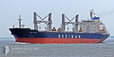
LIBERTY C
Bulk Carrier
Current Trip
BLENHEIM
| Time Travelled | 9 days |
|---|---|
| Remaining Time | --- |
| Distance Travelled | 2320.70 nm |
| Remaining Distance | --- |
| AVG Speed | 10.6 Knots |
| MAX Speed | 15.7 Knots |
| AVG Wind | 7.1 knots |
| MAX Wind | 18.3 knots |
| MIN Temp | 26°C / 78.8°F |
| MAX Temp | 31.5°C / 88.7°F |
| Draught | 6.3 m |
| Position Received | 2 d ago |
Current Position
| Longitude | 104.12420° |
|---|---|
| Latitude | 1.25868° |
| Status | Under way using engine |
| Speed | 12.9 Knots |
| Course | 84.1° |
| Area | Singapore Strait |
| Station | T-AIS |
| Position Received | 2 d ago |
Info
Information
The current position of LIBERTY C is in Singapore Strait with coordinates 1.25868° / 104.12420° as reported on 2024-05-17 09:07 by AIS to our vessel tracker app. The vessel's current speed is 12.9 Knots
The vessel LIBERTY C (IMO: 9597977, MMSI: 636019312) is a Bulk Carrier that was built in 2012 ( 12 years old ). It's sailing under the flag of [LR] Liberia.
In this page you can find informations about the vessels current position, last detected port calls, and current voyage information. If the vessels is not in coverage by AIS you will find the latest position.
The current position of LIBERTY C is detected by our AIS receivers and we are not responsible for the reliability of the data. The last position was recorded while the vessel was in Coverage by the Ais receivers of our vessel tracking app.
The current draught of LIBERTY C as reported by AIS is 6.3 meters
Weather
| Temperature | 27.5°C / 81.5°F |
|---|---|
| Wind Speed | 7 knots |
| Direction | 147° SSE |
| Pressure | 1009 hPa |
| Humidity | 81.1 % |
| Cloud Coverage | 4 % |
Featured Company
Last Port Calls
| Port | Arrival | Departure | Time In Port |
|---|---|---|---|
| 2024-05-01 09:40 | 2024-05-10 05:03 | 8 d | |
| 2024-04-04 05:58 | 2024-04-08 18:15 | 4 d | |
| 2024-03-27 22:08 | 2024-04-02 10:09 | 5 d | |
| 2024-03-09 00:03 | 2024-03-13 14:54 | 4 d |
Last Trips
| Origin | Departure | Destination | Arrival | Distance | |
|---|---|---|---|---|---|
| 2024-04-09 04:15 | 2024-05-01 15:40 | 5273.42 nm | |||
| 2024-04-02 20:09 | 2024-04-04 15:58 | 451.89 nm | |||
| 2024-03-13 23:54 | 2024-03-28 08:08 | 3763.47 nm | |||
| 2024-02-21 20:54 | 2024-03-09 09:03 | 1249.75 nm |
Events
| Time | Event | Details | Position / Dest | Info |
|---|---|---|---|---|
| 2024-05-17 09:12 | Status Changed | Default Under way using engine |
1.26090 / 104.14507
BLENHEIM
|
Speed: 12.9 kn Course: 84.1° |
| 2024-05-17 09:07 | ETA Changed | 2024/06/04 09:00 2024/06/04 15:00 |
1.25868 / 104.12420
BLENHEIM
|
Speed: 12.9 kn Course: 84.1° |
| 2024-05-17 09:07 | OUT of Coverage |
1.25868 / 104.12420
Singapore Strait
BLENHEIM
|
Speed: 12.9 kn Course: 84.1° |
|
| 2024-05-17 08:58 | Status Changed | Under way using engine Default |
1.25557 / 104.09193
BLENHEIM
|
Speed: 13.1 kn Course: 85° |
| 2024-05-17 08:48 | Status Changed | Default Under way using engine |
1.25281 / 104.05876
BLENHEIM
|
Speed: 13.1 kn Course: 86° |
| 2024-05-17 08:26 | Change Sea Area | Indonesian part of the Singapore Strait Singaporean part of the Singapore Strait |
1.24387 / 103.97670
Singapore Strait
BLENHEIM
|
Speed: 12.7 kn Course: 79.4° |
| 2024-05-17 08:16 | Destination Changed | BLENHEIM PEBGB |
1.26224 / 103.94969
BLENHEIM
|
Speed: 7.9 kn Course: 153.3° |
| 2024-05-17 08:16 | ETA Changed | 2024/06/04 15:00 2024/05/15 15:00 |
1.26224 / 103.94969
BLENHEIM
|
Speed: 7.9 kn Course: 153.3° |
| 2024-05-17 07:56 | START Moving | 5.01 nm, North East of SINGAPORE |
1.29171 / 103.93069
PEBGB
|
Speed: 3.6 kn Course: 103° |
| 2024-05-17 07:54 | Status Changed | Under way using engine At anchor |
1.29221 / 103.92901
PEBGB
|
Speed: 0.3 kn Course: 92° |