
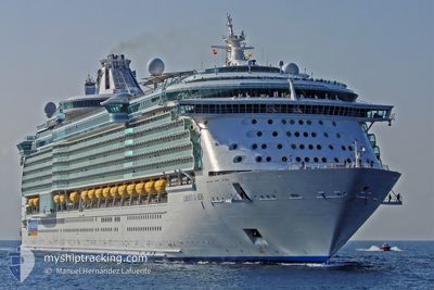
LIBERTY OF THE SEAS
Passengers Ship
Current Trip
BM KWF
| Time Travelled | 9 h, 57 mins |
|---|---|
| Remaining Time | --- |
| Distance Travelled | 165.45 nm |
| Remaining Distance | --- |
| AVG Speed | 16.5 Knots |
| MAX Speed | 18.2 Knots |
| AVG Wind | 4.3 knots |
| MAX Wind | 7.8 knots |
| MIN Temp | 20.8°C / 69.44°F |
| MAX Temp | 24.3°C / 75.74°F |
| Draught | 9 m |
| Position Received | 5 h, 29 m ago |
Current Position
| Longitude | -72.92447° |
|---|---|
| Latitude | 39.67050° |
| Status | Under way using engine |
| Speed | 18.1 Knots |
| Course | 137.7° |
| Area | North Atlantic Ocean |
| Station | T-AIS |
| Position Received | 5 h, 29 m ago |
Info
Information
The current position of LIBERTY OF THE SEAS is in North Atlantic Ocean with coordinates 39.67050° / -72.92447° as reported on 2024-06-16 00:45 by AIS to our vessel tracker app. The vessel's current speed is 18.1 Knots
The vessel LIBERTY OF THE SEAS (IMO: 9330032, MMSI: 309436000) is a Passengers Ship that was built in 2007 ( 17 years old ). It's sailing under the flag of [BS] Bahamas.
In this page you can find informations about the vessels current position, last detected port calls, and current voyage information. If the vessels is not in coverage by AIS you will find the latest position.
The current position of LIBERTY OF THE SEAS is detected by our AIS receivers and we are not responsible for the reliability of the data. The last position was recorded while the vessel was in Coverage by the Ais receivers of our vessel tracking app.
The current draught of LIBERTY OF THE SEAS as reported by AIS is 9 meters
Weather
| Temperature | 22°C / 71.6°F |
|---|---|
| Wind Speed | 7 knots |
| Direction | 23° NNE |
| Pressure | 1019.1 hPa |
| Humidity | 54.9 % |
| Cloud Coverage | --- |
Featured Company
Last Port Calls
| Port | Arrival | Departure | Time In Port |
|---|---|---|---|
| 2024-06-15 09:59 | 2024-06-15 20:18 | 10 h | |
| 2024-06-13 09:58 | 2024-06-13 21:27 | 11 h | |
| 2024-06-11 10:04 | 2024-06-11 20:27 | 10 h | |
| 2024-06-06 09:58 | 2024-06-06 20:34 | 10 h | |
| 2024-06-01 10:02 | 2024-06-01 20:35 | 10 h | |
| 2024-05-29 10:34 | 2024-05-29 19:10 | 8 h | |
| 2024-05-28 10:06 | 2024-05-28 18:46 | 8 h | |
| 2024-05-27 15:23 | 2024-05-27 22:47 | 7 h | |
| 2024-05-23 09:59 | 2024-05-23 20:29 | 10 h | |
| 2024-05-18 10:14 | 2024-05-18 20:28 | 10 h |
Most Visited Ports (Last year)
| Port | Arrivals | |
|---|---|---|
| 53 | ||
| 45 | ||
| 30 | ||
| 9 | ||
| 5 | ||
| 5 |
Last Trips
| Origin | Departure | Destination | Arrival | Distance | |
|---|---|---|---|---|---|
| 2024-06-13 18:27 | 2024-06-15 05:59 | 595.51 nm | |||
| 2024-06-11 16:27 | 2024-06-13 06:58 | 600.92 nm | |||
| 2024-06-06 16:34 | 2024-06-11 06:04 | 1398.85 nm | |||
| 2024-06-01 16:35 | 2024-06-06 05:58 | 1399.49 nm | |||
| 2024-05-29 15:10 | 2024-06-01 06:02 | 1259.75 nm | |||
| 2024-05-28 14:46 | 2024-05-29 06:34 | 275.83 nm | |||
| 2024-05-27 18:47 | 2024-05-28 06:06 | 185.31 nm | |||
| 2024-05-23 16:29 | 2024-05-27 11:23 | 1590.86 nm | |||
| 2024-05-18 16:28 | 2024-05-23 05:59 | 1401.44 nm | |||
| 2024-05-15 15:10 | 2024-05-18 06:14 | 1297.26 nm |
Events
| Time | Event | Details | Position / Dest | Info |
|---|---|---|---|---|
| 2024-06-16 00:51 | Status Changed | Default Under way using engine |
39.64753 / -72.89722
BM KWF
|
Speed: 18.1 kn Course: 137.7° |
| 2024-06-16 00:45 | OUT of Coverage |
39.67050 / -72.92447
North Atlantic Ocean
BM KWF
|
Speed: 18.1 kn Course: 137.7° |
|
| 2024-06-16 00:22 | Status Changed | Under way using engine Default |
39.75158 / -73.02507
BM KWF
|
Speed: 18 kn Course: 135° |
| 2024-06-16 00:16 | Status Changed | Default Under way using engine |
39.77334 / -73.05334
BM KWF
|
Speed: 17.8 kn Course: 135.5° |
| 2024-06-16 00:14 | Status Changed | Under way using engine Default |
39.77992 / -73.06142
BM KWF
|
Speed: 18 kn Course: 135° |
| 2024-06-16 00:07 | Status Changed | Default Under way using engine |
39.80500 / -73.09333
BM KWF
|
Speed: 17.7 kn Course: 135.1° |
| 2024-06-15 23:57 | Status Changed | Under way using engine Default |
39.84160 / -73.14172
BM KWF
|
Speed: 18 kn Course: 135° |
| 2024-06-15 23:55 | Status Changed | Default Under way using engine |
39.84667 / -73.14833
BM KWF
|
Speed: 17.7 kn Course: 135.1° |
| 2024-06-15 20:18 | PORT DEPARTURE |
|
40.57715 / -74.03498
BM KWF
|
Speed: 16.7 kn Course: 168° |
| 2024-06-15 20:18 | Draught Changed | 9 9.1 |
40.58002 / -74.03592
[US] NEW YORK
|
Speed: 16.8 kn Course: 167° |