
LIBERTY
Vehicles Carrier
Current Trip
| Time Travelled | 13 h, 0 mins |
|---|---|
| Remaining Time | --- |
| Distance Travelled | 180.98 nm |
| Remaining Distance | --- |
| AVG Speed | 14.1 Knots |
| MAX Speed | 17 Knots |
| AVG Wind | 5.6 knots |
| MAX Wind | 10 knots |
| MIN Temp | 21.4°C / 70.52°F |
| MAX Temp | 23.8°C / 74.84°F |
| Draught | 9.9 m |
| Position Received | Now |
Current Position
| Longitude | -43.35308° |
|---|---|
| Latitude | -23.77630° |
| Status | Under way using engine |
| Speed | 14 Knots |
| Course | 75.7° |
| Area | South Atlantic Ocean |
| Station | T-AIS |
| Position Received | Now |
Info
Information
The current position of LIBERTY is in South Atlantic Ocean with coordinates -23.77630° / -43.35308° as reported on 2024-06-21 00:33 by AIS to our vessel tracker app. The vessel's current speed is 14 Knots and is heading at the port of CARTAGENA. The estimated time of arrival as calculated by vessel tracking app is 2024-07-03 11:00 LT
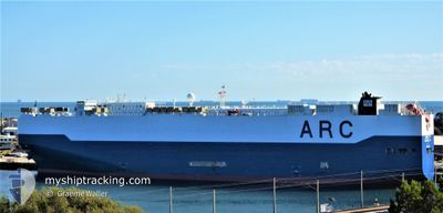
The vessel LIBERTY (IMO: 9310109, MMSI: 367125000) is a Vehicles Carrier that was built in 2006 ( 18 years old ). It's sailing under the flag of [US] USA.
In this page you can find informations about the vessels current position, last detected port calls, and current voyage information. If the vessels is not in coverage by AIS you will find the latest position.
The current position of LIBERTY is detected by our AIS receivers and we are not responsible for the reliability of the data. The last position was recorded while the vessel was in Coverage by the Ais receivers of our vessel tracking app.
The current draught of LIBERTY as reported by AIS is 9.9 meters
Weather
| Temperature | 23.5°C / 74.3°F |
|---|---|
| Wind Speed | 9 knots |
| Direction | 120° ESE |
| Pressure | 1019.3 hPa |
| Humidity | 76.5 % |
| Cloud Coverage | --- |
Featured Company
Last Port Calls
| Port | Arrival | Departure | Time In Port |
|---|---|---|---|
| 2024-06-19 14:06 | 2024-06-20 11:34 | 21 h | |
| 2024-06-17 13:55 | 2024-06-17 21:02 | 7 h | |
| 2024-06-16 03:00 | 2024-06-16 08:18 | 5 h | |
| 2024-06-16 02:26 | 2024-06-16 02:32 | 6 m | |
| 2024-05-31 12:59 | 2024-06-01 01:59 | 12 h | |
| 2024-05-26 08:24 | 2024-05-27 05:02 | 20 h | |
| 2024-05-24 01:58 | 2024-05-25 00:10 | 22 h | |
| 2024-05-21 21:11 | 2024-05-22 23:02 | 1 d | |
| 2024-05-18 19:59 | 2024-05-20 05:32 | 1 d | |
| 2024-05-13 02:04 | 2024-05-13 17:46 | 15 h |
Most Visited Ports (Last year)
| Port | Arrivals | |
|---|---|---|
| 13 | ||
| 12 | ||
| 4 | ||
| 3 | ||
| 3 | ||
| 3 |
Last Trips
| Origin | Departure | Destination | Arrival | Distance | |
|---|---|---|---|---|---|
| 2024-06-17 18:02 | 2024-06-19 11:06 | 222.67 nm | |||
| 2024-06-16 05:18 | 2024-06-17 10:55 | 370.84 nm | |||
| 2024-06-15 23:32 | 2024-06-16 00:00 | 0.93 nm | |||
| 2024-05-31 20:59 | 2024-06-15 23:26 | 4625.56 nm | |||
| 2024-05-27 00:02 | 2024-05-31 07:59 | 1588.14 nm | |||
| 2024-05-24 19:10 | 2024-05-26 03:24 | 477.52 nm | |||
| 2024-05-22 18:02 | 2024-05-23 20:58 | 239.19 nm | |||
| 2024-05-20 00:32 | 2024-05-21 16:11 | 640.07 nm | |||
| 2024-05-13 12:46 | 2024-05-18 14:59 | 1551.70 nm | |||
| 2024-05-01 22:53 | 2024-05-12 21:04 | 3331.94 nm |
Events
| Time | Event | Details | Position / Dest | Info |
|---|---|---|---|---|
| 2024-06-21 00:18 | Status Changed | Under way using engine Default |
-23.79027 / -43.41224
BRSSZ>COCTG
|
Speed: 14.1 kn Course: 75° |
| 2024-06-21 00:14 | Status Changed | Default Under way using engine |
-23.79495 / -43.43205
BRSSZ>COCTG
|
Speed: 14.1 kn Course: 76° |
| 2024-06-21 00:08 | Status Changed | Under way using engine Default |
-23.80098 / -43.45735
BRSSZ>COCTG
|
Speed: 14 kn Course: 75° |
| 2024-06-21 00:02 | Status Changed | Default Under way using engine |
-23.80658 / -43.48082
BRSSZ>COCTG
|
Speed: 14.1 kn Course: 74.7° |
| 2024-06-20 23:44 | Status Changed | Under way using engine Default |
-23.82253 / -43.55354
BRSSZ>COCTG
|
Speed: 14.2 kn Course: 76° |
| 2024-06-20 23:38 | Status Changed | Default Under way using engine |
-23.82817 / -43.57934
BRSSZ>COCTG
|
Speed: 14.1 kn Course: 76.6° |
| 2024-06-20 23:28 | Status Changed | Under way using engine Default |
-23.83732 / -43.62185
BRSSZ>COCTG
|
Speed: 14.2 kn Course: 77° |
| 2024-06-20 23:26 | Status Changed | Default Under way using engine |
-23.83912 / -43.63023
BRSSZ>COCTG
|
Speed: 14.2 kn Course: 76.8° |
| 2024-06-20 22:51 | Status Changed | Under way using engine Default |
-23.86912 / -43.77694
BRSSZ>COCTG
|
Speed: 13.9 kn Course: 78° |
| 2024-06-20 22:34 | IN Coverage |
-23.86807 / -43.77140
South Atlantic Ocean
BRSSZ>COCTG
|
Speed: 14 kn Course: 78.3° |