
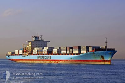
LICA MAERSK
Container Ship
Current Trip
| Time Travelled | 1 day |
|---|---|
| Remaining Time | 1 day |
| Distance Travelled | 775.06 nm |
| Remaining Distance | 737.44 nm |
| AVG Speed | 19.5 Knots |
| MAX Speed | 22.7 Knots |
| AVG Wind | 7.6 knots |
| MAX Wind | 18.5 knots |
| MIN Temp | 21.3°C / 70.34°F |
| MAX Temp | 25.3°C / 77.54°F |
| Draught | 12 m |
| Position Received | Now |
Current Position
| Longitude | 10.34895° |
|---|---|
| Latitude | 37.54125° |
| Status | Under way using engine |
| Speed | 20.3 Knots |
| Course | 103.9° |
| Area | Mediterranean Sea - Western Basin |
| Station | T-AIS |
| Position Received | Now |
Info
Information
The current position of LICA MAERSK is in Mediterranean Sea - Western Basin with coordinates 37.54125° / 10.34895° as reported on 2024-06-29 03:58 by AIS to our vessel tracker app. The vessel's current speed is 20.3 Knots and is heading at the port of PIRAEUS. The estimated time of arrival as calculated by vessel tracking app is 2024-06-30 16:04 LT
The vessel LICA MAERSK (IMO: 9190779, MMSI: 477714300) is a Container Ship that was built in 2001 ( 23 years old ). It's sailing under the flag of [HK] Hong Kong.
In this page you can find informations about the vessels current position, last detected port calls, and current voyage information. If the vessels is not in coverage by AIS you will find the latest position.
The current position of LICA MAERSK is detected by our AIS receivers and we are not responsible for the reliability of the data. The last position was recorded while the vessel was in Coverage by the Ais receivers of our vessel tracking app.
The current draught of LICA MAERSK as reported by AIS is 12 meters
Weather
| Temperature | 23.8°C / 74.84°F |
|---|---|
| Wind Speed | 13 knots |
| Direction | 96° E |
| Pressure | 1014.1 hPa |
| Humidity | 80.8 % |
| Cloud Coverage | 39 % |
Featured Company
Last Port Calls
| Port | Arrival | Departure | Time In Port |
|---|---|---|---|
| 2024-06-27 00:17 | 2024-06-27 13:17 | 12 h | |
| 2024-06-25 04:27 | 2024-06-25 20:13 | 15 h | |
| 2024-06-14 00:33 | 2024-06-15 12:54 | 1 d | |
| 2024-06-08 03:45 | 2024-06-08 21:52 | 18 h | |
| 2024-06-04 17:36 | 2024-06-06 01:11 | 1 d | |
| 2024-06-02 21:18 | 2024-06-03 16:20 | 19 h | |
| 2024-05-30 22:44 | 2024-05-31 23:35 | 1 d | |
| 2024-05-24 07:55 | 2024-05-25 08:26 | 1 d | |
| 2024-05-13 10:33 | 2024-05-14 00:32 | 13 h | |
| 2024-05-06 13:46 | 2024-05-07 18:37 | 1 d |
Most Visited Ports (Last year)
| Port | Arrivals | |
|---|---|---|
| 16 | ||
| 10 | ||
| 10 | ||
| 9 | ||
| 6 | ||
| 6 |
Last Trips
| Origin | Departure | Destination | Arrival | Distance | |
|---|---|---|---|---|---|
| 2024-06-25 21:13 | 2024-06-27 02:17 | 29.98 nm | |||
| 2024-06-15 07:54 | 2024-06-25 05:27 | 4341.34 nm | |||
| 2024-06-08 16:52 | 2024-06-13 19:33 | 919.12 nm | |||
| 2024-06-05 20:11 | 2024-06-07 22:45 | 768.52 nm | |||
| 2024-06-03 11:20 | 2024-06-04 12:36 | 362.22 nm | |||
| 2024-05-31 18:35 | 2024-06-02 16:18 | 432.75 nm | |||
| 2024-05-25 04:26 | 2024-05-30 17:44 | 2038.39 nm | |||
| 2024-05-14 02:32 | 2024-05-24 03:55 | 3272.88 nm | |||
| 2024-05-07 21:37 | 2024-05-13 12:33 | 1946.16 nm | |||
| 2024-05-06 08:36 | 2024-05-06 16:46 | 62.55 nm |
Events
| Time | Event | Details | Position / Dest | Info |
|---|---|---|---|---|
| 2024-06-28 23:26 | Change Sea Area | Tunisian part of the Mediterranean Sea - Western Basin Algerian part of the Mediterranean Sea - Western Basin |
37.29294 / 8.50061
Mediterranean Sea - Western Basin
ESALG > GRPIR
|
Speed: 20.2 kn Course: 96.2° |
| 2024-06-28 20:22 | Status Changed | Under way using engine Default |
37.40637 / 7.21110
ESALG > GRPIR
|
Speed: 20 kn Course: 98° |
| 2024-06-28 20:11 | Status Changed | Default Under way using engine |
37.41466 / 7.13499
ESALG > GRPIR
|
Speed: 19.9 kn Course: 97.8° |
| 2024-06-28 20:04 | Status Changed | Under way using engine Default |
37.41969 / 7.09029
ESALG > GRPIR
|
Speed: 19.9 kn Course: 98° |
| 2024-06-28 19:28 | Status Changed | Default Under way using engine |
37.43512 / 6.83887
ESALG > GRPIR
|
Speed: 19.7 kn Course: 88.3° |
| 2024-06-28 18:41 | Status Changed | Under way using engine Default |
37.42671 / 6.51581
ESALG > GRPIR
|
Speed: 19.6 kn Course: 89° |
| 2024-06-28 18:29 | IN Coverage |
37.42671 / 6.51581
Mediterranean Sea - Western Basin
ESALG > GRPIR
|
Speed: 19.7 kn Course: 89.1° |
|
| 2024-06-28 03:07 | Status Changed | Default Under way using engine |
36.67385 / .15210
ESALG > GRPIR
|
Speed: 20.9 kn Course: 75.4° |
| 2024-06-28 02:55 | OUT of Coverage |
36.65729 / .06863
Mediterranean Sea - Western Basin
ESALG > GRPIR
|
Speed: 20.9 kn Course: 75.4° |
|
| 2024-06-27 23:29 | Change Sea Area | Algerian part of the Mediterranean Sea - Western Basin Spanish part of the Mediterranean Sea - Western Basin |
36.39331 / -1.35886
Mediterranean Sea - Western Basin
ESALG > GRPIR
|
Speed: 20.2 kn Course: 80.3° |