
LILA SYDNEY
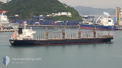
Bulk Carrier
Current Trip
| Trip Time | 13 days |
|---|---|
| Trip Distance | 1994.49 nm |
| AVG Speed | 10.2 Knots |
| MAX Speed | 14.1 Knots |
| Draught | 9.9 m |
| AVG Wind | 10.3 knots |
| MAX Wind | 20.9 knots |
| MIN Temp | 19.9°C / 67.82°F |
| MAX Temp | 33.1°C / 91.58°F |
| Position Received | 6 d ago |
Current Position
| Longitude | -89.34137° |
|---|---|
| Latitude | 28.01855° |
| Status | Under way using engine |
| Speed | 11.9 Knots |
| Course | 171° |
| Area | Gulf of Mexico |
| Station | T-AIS |
| Position Received | 6 d ago |
Info
Information
The current position of LILA SYDNEY is in Gulf of Mexico with coordinates 28.01855° / -89.34137° as reported on 2024-05-12 07:59 by AIS to our vessel tracker app. The vessel's current speed is 11.9 Knots and is currently inside the port of PORT AU PRINCE.
The vessel LILA SYDNEY (IMO: 9660035, MMSI: 636022465) is a Bulk Carrier that was built in 2013 ( 11 years old ). It's sailing under the flag of [LR] Liberia.
In this page you can find informations about the vessels current position, last detected port calls, and current voyage information. If the vessels is not in coverage by AIS you will find the latest position.
The current position of LILA SYDNEY is detected by our AIS receivers and we are not responsible for the reliability of the data. The last position was recorded while the vessel was in Coverage by the Ais receivers of our vessel tracking app.
The current draught of LILA SYDNEY as reported by AIS is 9.9 meters
Weather
| Temperature | 25.7°C / 78.26°F |
|---|---|
| Wind Speed | 3 knots |
| Direction | 235° SW |
| Pressure | 1015.8 hPa |
| Humidity | 85.2 % |
| Cloud Coverage | --- |
Featured Company
Last Port Calls
| Port | Arrival | Departure | Time In Port |
|---|---|---|---|
| 2024-05-17 16:13 | |||
| 2024-04-28 15:02 | 2024-05-04 08:22 | 5 d | |
| 2024-03-28 07:53 | 2024-03-31 01:08 | 2 d | |
| 2024-03-19 05:47 | 2024-03-28 03:58 | 8 d |
Most Visited Ports (Last year)
| Port | Arrivals | |
|---|---|---|
| 2 | ||
| 2 | ||
| 2 | ||
| 1 | ||
| 1 | ||
| 1 |
Last Trips
| Origin | Departure | Destination | Arrival | Distance | |
|---|---|---|---|---|---|
| 2024-05-04 03:22 | 2024-05-17 12:13 | 1994.49 nm | |||
| 2024-03-30 22:08 | 2024-04-28 10:02 | 6620.03 nm | |||
| 2024-03-28 00:58 | 2024-03-28 04:53 | 25.24 nm | |||
| 2023-12-23 06:47 | 2024-03-19 02:47 | 2569.55 nm |
Events
| Time | Event | Details | Position / Dest | Info |
|---|---|---|---|---|
| 2024-05-17 16:36 | STOP Moving |
18.54644 / -72.38769
[HT] PORT AU PRINCE
|
Speed: 0.3 kn Course: 159° |
|
| 2024-05-17 16:13 | PORT ARRIVAL |
|
18.55591 / -72.39016
[HT] PORT AU PRINCE
|
Speed: 4.9 kn Course: 145° |
| 2024-05-17 16:06 | START Moving | 1.83 nm, West of PORT AU PRINCE |
18.56376 / -72.39518
PORT AU PRINCE
|
Speed: 4.9 kn Course: 145° |
| 2024-05-12 08:04 | Status Changed | Default Under way using engine |
28.00221 / -89.33852
PORT AU PRINCE
|
Speed: 11.9 kn Course: 171° |
| 2024-05-12 07:59 | Status Changed | Under way using engine Default |
28.01855 / -89.34137
PORT AU PRINCE
|
Speed: 11.8 kn Course: 171° |
| 2024-05-12 07:59 | OUT of Coverage |
28.01855 / -89.34137
Gulf of Mexico
PORT AU PRINCE
|
Speed: 11.9 kn Course: 171° |
|
| 2024-05-12 07:49 | Status Changed | Default Under way using engine |
28.05150 / -89.34730
PORT AU PRINCE
|
Speed: 12 kn Course: 187.6° |
| 2024-05-12 07:24 | Status Changed | Under way using engine Default |
28.13120 / -89.35219
PORT AU PRINCE
|
Speed: 12 kn Course: 187° |
| 2024-05-12 07:14 | Status Changed | Default Under way using engine |
28.16432 / -89.34751
PORT AU PRINCE
|
Speed: 11.9 kn Course: 186.7° |
| 2024-05-12 06:57 | Status Changed | Under way using engine Default |
28.21928 / -89.33982
PORT AU PRINCE
|
Speed: 11.7 kn Course: 188° |