
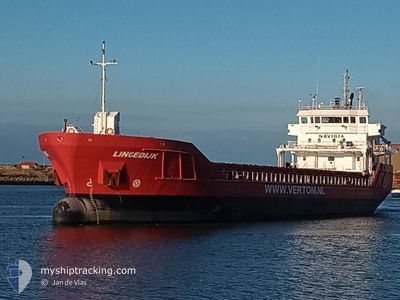
LINGEDIJK
General Cargo
Current Trip
| Time Travelled | 1 day |
|---|---|
| Remaining Time | --- |
| Distance Travelled | 411.01 nm |
| Remaining Distance | --- |
| AVG Speed | 9.7 Knots |
| MAX Speed | 12 Knots |
| AVG Wind | 14.5 knots |
| MAX Wind | 22 knots |
| MIN Temp | 20.6°C / 69.08°F |
| MAX Temp | 23.1°C / 73.58°F |
| Draught | 6.4 m |
| Position Received | 10 h, 16 m ago |
Current Position
| Longitude | 1.28914° |
|---|---|
| Latitude | 36.92448° |
| Status | Under way using engine |
| Speed | 9.7 Knots |
| Course | 70.7° |
| Area | Mediterranean Sea - Western Basin |
| Station | T-AIS |
| Position Received | 10 h, 16 m ago |
Info
Information
The current position of LINGEDIJK is in Mediterranean Sea - Western Basin with coordinates 36.92448° / 1.28914° as reported on 2024-06-25 19:55 by AIS to our vessel tracker app. The vessel's current speed is 9.7 Knots and is heading at the port of ABU QIR. The estimated time of arrival as calculated by vessel tracking app is 2024-07-02 06:00 LT
The vessel LINGEDIJK (IMO: 9515010, MMSI: 245947000) is a General Cargo that was built in 2010 ( 14 years old ). It's sailing under the flag of [NL] Netherlands.
In this page you can find informations about the vessels current position, last detected port calls, and current voyage information. If the vessels is not in coverage by AIS you will find the latest position.
The current position of LINGEDIJK is detected by our AIS receivers and we are not responsible for the reliability of the data. The last position was recorded while the vessel was in Coverage by the Ais receivers of our vessel tracking app.
The current draught of LINGEDIJK as reported by AIS is 6.4 meters
Weather
| Temperature | 22.7°C / 72.86°F |
|---|---|
| Wind Speed | 22 knots |
| Direction | 86° E |
| Pressure | 1009.1 hPa |
| Humidity | 81.2 % |
| Cloud Coverage | 2 % |
Featured Company
Last Port Calls
| Port | Arrival | Departure | Time In Port |
|---|---|---|---|
| 2024-06-24 05:56 | 2024-06-24 11:17 | 5 h | |
| 2024-06-05 02:22 | 2024-06-14 00:09 | 8 d | |
| 2024-05-31 14:36 | 2024-05-31 15:10 | 33 m | |
| 2024-05-24 13:21 | 2024-05-31 14:17 | 7 d | |
| 2024-05-24 12:15 | 2024-05-24 12:50 | 34 m | |
| 2024-05-17 17:27 | 2024-05-17 21:08 | 3 h | |
| 2024-05-12 12:22 | 2024-05-16 10:10 | 3 d | |
| 2024-05-08 17:35 | 2024-05-10 18:26 | 2 d | |
| 2024-04-28 07:51 | 2024-04-29 10:18 | 1 d | |
| 2024-04-15 10:25 | 2024-04-22 13:33 | 7 d |
Last Trips
| Origin | Departure | Destination | Arrival | Distance | |
|---|---|---|---|---|---|
| 2024-06-14 02:09 | 2024-06-24 07:56 | 2384.18 nm | |||
| 2024-05-31 16:10 | 2024-06-05 04:22 | 1172.70 nm | |||
| 2024-05-31 15:17 | 2024-05-31 15:36 | 2.04 nm | |||
| 2024-05-24 13:50 | 2024-05-24 14:21 | 1.92 nm | |||
| 2024-05-17 23:08 | 2024-05-24 13:15 | 1362.40 nm | |||
| 2024-05-16 11:10 | 2024-05-17 19:27 | 254.72 nm | |||
| 2024-05-10 20:26 | 2024-05-12 13:22 | 416.39 nm | |||
| 2024-04-29 12:18 | 2024-05-08 19:35 | 2075.29 nm | |||
| 2024-04-22 15:33 | 2024-04-28 09:51 | 109.79 nm | |||
| 2024-04-03 22:27 | 2024-04-15 12:25 | 1831.12 nm |
Events
| Time | Event | Details | Position / Dest | Info |
|---|---|---|---|---|
| 2024-06-25 20:01 | Status Changed | Default Under way using engine |
36.92992 / 1.31092
EG AKI
|
Speed: 9.7 kn Course: 70.7° |
| 2024-06-25 19:55 | OUT of Coverage |
36.92448 / 1.28914
Mediterranean Sea - Western Basin
EG AKI
|
Speed: 9.7 kn Course: 70.7° |
|
| 2024-06-25 19:48 | Status Changed | Under way using engine Default |
36.91903 / 1.26791
EG AKI
|
Speed: 9.7 kn Course: 74° |
| 2024-06-25 19:45 | Status Changed | Default Under way using engine |
36.91700 / 1.26000
EG AKI
|
Speed: 9.9 kn Course: 70.8° |
| 2024-06-25 18:34 | Status Changed | Under way using engine Default |
36.86927 / 1.02584
EG AKI
|
Speed: 9.6 kn Course: 78° |
| 2024-06-25 18:25 | IN Coverage |
36.86927 / 1.02584
Mediterranean Sea - Western Basin
EG AKI
|
Speed: 9.7 kn Course: 75.9° |
|
| 2024-06-25 17:34 | Status Changed | Default Under way using engine |
36.83281 / .83302
EG AKI
|
Speed: 9.5 kn Course: 75.6° |
| 2024-06-25 17:27 | OUT of Coverage |
36.82886 / .81065
Mediterranean Sea - Western Basin
EG AKI
|
Speed: 9.5 kn Course: 75.6° |
|
| 2024-06-25 16:48 | Status Changed | Under way using engine Default |
36.80760 / .68903
EG AKI
|
Speed: 9.3 kn Course: 79° |
| 2024-06-25 16:37 | Status Changed | Default Under way using engine |
36.80102 / .65226
EG AKI
|
Speed: 9.3 kn Course: 79.1° |