
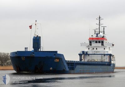
LISA
General Cargo
Current Trip
BEPUU
| Time Travelled | 1 day |
|---|---|
| Remaining Time | --- |
| Distance Travelled | 428.42 nm |
| Remaining Distance | --- |
| AVG Speed | 9.3 Knots |
| MAX Speed | 10.2 Knots |
| AVG Wind | 13.5 knots |
| MAX Wind | 18 knots |
| MIN Temp | 13.3°C / 55.94°F |
| MAX Temp | 19°C / 66.2°F |
| Draught | 5.6 m |
| Position Received | 1 h, 19 m ago |
Current Position
| Longitude | -3.99370° |
|---|---|
| Latitude | 49.37337° |
| Status | Under way using engine |
| Speed | 8.9 Knots |
| Course | 61.3° |
| Area | English Channel |
| Station | T-AIS |
| Position Received | 1 h, 19 m ago |
Info
Information
The current position of LISA is in English Channel with coordinates 49.37337° / -3.99370° as reported on 2024-05-31 17:58 by AIS to our vessel tracker app. The vessel's current speed is 8.9 Knots
The vessel LISA (IMO: 9235505, MMSI: 209989000) is a General Cargo that was built in 2001 ( 23 years old ). It's sailing under the flag of [CY] Cyprus.
In this page you can find informations about the vessels current position, last detected port calls, and current voyage information. If the vessels is not in coverage by AIS you will find the latest position.
The current position of LISA is detected by our AIS receivers and we are not responsible for the reliability of the data. The last position was recorded while the vessel was in Coverage by the Ais receivers of our vessel tracking app.
The current draught of LISA as reported by AIS is 5.6 meters
Weather
| Temperature | 15.3°C / 59.54°F |
|---|---|
| Wind Speed | 10 knots |
| Direction | 14° NNE |
| Pressure | 1022.6 hPa |
| Humidity | 76.2 % |
| Cloud Coverage | 7 % |
Featured Company
Last Port Calls
| Port | Arrival | Departure | Time In Port |
|---|---|---|---|
| 2024-05-28 20:22 | 2024-05-29 19:57 | 23 h | |
| 2024-05-27 04:04 | 2024-05-28 17:12 | 1 d | |
| 2024-05-21 19:42 | 2024-05-23 21:36 | 2 d | |
| 2024-05-13 16:47 | 2024-05-15 09:38 | 1 d | |
| 2024-05-11 17:16 | 2024-05-12 11:21 | 18 h | |
| 2024-05-07 12:19 | 2024-05-08 06:43 | 18 h | |
| 2024-05-02 16:08 | 2024-05-04 20:59 | 2 d | |
| 2024-04-24 21:16 | 2024-04-26 12:28 | 1 d | |
| 2024-04-24 16:11 | 2024-04-24 18:58 | 2 h | |
| 2024-04-19 17:15 | 2024-04-24 15:38 | 4 d |
Last Trips
| Origin | Departure | Destination | Arrival | Distance | |
|---|---|---|---|---|---|
| 2024-05-28 19:12 | 2024-05-28 22:22 | 15.16 nm | |||
| 2024-05-23 22:36 | 2024-05-27 06:04 | 708.22 nm | |||
| 2024-05-15 11:38 | 2024-05-21 20:42 | 1047.62 nm | |||
| 2024-05-12 13:21 | 2024-05-13 18:47 | 299.06 nm | |||
| 2024-05-08 08:43 | 2024-05-11 19:16 | 764.33 nm | |||
| 2024-05-04 22:59 | 2024-05-07 14:19 | 488.16 nm | |||
| 2024-04-26 14:28 | 2024-05-02 18:08 | 1090.41 nm | |||
| 2024-04-24 20:58 | 2024-04-24 23:16 | 19.13 nm | |||
| 2024-04-24 17:38 | 2024-04-24 18:11 | 2.22 nm | |||
| 2024-04-19 18:36 | 2024-04-19 19:15 | 2.32 nm |
Events
| Time | Event | Details | Position / Dest | Info |
|---|---|---|---|---|
| 2024-05-31 18:02 | Status Changed | Default Under way using engine |
49.37824 / -3.98108
BEPUU
|
Speed: 8.9 kn Course: 61.3° |
| 2024-05-31 17:58 | OUT of Coverage |
49.37337 / -3.99370
English Channel
BEPUU
|
Speed: 8.9 kn Course: 61.3° |
|
| 2024-05-31 14:30 | Status Changed | Under way using engine Default |
49.11444 / -4.66441
BEPUU
|
Speed: 9.1 kn Course: 61° |
| 2024-05-31 14:22 | Status Changed | Default Under way using engine |
49.10394 / -4.69097
BEPUU
|
Speed: 9 kn Course: 59.2° |
| 2024-05-31 13:26 | Change Sea Area | French part of the English Channel French part of the Celtic Sea |
49.03208 / -4.87588
English Channel
BEPUU
|
Speed: 9.1 kn Course: 62.4° |
| 2024-05-31 11:33 | Detected in Sea | French part of the Celtic Sea |
48.88835 / -5.26810
Celtic Sea
BEPUU
|
Speed: 9.4 kn Course: 59.3° |
| 2024-05-31 11:33 | Status Changed | Under way using engine Default |
48.88835 / -5.26810
BEPUU
|
Speed: 9.6 kn Course: 61° |
| 2024-05-31 11:33 | IN Coverage |
48.88835 / -5.26810
Celtic Sea
BEPUU
|
Speed: 9.4 kn Course: 59.3° |
|
| 2024-05-29 22:12 | Status Changed | Default Under way using engine |
43.72865 / -8.28830
BEPUU
|
Speed: 10.1 kn Course: 18.6° |
| 2024-05-29 22:05 | OUT of Coverage |
43.71053 / -8.29763
North Atlantic Ocean
BEPUU
|
Speed: 10.1 kn Course: 18.6° |