
LISTER
General Cargo
Current Trip
| Time Travelled | 10 h, 51 mins |
|---|---|
| Remaining Time | 2 days |
| Distance Travelled | 101.94 nm |
| Remaining Distance | 577.94 nm |
| AVG Speed | 9.6 Knots |
| MAX Speed | 10.4 Knots |
| AVG Wind | 7.1 knots |
| MAX Wind | 13.2 knots |
| MIN Temp | 11.1°C / 51.98°F |
| MAX Temp | 12.5°C / 54.5°F |
| Draught | 4.4 m |
| Position Received | 7 h, 6 m ago |
Current Position
| Longitude | 20.27330° |
|---|---|
| Latitude | 63.11365° |
| Status | Under way using engine |
| Speed | 9.9 Knots |
| Course | 192.9° |
| Area | Gulf of Bothnia |
| Station | T-AIS |
| Position Received | 7 h, 6 m ago |
Info
Information
The current position of LISTER is in Gulf of Bothnia with coordinates 63.11365° / 20.27330° as reported on 2024-06-18 06:17 by AIS to our vessel tracker app. The vessel's current speed is 9.9 Knots and is heading at the port of HELSINGBORG. The estimated time of arrival as calculated by vessel tracking app is 2024-06-21 00:58 LT
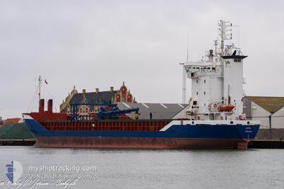
The vessel LISTER (IMO: 9155963, MMSI: 231023000) is a General Cargo that was built in 1997 ( 27 years old ). It's sailing under the flag of [FO] Faroe Is.
In this page you can find informations about the vessels current position, last detected port calls, and current voyage information. If the vessels is not in coverage by AIS you will find the latest position.
The current position of LISTER is detected by our AIS receivers and we are not responsible for the reliability of the data. The last position was recorded while the vessel was in Coverage by the Ais receivers of our vessel tracking app.
The current draught of LISTER as reported by AIS is 4.4 meters
Weather
| Temperature | 12.5°C / 54.5°F |
|---|---|
| Wind Speed | 9 knots |
| Direction | 216° SW |
| Pressure | 1007.7 hPa |
| Humidity | 92.5 % |
| Cloud Coverage | --- |
Featured Company
Last Port Calls
| Port | Arrival | Departure | Time In Port |
|---|---|---|---|
| 2024-06-15 18:03 | 2024-06-18 02:32 | 2 d | |
| 2024-06-14 06:52 | 2024-06-14 07:32 | 39 m | |
| 2024-06-12 06:41 | 2024-06-14 01:25 | 1 d | |
| 2024-06-12 01:53 | 2024-06-12 02:13 | 19 m | |
| 2024-06-05 21:45 | 2024-06-07 17:20 | 1 d | |
| 2024-06-03 04:18 | 2024-06-04 08:36 | 1 d | |
| 2024-05-28 02:39 | 2024-05-30 12:21 | 2 d | |
| 2024-05-25 16:24 | 2024-05-26 19:28 | 1 d | |
| 2024-05-23 14:00 | 2024-05-24 20:16 | 1 d | |
| 2024-05-19 16:29 | 2024-05-22 17:10 | 3 d |
Most Visited Ports (Last year)
| Port | Arrivals | |
|---|---|---|
| 12 | ||
| 12 | ||
| 8 | ||
| 7 | ||
| 5 | ||
| 5 |
Last Trips
| Origin | Departure | Destination | Arrival | Distance | |
|---|---|---|---|---|---|
| 2024-06-14 09:32 | 2024-06-15 20:03 | 385.81 nm | |||
| 2024-06-14 03:25 | 2024-06-14 08:52 | 48.91 nm | |||
| 2024-06-12 04:13 | 2024-06-12 08:41 | 49.62 nm | |||
| 2024-06-07 19:20 | 2024-06-12 03:53 | 655.56 nm | |||
| 2024-06-04 10:36 | 2024-06-05 23:45 | 386.13 nm | |||
| 2024-05-30 14:21 | 2024-06-03 06:18 | 409.69 nm | |||
| 2024-05-26 21:28 | 2024-05-28 04:39 | 363.36 nm | |||
| 2024-05-24 22:16 | 2024-05-25 18:24 | 114.37 nm | |||
| 2024-05-22 19:10 | 2024-05-23 16:00 | 223.89 nm | |||
| 2024-05-18 18:16 | 2024-05-19 18:29 | 216.71 nm |
Events
| Time | Event | Details | Position / Dest | Info |
|---|---|---|---|---|
| 2024-06-18 06:21 | Status Changed | Default Under way using engine |
63.10074 / 20.26686
SEHEL
|
Speed: 9.9 kn Course: 192.9° |
| 2024-06-18 06:17 | Status Changed | Under way using engine Default |
63.11365 / 20.27330
SEHEL
|
Speed: 9.9 kn Course: 193° |
| 2024-06-18 06:17 | OUT of Coverage |
63.11365 / 20.27330
Gulf of Bothnia
SEHEL
|
Speed: 9.9 kn Course: 192.9° |
|
| 2024-06-18 05:53 | Status Changed | Default Under way using engine |
63.17617 / 20.30491
SEHEL
|
Speed: 9.7 kn Course: 193.2° |
| 2024-06-18 05:41 | Detected in Sea | Finnish part of the Gulf of Bothnia |
63.21023 / 20.32252
Gulf of Bothnia
SEHEL
|
Speed: 9.7 kn Course: 193.6° |
| 2024-06-18 05:41 | Status Changed | Under way using engine Default |
63.21023 / 20.32252
SEHEL
|
Speed: 9.8 kn Course: 194° |
| 2024-06-18 04:57 | Status Changed | Default Under way using engine |
63.32722 / 20.38188
SEHEL
|
Speed: 9.9 kn Course: 192.7° |
| 2024-06-18 04:51 | Status Changed | Under way using engine Default |
63.34483 / 20.39049
SEHEL
|
Speed: 9.9 kn Course: 193° |
| 2024-06-18 04:49 | Status Changed | Default Under way using engine |
63.34900 / 20.39261
SEHEL
|
Speed: 9.9 kn Course: 193° |
| 2024-06-18 04:49 | Status Changed | Under way using engine Default |
63.34935 / 20.39278
SEHEL
|
Speed: 10.1 kn Course: 192° |