
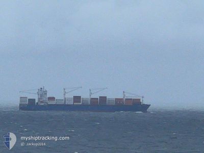
LIVORNO EXPRESS
Cargo B
Current Trip
| Time Travelled | 1 day |
|---|---|
| Remaining Time | --- |
| Distance Travelled | 280.10 nm |
| Remaining Distance | --- |
| AVG Speed | 10.8 Knots |
| MAX Speed | 13.5 Knots |
| AVG Wind | 10.6 knots |
| MAX Wind | 15 knots |
| MIN Temp | 15.7°C / 60.26°F |
| MAX Temp | 19.5°C / 67.1°F |
| Draught | 10.5 m |
| Position Received | 1 d ago |
Current Position
| Longitude | -9.56813° |
|---|---|
| Latitude | 36.82015° |
| Status | Under way using engine |
| Speed | 11.9 Knots |
| Course | 166.7° |
| Area | North Atlantic Ocean |
| Station | T-AIS |
| Position Received | 1 d ago |
Info
Information
The current position of LIVORNO EXPRESS is in North Atlantic Ocean with coordinates 36.82015° / -9.56813° as reported on 2024-06-19 10:58 by AIS to our vessel tracker app. The vessel's current speed is 11.9 Knots and is heading at the port of TANGER MED. The estimated time of arrival as calculated by vessel tracking app is 2024-06-20 05:00 LT
The vessel LIVORNO EXPRESS (IMO: 9610157, MMSI: 477486100) is a Cargo B It's sailing under the flag of [HK] Hong Kong.
In this page you can find informations about the vessels current position, last detected port calls, and current voyage information. If the vessels is not in coverage by AIS you will find the latest position.
The current position of LIVORNO EXPRESS is detected by our AIS receivers and we are not responsible for the reliability of the data. The last position was recorded while the vessel was in Coverage by the Ais receivers of our vessel tracking app.
The current draught of LIVORNO EXPRESS as reported by AIS is 10.5 meters
Weather
| Temperature | 19.4°C / 66.92°F |
|---|---|
| Wind Speed | 10 knots |
| Direction | 316° NW |
| Pressure | 1021.1 hPa |
| Humidity | 70.5 % |
| Cloud Coverage | 2 % |
Featured Company
Last Port Calls
| Port | Arrival | Departure | Time In Port |
|---|---|---|---|
| 2024-06-18 05:48 | 2024-06-18 23:21 | 17 h | |
| 2024-06-14 10:35 | 2024-06-14 20:31 | 9 h | |
| 2024-06-10 19:47 | 2024-06-11 17:00 | 21 h | |
| 2024-05-28 12:28 | 2024-05-30 10:21 | 1 d | |
| 2024-05-26 21:32 | 2024-05-27 18:33 | 21 h | |
| 2024-05-24 19:36 | 2024-05-26 03:12 | 1 d | |
| 2024-05-21 04:09 | 2024-05-21 08:40 | 4 h | |
| 2024-05-07 07:57 | 2024-05-10 11:49 | 3 d | |
| 2024-05-02 09:34 | 2024-05-02 21:03 | 11 h | |
| 2024-04-24 10:28 | 2024-04-24 22:28 | 11 h |
Most Visited Ports (Last year)
| Port | Arrivals | |
|---|---|---|
| 7 | ||
| 7 | ||
| 7 | ||
| 7 | ||
| 6 | ||
| 6 |
Last Trips
| Origin | Departure | Destination | Arrival | Distance | |
|---|---|---|---|---|---|
| 2024-06-14 22:31 | 2024-06-18 06:48 | 995.89 nm | |||
| 2024-06-11 19:00 | 2024-06-14 12:35 | 372.77 nm | |||
| 2024-05-30 12:21 | 2024-06-10 21:47 | 2410.39 nm | |||
| 2024-05-27 20:33 | 2024-05-28 14:28 | 169.47 nm | |||
| 2024-05-26 05:12 | 2024-05-26 23:32 | 330.67 nm | |||
| 2024-05-21 09:40 | 2024-05-24 21:36 | 1033.32 nm | |||
| 2024-05-10 07:49 | 2024-05-21 05:09 | 3238.04 nm | |||
| 2024-05-02 18:03 | 2024-05-07 03:57 | 1266.11 nm | |||
| 2024-04-25 00:28 | 2024-05-02 06:34 | 2786.30 nm | |||
| 2024-04-21 11:23 | 2024-04-24 12:28 | 696.16 nm |
Events
| Time | Event | Details | Position / Dest | Info |
|---|---|---|---|---|
| 2024-06-19 11:04 | Status Changed | Default Under way using engine |
36.80254 / -9.56307
MAPTM
|
Speed: 11.9 kn Course: 166.7° |
| 2024-06-19 10:58 | OUT of Coverage |
36.82015 / -9.56813
North Atlantic Ocean
MAPTM
|
Speed: 11.9 kn Course: 166.7° |
|
| 2024-06-19 10:56 | Status Changed | Under way using engine Default |
36.82890 / -9.57061
MAPTM
|
Speed: 12 kn Course: 166° |
| 2024-06-19 10:47 | Status Changed | Default Under way using engine |
36.85450 / -9.57868
MAPTM
|
Speed: 12.1 kn Course: 165.3° |
| 2024-06-19 08:45 | Status Changed | Under way using engine Default |
37.24598 / -9.70542
MAPTM
|
Speed: 12 kn Course: 166° |
| 2024-06-19 08:44 | Status Changed | Default Under way using engine |
37.24965 / -9.70646
MAPTM
|
Speed: 12.1 kn Course: 166.3° |
| 2024-06-19 08:17 | Status Changed | Under way using engine Default |
37.33740 / -9.73175
MAPTM
|
Speed: 12 kn Course: 167° |
| 2024-06-19 08:15 | Status Changed | Default Under way using engine |
37.34145 / -9.73289
MAPTM
|
Speed: 12 kn Course: 166.4° |
| 2024-06-19 07:49 | Status Changed | Under way using engine Default |
37.42694 / -9.75634
MAPTM
|
Speed: 11.6 kn Course: 168° |
| 2024-06-19 07:47 | Status Changed | Default Under way using engine |
37.43067 / -9.75738
MAPTM
|
Speed: 11.6 kn Course: 167.3° |