
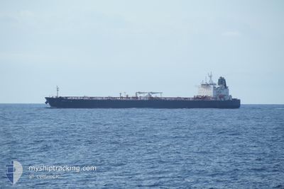
LIWA-V
Oil Products Tanker
Current Trip
| Time Travelled | 23 days |
|---|---|
| Remaining Time | 59 mins |
| Distance Travelled | 6350.19 nm |
| Remaining Distance | 17.47 nm |
| AVG Speed | 12.2 Knots |
| MAX Speed | 15.5 Knots |
| AVG Wind | 10.7 knots |
| MAX Wind | 31.3 knots |
| MIN Temp | 19.6°C / 67.28°F |
| MAX Temp | 34°C / 93.2°F |
| Draught | 12.4 m |
| Position Received | 10 d ago |
Current Position
| Longitude | 104.21309° |
|---|---|
| Latitude | 1.26852° |
| Status | Under way using engine |
| Speed | 11.2 Knots |
| Course | 82.5° |
| Area | Singapore Strait |
| Station | T-AIS |
| Position Received | 10 d ago |
Info
Information
The current position of LIWA-V is in Singapore Strait with coordinates 1.26852° / 104.21309° as reported on 2024-06-05 23:05 by AIS to our vessel tracker app. The vessel's current speed is 11.2 Knots and is heading at the port of TOKUYAMA. The estimated time of arrival as calculated by vessel tracking app is 2024-06-16 05:26 LT
The vessel LIWA-V (IMO: 9489039, MMSI: 636014929) is a Oil Products Tanker that was built in 2011 ( 13 years old ). It's sailing under the flag of [LR] Liberia.
In this page you can find informations about the vessels current position, last detected port calls, and current voyage information. If the vessels is not in coverage by AIS you will find the latest position.
The current position of LIWA-V is detected by our AIS receivers and we are not responsible for the reliability of the data. The last position was recorded while the vessel was in Coverage by the Ais receivers of our vessel tracking app.
The current draught of LIWA-V as reported by AIS is 12.4 meters
Weather
| Temperature | 23.2°C / 73.76°F |
|---|---|
| Wind Speed | 1 knots |
| Direction | 203° SSW |
| Pressure | 1005.7 hPa |
| Humidity | 82.8 % |
| Cloud Coverage | 75 % |
Featured Company
Last Port Calls
| Port | Arrival | Departure | Time In Port |
|---|---|---|---|
| 2024-05-21 04:29 | 2024-05-23 07:48 | 2 d | |
| 2024-04-24 23:07 | 2024-04-26 18:00 | 1 d | |
| 2024-04-18 03:16 | 2024-04-20 03:03 | 1 d |
Most Visited Ports (Last year)
| Port | Arrivals | |
|---|---|---|
| 4 | ||
| 2 | ||
| 2 | ||
| 1 | ||
| 1 | ||
| 1 |
Last Trips
| Origin | Departure | Destination | Arrival | Distance | |
|---|---|---|---|---|---|
| 2024-04-27 04:00 | 2024-05-21 08:29 | 7323.81 nm | |||
| 2024-04-20 15:03 | 2024-04-25 09:07 | 1300.99 nm | |||
| 2024-03-31 14:09 | 2024-04-18 15:16 | 5100.26 nm |
Events
| Time | Event | Details | Position / Dest | Info |
|---|---|---|---|---|
| 2024-06-16 02:33 | START Moving | 3.53 nm, South West of TOKUYAMA |
33.99084 / 131.75604
JPTXD
|
Speed: 5.3 kn Course: 281° |
| 2024-06-14 23:36 | STOP Moving | 3.56 nm, South of TOKUYAMA |
33.98962 / 131.75822
JPTXD
|
Speed: 0.3 kn Course: 79° |
| 2024-06-14 22:53 | START Moving | 4.71 nm, South West of KUDAMATSU |
33.96606 / 131.76482
JPTXD
|
Speed: 4.5 kn Course: 280° |
| 2024-06-14 07:21 | STOP Moving | 4.67 nm, South West of KUDAMATSU |
33.96464 / 131.76665
JPTXD
|
Speed: 0.2 kn Course: 50° |