
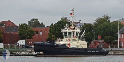
LLOYDSMAN
Tug
Current Trip
TYNE
| Time Travelled | 10 h, 47 mins |
|---|---|
| Remaining Time | --- |
| Distance Travelled | 115.03 nm |
| Remaining Distance | --- |
| AVG Speed | 12.1 Knots |
| MAX Speed | 14 Knots |
| AVG Wind | 5.1 knots |
| MAX Wind | 8.9 knots |
| MIN Temp | 14.8°C / 58.64°F |
| MAX Temp | 19°C / 66.2°F |
| Draught | 4.8 m |
| Position Received | 38 m ago |
Current Position
| Longitude | -0.83533° |
|---|---|
| Latitude | 54.78070° |
| Status | Moored |
| Speed | 10 Knots |
| Course | 315° |
| Area | North Sea |
| Station | T-AIS |
| Position Received | 38 m ago |
Info
Information
The current position of LLOYDSMAN is in North Sea with coordinates 54.78070° / -0.83533° as reported on 2024-06-23 18:28 by AIS to our vessel tracker app. The vessel's current speed is 10 Knots
The vessel LLOYDSMAN (IMO: 9850513, MMSI: 232038380) is a Tug It's sailing under the flag of [GB] United Kingdom.
In this page you can find informations about the vessels current position, last detected port calls, and current voyage information. If the vessels is not in coverage by AIS you will find the latest position.
The current position of LLOYDSMAN is detected by our AIS receivers and we are not responsible for the reliability of the data. The last position was recorded while the vessel was in Coverage by the Ais receivers of our vessel tracking app.
The current draught of LLOYDSMAN as reported by AIS is 4.8 meters
Weather
| Temperature | 15.9°C / 60.62°F |
|---|---|
| Wind Speed | 7 knots |
| Direction | 92° E |
| Pressure | 1018.4 hPa |
| Humidity | 86.9 % |
| Cloud Coverage | 52 % |
Featured Company
Last Port Calls
| Port | Arrival | Departure | Time In Port |
|---|---|---|---|
| 2024-06-22 19:00 | 2024-06-23 08:19 | 13 h | |
| 2024-06-22 09:22 | 2024-06-22 18:58 | 9 h | |
| 2024-06-22 05:24 | 2024-06-22 09:15 | 3 h | |
| 2024-06-21 06:23 | 2024-06-22 03:36 | 21 h | |
| 2024-06-20 02:26 | 2024-06-21 04:48 | 1 d | |
| 2024-06-19 22:15 | 2024-06-20 00:41 | 2 h | |
| 2024-06-19 18:47 | 2024-06-19 22:08 | 3 h | |
| 2024-06-19 15:05 | 2024-06-19 18:12 | 3 h | |
| 2024-06-19 02:34 | 2024-06-19 14:05 | 11 h | |
| 2024-06-19 00:58 | 2024-06-19 01:47 | 48 m |
Most Visited Ports (Last year)
| Port | Arrivals | |
|---|---|---|
| 193 | ||
| 150 | ||
| 132 | ||
| 72 | ||
| 21 | ||
| 6 |
Last Trips
| Origin | Departure | Destination | Arrival | Distance | |
|---|---|---|---|---|---|
| 2024-06-22 19:58 | 2024-06-22 20:00 | 0.29 nm | |||
| 2024-06-22 10:15 | 2024-06-22 10:22 | 0.29 nm | |||
| 2024-06-22 04:36 | 2024-06-22 06:24 | 5.90 nm | |||
| 2024-06-21 05:48 | 2024-06-21 07:23 | 6.60 nm | |||
| 2024-06-20 01:41 | 2024-06-20 03:26 | 7.45 nm | |||
| 2024-06-19 23:08 | 2024-06-19 23:15 | 0.64 nm | |||
| 2024-06-19 19:12 | 2024-06-19 19:47 | 7.18 nm | |||
| 2024-06-19 15:05 | 2024-06-19 16:05 | 5.50 nm | |||
| 2024-06-19 02:47 | 2024-06-19 03:34 | 6.71 nm | |||
| 2024-06-19 01:16 | 2024-06-19 01:58 | 5.94 nm |
Events
| Time | Event | Details | Position / Dest | Info |
|---|---|---|---|---|
| 2024-06-23 18:33 | Status Changed | Default Moored |
54.79062 / -.85217
TYNE
|
Speed: 10 kn Course: 315° |
| 2024-06-23 18:28 | Status Changed | Moored Default |
54.78070 / -.83533
TYNE
|
Speed: 9.8 kn Course: 315° |
| 2024-06-23 18:28 | IN Coverage |
54.78070 / -.83533
North Sea
|
Speed: 10 kn Course: 315° |
|
| 2024-06-23 16:48 | Status Changed | Default Moored |
54.58303 / -.53519
TYNE
|
Speed: 9.2 kn Course: 323.5° |
| 2024-06-23 16:39 | OUT of Coverage |
54.56518 / -.51235
North Sea
|
Speed: 9.2 kn Course: 323.5° |
|
| 2024-06-23 16:34 | Status Changed | Moored Default |
54.55559 / -.50005
TYNE
|
Speed: 9.3 kn Course: 321° |
| 2024-06-23 16:34 | IN Coverage |
54.55559 / -.50005
North Sea
|
Speed: 9.3 kn Course: 323° |
|
| 2024-06-23 13:43 | OUT of Coverage |
54.17520 / -.03076
North Sea
|
Speed: 10.5 kn Course: 326.3° |
|
| 2024-06-23 11:58 | Status Changed | Moored Default |
53.88246 / .21860
TYNE
|
Speed: 11.7 kn Course: 334° |
| 2024-06-23 11:58 | IN Coverage |
53.88429 / .21706
North Sea
|
Speed: 11.7 kn Course: 333.7° |