
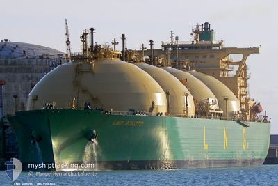
LNG SOKOTO
Lng Tanker
Current Trip
| Time Travelled | 15 days |
|---|---|
| Remaining Time | --- |
| Distance Travelled | 3229.35 nm |
| Remaining Distance | --- |
| AVG Speed | 9.8 Knots |
| MAX Speed | 15.4 Knots |
| AVG Wind | 12.9 knots |
| MAX Wind | 27 knots |
| MIN Temp | 14.8°C / 58.64°F |
| MAX Temp | 28.6°C / 83.48°F |
| Draught | 9.8 m |
| Position Received | 7 d ago |
Current Position
| Longitude | -16.71271° |
|---|---|
| Latitude | 27.29369° |
| Status | At anchor |
| Speed | 9.3 Knots |
| Course | 214.9° |
| Area | North Atlantic Ocean |
| Station | T-AIS |
| Position Received | 7 d ago |
Info
Information
The current position of LNG SOKOTO is in North Atlantic Ocean with coordinates 27.29369° / -16.71271° as reported on 2024-05-11 19:59 by AIS to our vessel tracker app. The vessel's current speed is 9.3 Knots and is heading at the port of BONNY. The estimated time of arrival as calculated by vessel tracking app is 2024-06-01 05:00 LT
The vessel LNG SOKOTO (IMO: 9216303, MMSI: 310378000) is a Lng Tanker that was built in 2002 ( 22 years old ). It's sailing under the flag of [BM] Bermuda.
In this page you can find informations about the vessels current position, last detected port calls, and current voyage information. If the vessels is not in coverage by AIS you will find the latest position.
The current position of LNG SOKOTO is detected by our AIS receivers and we are not responsible for the reliability of the data. The last position was recorded while the vessel was in Coverage by the Ais receivers of our vessel tracking app.
The current draught of LNG SOKOTO as reported by AIS is 9.8 meters
Weather
| Temperature | 27.7°C / 81.86°F |
|---|---|
| Wind Speed | 15 knots |
| Direction | 166° SSE |
| Pressure | 1012.3 hPa |
| Humidity | 77.3 % |
| Cloud Coverage | 100 % |
Featured Company
Most Visited Ports (Last year)
| Port | Arrivals | |
|---|---|---|
| 7 | ||
| 2 | ||
| 1 | ||
| 1 | ||
| 1 | ||
| 1 |
Events
| Time | Event | Details | Position / Dest | Info |
|---|---|---|---|---|
| 2024-05-11 20:06 | Status Changed | Default At anchor |
27.27751 / -16.72525
NGBON
|
Speed: 9.3 kn Course: 214.9° |
| 2024-05-11 19:59 | Status Changed | At anchor Default |
27.29369 / -16.71271
NGBON
|
Speed: 9.3 kn Course: 214° |
| 2024-05-11 19:59 | OUT of Coverage |
27.29369 / -16.71271
North Atlantic Ocean
NGBON
|
Speed: 9.3 kn Course: 214.9° |
|
| 2024-05-11 19:46 | Status Changed | Default At anchor |
27.31988 / -16.69242
NGBON
|
Speed: 9.3 kn Course: 213.6° |
| 2024-05-11 19:37 | Status Changed | At anchor Default |
27.33933 / -16.67760
NGBON
|
Speed: 9.3 kn Course: 215° |
| 2024-05-11 19:30 | Status Changed | Default At anchor |
27.35520 / -16.66548
NGBON
|
Speed: 9.3 kn Course: 214.3° |
| 2024-05-11 18:53 | Status Changed | At anchor Default |
27.43497 / -16.60187
NGBON
|
Speed: 9.7 kn Course: 216° |
| 2024-05-11 18:46 | Status Changed | Default At anchor |
27.45058 / -16.58886
NGBON
|
Speed: 9.6 kn Course: 216° |
| 2024-05-11 17:39 | Status Changed | At anchor Default |
27.60212 / -16.47424
NGBON
|
Speed: 9.8 kn Course: 212° |
| 2024-05-11 17:38 | Status Changed | Default At anchor |
27.60494 / -16.47235
NGBON
|
Speed: 9.8 kn Course: 211° |