
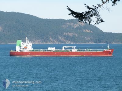
LONE STAR MARINER
Tanker
Current Trip
| Time Travelled | 1 day |
|---|---|
| Remaining Time | 1 day |
| Distance Travelled | 519.14 nm |
| Remaining Distance | 400.14 nm |
| AVG Speed | 11.9 Knots |
| MAX Speed | 15.2 Knots |
| AVG Wind | 13.1 knots |
| MAX Wind | 23 knots |
| MIN Temp | 28.4°C / 83.12°F |
| MAX Temp | 30.3°C / 86.54°F |
| Draught | 11.7 m |
| Position Received | 1 d ago |
Current Position
| Longitude | -87.73215° |
|---|---|
| Latitude | 16.26463° |
| Status | Under way using engine |
| Speed | 12.3 Knots |
| Course | 53° |
| Area | Caribbean Sea |
| Station | T-AIS |
| Position Received | 1 d ago |
Info
Information
The current position of LONE STAR MARINER is in Caribbean Sea with coordinates 16.26463° / -87.73215° as reported on 2024-05-27 20:04 by AIS to our vessel tracker app. The vessel's current speed is 12.3 Knots and is heading at the port of PUERTO CORTES. The estimated time of arrival as calculated by vessel tracking app is 2024-05-30 11:08 LT
The vessel LONE STAR MARINER (IMO: 9902859, MMSI: 538009133) is a Tanker It's sailing under the flag of [MH] Marshall Is.
In this page you can find informations about the vessels current position, last detected port calls, and current voyage information. If the vessels is not in coverage by AIS you will find the latest position.
The current position of LONE STAR MARINER is detected by our AIS receivers and we are not responsible for the reliability of the data. The last position was recorded while the vessel was in Coverage by the Ais receivers of our vessel tracking app.
The current draught of LONE STAR MARINER as reported by AIS is 11.7 meters
Weather
| Temperature | 28.3°C / 82.94°F |
|---|---|
| Wind Speed | 11 knots |
| Direction | 109° ESE |
| Pressure | 1015.2 hPa |
| Humidity | 75.7 % |
| Cloud Coverage | --- |
Featured Company
Last Port Calls
| Port | Arrival | Departure | Time In Port |
|---|---|---|---|
| 2024-05-25 14:14 | 2024-05-27 13:19 | 1 d | |
| 2024-05-24 03:25 | 2024-05-25 07:32 | 1 d | |
| 2024-05-15 07:36 | 2024-05-20 01:24 | 4 d | |
| 2024-05-07 17:10 | 2024-05-09 10:10 | 1 d | |
| 2024-05-03 16:44 | 2024-05-04 21:27 | 1 d | |
| 2024-04-25 03:47 | 2024-04-29 10:46 | 4 d | |
| 2024-04-16 15:04 | 2024-04-19 00:05 | 2 d | |
| 2024-04-15 02:31 | 2024-04-16 03:29 | 1 d | |
| 2024-04-08 02:50 | 2024-04-10 23:44 | 2 d | |
| 2024-03-29 01:45 | 2024-04-01 01:51 | 3 d |
Most Visited Ports (Last year)
| Port | Arrivals | |
|---|---|---|
| 5 | ||
| 4 | ||
| 4 | ||
| 3 | ||
| 2 | ||
| 2 |
Last Trips
| Origin | Departure | Destination | Arrival | Distance | |
|---|---|---|---|---|---|
| 2024-05-25 01:32 | 2024-05-25 08:14 | 63.95 nm | |||
| 2024-05-19 20:24 | 2024-05-23 21:25 | 1141.72 nm | |||
| 2024-05-09 04:10 | 2024-05-15 02:36 | 1216.68 nm | |||
| 2024-05-04 15:27 | 2024-05-07 11:10 | 66.97 nm | |||
| 2024-04-29 05:46 | 2024-05-03 10:44 | 1145.57 nm | |||
| 2024-04-18 18:05 | 2024-04-24 22:47 | 1201.48 nm | |||
| 2024-04-15 21:29 | 2024-04-16 09:04 | 67.90 nm | |||
| 2024-04-10 18:44 | 2024-04-14 20:31 | 1144.06 nm | |||
| 2024-03-31 21:51 | 2024-04-07 21:50 | 1945.87 nm | |||
| 2024-03-12 06:01 | 2024-03-28 21:45 | 3721.60 nm |
Events
| Time | Event | Details | Position / Dest | Info |
|---|---|---|---|---|
| 2024-05-27 20:10 | Status Changed | Default Under way using engine |
16.27667 / -87.71333
PUERTO CORTES
|
Speed: 12.3 kn Course: 53° |
| 2024-05-27 20:04 | Change Sea Area | Belizean part of the Caribbean Sea Honduran part of the Caribbean Sea |
16.26463 / -87.73215
Caribbean Sea
|
Speed: 12.3 kn Course: 53° |
| 2024-05-27 20:04 | Status Changed | Under way using engine Default |
16.26463 / -87.73215
PUERTO CORTES
|
Speed: 12 kn Course: 54° |
| 2024-05-27 20:04 | OUT of Coverage |
16.26463 / -87.73215
Caribbean Sea
|
Speed: 12.3 kn Course: 53° |
|
| 2024-05-27 19:58 | Status Changed | Default Under way using engine |
16.25215 / -87.75000
PUERTO CORTES
|
Speed: 12.6 kn Course: 54.5° |
| 2024-05-27 19:49 | Status Changed | Under way using engine Default |
16.23297 / -87.77745
PUERTO CORTES
|
Speed: 12 kn Course: 54° |
| 2024-05-27 19:34 | Status Changed | Default Under way using engine |
16.20333 / -87.81834
PUERTO CORTES
|
Speed: 12.5 kn Course: 55.2° |
| 2024-05-27 18:58 | Change Sea Area | Honduran part of the Caribbean Sea United States part of the Gulf of Mexico |
16.12972 / -87.92825
Caribbean Sea
|
Speed: 12.6 kn Course: 53.9° |
| 2024-05-27 18:58 | Status Changed | Under way using engine Default |
16.12972 / -87.92825
PUERTO CORTES
|
Speed: 12.5 kn Course: 54° |
| 2024-05-27 18:51 | IN Coverage |
16.12972 / -87.92825
Caribbean Sea
|
Speed: 12.6 kn Course: 53.9° |