
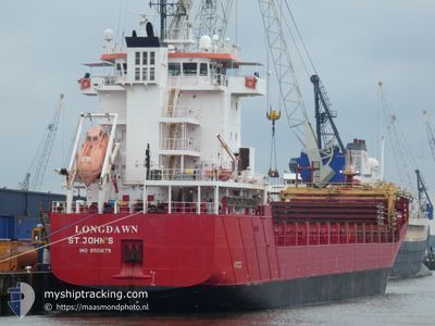
LONGDAWN
General Cargo
Current Trip
| Trip Time | 4 days |
|---|---|
| Trip Distance | 1190.65 nm |
| AVG Speed | 11.9 Knots |
| MAX Speed | 14.8 Knots |
| Draught | 5.6 m |
| AVG Wind | 11 knots |
| MAX Wind | 27.3 knots |
| MIN Temp | 8.6°C / 47.48°F |
| MAX Temp | 17.6°C / 63.68°F |
| Position Received | 3 d ago |
Current Position
| Longitude | -4.57271° |
|---|---|
| Latitude | 58.98432° |
| Status | Under way using engine |
| Speed | 11.3 Knots |
| Course | 296.6° |
| Area | North Atlantic Ocean |
| Station | T-AIS |
| Position Received | 3 d ago |
Info
Information
The current position of LONGDAWN is in North Atlantic Ocean with coordinates 58.98432° / -4.57271° as reported on 2024-06-23 04:25 by AIS to our vessel tracker app. The vessel's current speed is 11.3 Knots and is currently inside the port of STRAUMSVIK.
The vessel LONGDAWN (IMO: 9501679, MMSI: 305835000) is a General Cargo that was built in 2013 ( 11 years old ). It's sailing under the flag of [AG] Antigua Barbuda.
In this page you can find informations about the vessels current position, last detected port calls, and current voyage information. If the vessels is not in coverage by AIS you will find the latest position.
The current position of LONGDAWN is detected by our AIS receivers and we are not responsible for the reliability of the data. The last position was recorded while the vessel was in Coverage by the Ais receivers of our vessel tracking app.
The current draught of LONGDAWN as reported by AIS is 5.6 meters
Weather
| Temperature | 6.5°C / 43.7°F |
|---|---|
| Wind Speed | 6 knots |
| Direction | 153° SSE |
| Pressure | 1005.3 hPa |
| Humidity | 89.5 % |
| Cloud Coverage | 96 % |
Featured Company
Last Port Calls
| Port | Arrival | Departure | Time In Port |
|---|---|---|---|
| 2024-06-25 12:47 | |||
| 2024-06-18 07:50 | 2024-06-21 09:23 | 3 d | |
| 2024-06-11 03:48 | 2024-06-13 23:10 | 2 d | |
| 2024-06-03 23:47 | 2024-06-06 17:29 | 2 d | |
| 2024-05-27 16:20 | 2024-05-30 18:44 | 3 d | |
| 2024-05-21 08:47 | 2024-05-23 15:20 | 2 d | |
| 2024-05-16 11:05 | 2024-05-17 15:06 | 1 d | |
| 2024-05-13 07:30 | 2024-05-16 00:40 | 2 d | |
| 2024-05-06 16:13 | 2024-05-09 06:55 | 2 d | |
| 2024-04-29 03:50 | 2024-05-02 02:07 | 2 d |
Most Visited Ports (Last year)
| Port | Arrivals | |
|---|---|---|
| 25 | ||
| 25 | ||
| 1 |
Last Trips
| Origin | Departure | Destination | Arrival | Distance | |
|---|---|---|---|---|---|
| 2024-06-21 11:23 | 2024-06-25 12:47 | 1190.65 nm | |||
| 2024-06-13 23:10 | 2024-06-18 09:50 | 1197.83 nm | |||
| 2024-06-06 19:29 | 2024-06-11 03:48 | 1194.27 nm | |||
| 2024-05-30 18:44 | 2024-06-04 01:47 | 1196.30 nm | |||
| 2024-05-23 17:20 | 2024-05-27 16:20 | 1191.02 nm | |||
| 2024-05-17 15:06 | 2024-05-21 10:47 | 1073.97 nm | |||
| 2024-05-16 00:40 | 2024-05-16 11:05 | 124.95 nm | |||
| 2024-05-09 08:55 | 2024-05-13 07:30 | 1199.01 nm | |||
| 2024-05-02 02:07 | 2024-05-06 18:13 | 1211.89 nm | |||
| 2024-04-24 21:42 | 2024-04-29 03:50 | 1189.86 nm |
Events
| Time | Event | Details | Position / Dest | Info |
|---|---|---|---|---|
| 2024-06-25 13:04 | STOP Moving |
64.04521 / -22.03864
[IS] STRAUMSVIK
|
Speed: Course: 17° |
|
| 2024-06-25 12:47 | PORT ARRIVAL |
|
64.04561 / -22.04108
[IS] STRAUMSVIK
|
Speed: 8.1 kn Course: 134° |
| 2024-06-23 04:31 | Status Changed | Default Under way using engine |
58.99411 / -4.61020
ISSTR
|
Speed: 11.3 kn Course: 296.6° |
| 2024-06-23 04:25 | OUT of Coverage |
58.98432 / -4.57271
North Atlantic Ocean
ISSTR
|
Speed: 11.3 kn Course: 296.6° |
|
| 2024-06-23 01:11 | Change Sea Area | United Kingdom part of the North Atlantic Ocean United Kingdom part of the North Sea |
58.76523 / -3.41674
North Atlantic Ocean
ISSTR
|
Speed: 12.9 kn Course: 292.8° |
| 2024-06-22 23:04 | Status Changed | Under way using engine Default |
58.56394 / -2.81824
ISSTR
|
Speed: 10.8 kn Course: 321° |
| 2024-06-22 22:55 | Status Changed | Default Under way using engine |
58.54462 / -2.78877
ISSTR
|
Speed: 11.3 kn Course: 322.4° |
| 2024-06-22 22:47 | Status Changed | Under way using engine Default |
58.52477 / -2.75700
ISSTR
|
Speed: 11.2 kn Course: 320° |
| 2024-06-22 22:28 | Status Changed | Default Under way using engine |
58.47798 / -2.68065
ISSTR
|
Speed: 11.2 kn Course: 313.8° |
| 2024-06-22 22:22 | Status Changed | Under way using engine Default |
58.46623 / -2.65894
ISSTR
|
Speed: 11.6 kn Course: 319° |