
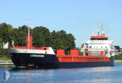
LONGVANN
General Cargo
Current Trip
| Time Travelled | 3 days |
|---|---|
| Remaining Time | 2 days |
| Distance Travelled | 909.72 nm |
| Remaining Distance | 667.23 nm |
| AVG Speed | 10.7 Knots |
| MAX Speed | 13.9 Knots |
| AVG Wind | 15.3 knots |
| MAX Wind | 30.4 knots |
| MIN Temp | 9.8°C / 49.64°F |
| MAX Temp | 15.5°C / 59.9°F |
| Draught | 6.1 m |
| Position Received | 1 d ago |
Current Position
| Longitude | -6.04790° |
|---|---|
| Latitude | 48.53007° |
| Status | Under way using engine |
| Speed | 11.5 Knots |
| Course | 211° |
| Area | Celtic Sea |
| Station | T-AIS |
| Position Received | 1 d ago |
Info
Information
The current position of LONGVANN is in Celtic Sea with coordinates 48.53007° / -6.04790° as reported on 2024-06-01 04:33 by AIS to our vessel tracker app. The vessel's current speed is 11.5 Knots and is heading at the port of CASABLANCA. The estimated time of arrival as calculated by vessel tracking app is 2024-06-05 01:59 LT
The vessel LONGVANN (IMO: 9548304, MMSI: 246670000) is a General Cargo that was built in 2011 ( 13 years old ). It's sailing under the flag of [NL] Netherlands.
In this page you can find informations about the vessels current position, last detected port calls, and current voyage information. If the vessels is not in coverage by AIS you will find the latest position.
The current position of LONGVANN is detected by our AIS receivers and we are not responsible for the reliability of the data. The last position was recorded while the vessel was in Coverage by the Ais receivers of our vessel tracking app.
The current draught of LONGVANN as reported by AIS is 6.1 meters
Weather
| Temperature | 15.5°C / 59.9°F |
|---|---|
| Wind Speed | 33 knots |
| Direction | 44° NE |
| Pressure | 1018.2 hPa |
| Humidity | 83.3 % |
| Cloud Coverage | --- |
Featured Company
Last Port Calls
| Port | Arrival | Departure | Time In Port |
|---|---|---|---|
| 2024-05-27 08:35 | 2024-05-30 00:50 | 2 d | |
| 2024-05-21 07:32 | 2024-05-23 13:04 | 2 d | |
| 2024-05-17 15:04 | 2024-05-18 21:08 | 1 d | |
| 2024-05-14 09:26 | 2024-05-16 04:11 | 1 d | |
| 2024-05-09 11:35 | 2024-05-10 16:45 | 1 d | |
| 2024-05-07 00:16 | 2024-05-07 22:07 | 21 h | |
| 2024-05-05 09:15 | 2024-05-06 10:42 | 1 d | |
| 2024-04-28 13:06 | 2024-04-30 21:30 | 2 d | |
| 2024-04-19 16:37 | 2024-04-21 12:02 | 1 d | |
| 2024-04-13 11:59 | 2024-04-14 00:21 | 12 h |
Most Visited Ports (Last year)
| Port | Arrivals | |
|---|---|---|
| 14 | ||
| 8 | ||
| 6 | ||
| 6 | ||
| 4 | ||
| 3 |
Last Trips
| Origin | Departure | Destination | Arrival | Distance | |
|---|---|---|---|---|---|
| 2024-05-23 15:04 | 2024-05-27 09:35 | 615.16 nm | |||
| 2024-05-19 00:08 | 2024-05-21 09:32 | 495.44 nm | |||
| 2024-05-16 06:11 | 2024-05-17 18:04 | 319.70 nm | |||
| 2024-05-10 18:45 | 2024-05-14 11:26 | 715.82 nm | |||
| 2024-05-08 00:07 | 2024-05-09 13:35 | 355.59 nm | |||
| 2024-05-06 12:42 | 2024-05-07 02:16 | 154.87 nm | |||
| 2024-04-30 23:30 | 2024-05-05 11:15 | 925.92 nm | |||
| 2024-04-21 13:02 | 2024-04-28 15:06 | 1033.39 nm | |||
| 2024-04-14 03:21 | 2024-04-19 17:37 | 1416.47 nm | |||
| 2024-04-03 20:08 | 2024-04-13 14:59 | 1880.53 nm |
Events
| Time | Event | Details | Position / Dest | Info |
|---|---|---|---|---|
| 2024-06-01 04:40 | Status Changed | Default Under way using engine |
48.51050 / -6.06573
MACAS
|
Speed: 11.5 kn Course: 211° |
| 2024-06-01 04:33 | OUT of Coverage |
48.53007 / -6.04790
Celtic Sea
MACAS
|
Speed: 11.5 kn Course: 211° |
|
| 2024-06-01 04:28 | Status Changed | Under way using engine Default |
48.54232 / -6.03660
MACAS
|
Speed: 11.4 kn Course: 207° |
| 2024-06-01 04:09 | IN Coverage |
48.54232 / -6.03660
Celtic Sea
MACAS
|
Speed: 11.4 kn Course: 211° |
|
| 2024-05-31 23:28 | Status Changed | Default Under way using engine |
49.14230 / -5.10333
MACAS
|
Speed: 9.5 kn Course: 237° |
| 2024-05-31 23:21 | OUT of Coverage |
49.15128 / -5.08123
Celtic Sea
MACAS
|
Speed: 9.5 kn Course: 237° |
|
| 2024-05-31 23:01 | Detected in Sea | French part of the Celtic Sea |
49.17920 / -5.01160
Celtic Sea
MACAS
|
Speed: 9.5 kn Course: 239° |
| 2024-05-31 21:14 | Status Changed | Under way using engine Default |
49.32582 / -4.62817
MACAS
|
Speed: 10.1 kn Course: 237° |
| 2024-05-31 21:08 | IN Coverage |
49.32582 / -4.62817
English Channel
MACAS
|
Speed: 10 kn Course: 240° |
|
| 2024-05-31 19:20 | OUT of Coverage |
49.50485 / -4.19792
English Channel
MACAS
|
Speed: 10.8 kn Course: 236° |