
LONGVIEW LOGGER
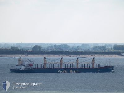
Bulk Carrier
Current Trip
| Time Travelled | 1 day |
|---|---|
| Remaining Time | --- |
| Distance Travelled | 331.54 nm |
| Remaining Distance | --- |
| AVG Speed | 10.8 Knots |
| MAX Speed | 13.6 Knots |
| AVG Wind | 12.9 knots |
| MAX Wind | 19 knots |
| MIN Temp | 10.3°C / 50.54°F |
| MAX Temp | 13.5°C / 56.3°F |
| Draught | 7.3 m |
| Position Received | 1 m ago |
Current Position
| Longitude | -0.89648° |
|---|---|
| Latitude | 54.72601° |
| Status | At anchor |
| Speed | 0.1 Knots |
| Course | 310° |
| Area | North Sea |
| Station | T-AIS |
| Position Received | 1 m ago |
Info
Information
The current position of LONGVIEW LOGGER is in North Sea with coordinates 54.72601° / -0.89648° as reported on 2024-05-29 09:45 by AIS to our vessel tracker app. The vessel's current speed is 0.1 Knots
The vessel LONGVIEW LOGGER (IMO: 9338541, MMSI: 477969800) is a Bulk Carrier that was built in 2007 ( 17 years old ). It's sailing under the flag of [HK] Hong Kong.
In this page you can find informations about the vessels current position, last detected port calls, and current voyage information. If the vessels is not in coverage by AIS you will find the latest position.
The current position of LONGVIEW LOGGER is detected by our AIS receivers and we are not responsible for the reliability of the data. The last position was recorded while the vessel was in Coverage by the Ais receivers of our vessel tracking app.
The current draught of LONGVIEW LOGGER as reported by AIS is 7.3 meters
Weather
| Temperature | 13.4°C / 56.12°F |
|---|---|
| Wind Speed | 11 knots |
| Direction | 280° W |
| Pressure | 1003.9 hPa |
| Humidity | 79.6 % |
| Cloud Coverage | 19 % |
Featured Company
Events
| Time | Event | Details | Position / Dest | Info |
|---|---|---|---|---|
| 2024-05-29 08:00 | Status Changed | At anchor Default |
54.72631 / -.89611
GB TEE
|
Speed: Course: 302° |
| 2024-05-29 07:48 | Status Changed | Default At anchor |
54.72630 / -.89615
GB TEE
|
Speed: Course: 302° |
| 2024-05-29 07:33 | Status Changed | At anchor Default |
54.72618 / -.89633
GB TEE
|
Speed: Course: 305° |
| 2024-05-29 07:27 | Status Changed | Default At anchor |
54.72612 / -.89637
GB TEE
|
Speed: Course: 305° |
| 2024-05-29 05:44 | Status Changed | At anchor Under way using engine |
54.72617 / -.89612
GB TEE
|
Speed: 0.3 kn Course: 299° |
| 2024-05-29 05:27 | STOP Moving | 10.65 nm, East of HARTLEPOOL |
54.72706 / -.89868
GB TEE
|
Speed: 0.3 kn Course: 297° |
| 2024-05-29 03:14 | Status Changed | Under way using engine Default |
54.58950 / -.44122
GB TEE
|
Speed: 12.3 kn Course: 295° |
| 2024-05-29 03:14 | IN Coverage |
54.58950 / -.44122
North Sea
GB TEE
|
Speed: 11.7 kn Course: 311.4° |
|
| 2024-05-28 04:29 | Status Changed | Default Under way using engine |
52.14847 / 2.68758
GB TEE
|
Speed: 13.3 kn Course: 358.1° |
| 2024-05-28 04:26 | OUT of Coverage |
52.13742 / 2.68739
North Sea
GB TEE
|
Speed: 13.3 kn Course: 358.1° |